Starting point: Martinj vrh (1030 m)
| Lat/Lon: | 46,1765°N 14,1289°E |
| |
Time of walking: 1 h 40 min
Difficulty: partly demanding marked way
Altitude difference: 532 m
Altitude difference po putu: 575 m
Map: Škofjeloško in Cerkljansko hribovje 1:50.000
Recommended equipment (summer):
Recommended equipment (winter): ice axe, crampons
Views: 36.871
 | 3 people like this post |
Access to the starting point:
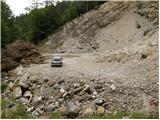
From Škofja Loka, drive towards Železniki and further towards Zale Log. Shortly after Železniki, we will see signs for the village of Martinj vrh, which will direct us to the left to the ascending road, which begins to climb along the Zadnja Smoleva stream. After a short climb, we reach a crossroads where we continue to the right along the road, which climbs steeply in a few serpentines, and then leads us to the next crossroads. Continue left (Javh and Pučar on the right) along the road, which takes you past individual farms to the next crossroads, where you turn sharp right in the direction of the Bendišć and Čemšišar farms. Continue past these farms and the road quickly leads to a large quarry, where it ends. You can park a little further down the road in one of the car parks along the road.
Path description:
At the end of the road, you will see a marked path (not marked on the maps), which crosses the relatively steep slopes of Romovec. After a few steps, you will come across the first steel cable, which will help you to cross the steep and slippery slope in the wet. A little beyond the steel cable, the path turns left and climbs steeply for a short time. The steepness eases and the path turns to the right where, after a few further steps, it leads to a second steel cable, which is used to climb up a very steep slope in a traverse. The path then re-lays and leads to an old military bunker, which is located above a small precipice.
The bunker is bypassed on the left, and the path then descends on an exposed ledge (high risk of slipping). Behind the ledge, the path widens, and after a few minutes of further walking, it leads to a large parking lot at Črni Kalo.
From the parking lot, turn onto the road, above which is a sign saying "walk from here on". Just at the above-mentioned inscription, however, the markings for Blegoš direct us to the right onto a wide footpath which, after a few metres, crosses a forest road leading to a cottage on Blegoš.
Continue along the footpath, which begins to climb steeply through the forest. Higher up, the steep path continues to lead us to the vegetated north-eastern ridge Blegoš, which we then climb for some time. The way forward leads us past an old military bunker, above which we soon reach a mini lookout point from which we open a beautiful view of the nearby Ratitovec.
At the viewpoint, the steepness eases, and after 5 minutes of further walking, the path leads us out of the forest to an undistinguished saddle between Špik (1538 m) on the left and Blegoš on the right. Here the path turns slightly to the right and after a few more steps leads to a scenic ridge. It is only a short walk past old military tunnels to the top of Blegoš, which is reached after a further 10 steps.

Pictures:
 1
1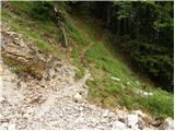 2
2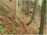 3
3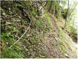 4
4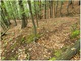 5
5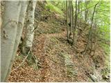 6
6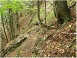 7
7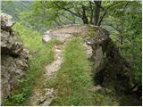 8
8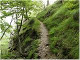 9
9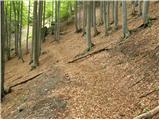 10
10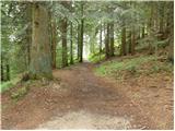 11
11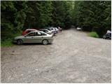 12
12 13
13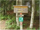 14
14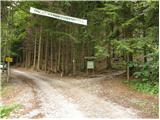 15
15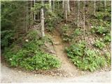 16
16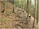 17
17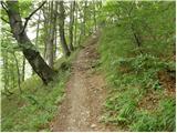 18
18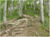 19
19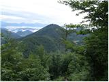 20
20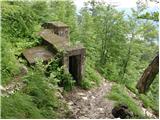 21
21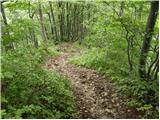 22
22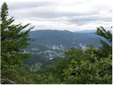 23
23 24
24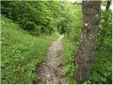 25
25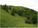 26
26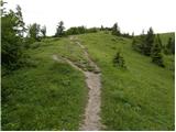 27
27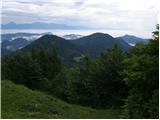 28
28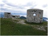 29
29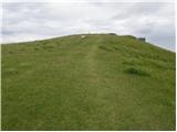 30
30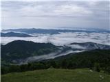 31
31 32
32
Discussion about the trail Martinj vrh - Blegoš
|
| georgia10. 04. 2021 18:57:47 |
Midva že nekaj časa hodiva na Blegoš le po tej poti, da je malce več vzpona in adrenalina ter manj vožnje. Še nikogar nisva srečala na odseku do Črnega Kala, torej je samotna in se še prehitro konča na obleganem parkirišču, midva sva pa že dobro ogreta za nadaljni vzpon po grebenski poti.  Vsekakor pa res previdno v mokrih in snežnih razmerah!
|
|
|
|
| Doohan4. 05. 2022 15:19:44 |
Po dveh letih spet po tej poti na Blegoš. Jeklenice, ki so v pomoč pri prečenju Romovca, niso v najboljšem stanju. Saj ne, da bi bilo zelo nevarno, a potreben je previden korak. Vzpon po grebenu Blegoša - poezija.
|
|
|