Maribor - Sveti Urban above Maribor (on path over Kozjak)
Starting point: Maribor (275 m)
| Lat/Lon: | 46,564°N 15,6481°E |
| |
Name of path: on path over Kozjak
Time of walking: 2 h
Difficulty: easy marked way
Altitude difference: 320 m
Altitude difference po putu: 540 m
Map: Pohorje 1:50.000
Recommended equipment (summer):
Recommended equipment (winter):
Views: 10.829
 | 3 people like this post |
Access to the starting point:
The start of the route can be practically in the centre of the city at the beginning of the city park by the sign for the Kozjak trail, or anywhere in the park up to Treh rybniki.
By car, exit Melje on the expressway through Maribor and continue along the railway station, at the first junction without traffic lights turn left along Tomšičeva Street, also the famous alley in the direction of Ribniško selo and park the vehicle somewhere near the park.
Path description:
At the beginning of the City Park, by the sign "Path over Kozjak", or by the Three Ponds, there is a concrete start of the route. It is easy to follow the mountain trail practically from the urban Maribor itself through Ribniško selo. At the top of Ribniško selo at the junction with Vinarji, right into the forest and under Marin's and Kaufman's banks, simply follow the well-marked and also undulating, "hilly", path. Soon you reach the top of the Rošpoh settlement, followed by a descent into the valley, where you cross the Kamnica - Kungota road.
Continue up by the chapel, past a large farmhouse with orchards, along an asphalt road. Somehow, St. Urban is practically in sight all the time and with the excellent signposting of the trail, we reach our destination in an easy stride.
The trail is perfectly traceable, with locals along the way always ready for a chat and helpful advice.
The trail is about 8000 metres long, with 540 positive vertical metres and 220 negative vertical metres (starting from the city park).

Pictures:
 1
1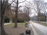 2
2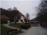 3
3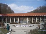 4
4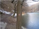 5
5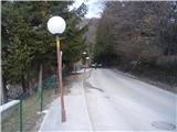 6
6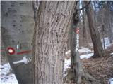 7
7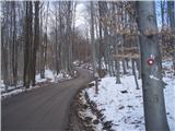 8
8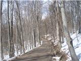 9
9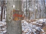 10
10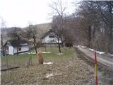 11
11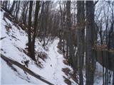 12
12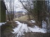 13
13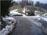 14
14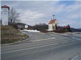 15
15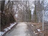 16
16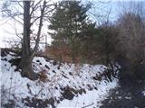 17
17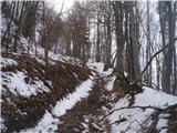 18
18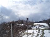 19
19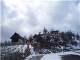 20
20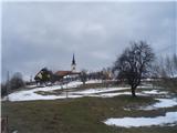 21
21 22
22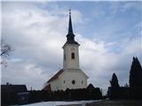 23
23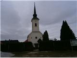 24
24
Discussion about the trail Maribor - Sveti Urban above Maribor (on path over Kozjak)
|
| bruny19. 03. 2014 |
Pred dnevi vpisal v iskalnik izletov...Maribor, predvideval !? itak in se je tudi v rdeči barvi izpisalo - ,,Trenutno ni v bazi nobenega izleta, ki bi ustrezal izbranim kriterijem,,. Štajerska metropola brez  konkretnega izhodišča po kar nekaj letih delovanja Hribi.net....Popravil in odpravil pomanjkljivost foruma, odločitev za eno bolj urbano izhodišče, malce prevetril slikovni material, bazo aktivnosti in Sv. Urban kot točka povezave Kozjaka in Slovenskih goric kar prava izbira za povezavo mestnega izhodišča in nemestnega cilja.Lp
|
|
|
|
| dprapr19. 03. 2014 |
Lepa varijanta je tudi po grebenu iz Kamnice pri Mariboru. Kakšne pol ure krajša.
|
|
|
|
| bruny20. 03. 2014 |
To je predvidevam pot, ki jo je opisal na teh straneh @pohodnik38 in ni označena planinska pot ampak trim pot vendar to ni pomembno. Osebno sem sestopil po planinski poti v smeri Kamnice ob domačiji Bračko, ki se spoji s cesto Kamnica - Rošpoh in v nadaljevanju skozi naselje doseže začetek oziroma konec poti neposredno v bližini hipodroma na povezavo Kamnica - Maribor... Več
|
|
|
|
| pohodnik3821. 04. 2014 |
Odlična pot po kateri bom še šel je prava izbira za turobne in vremensko nestanovitne dneve ko se ne da kam dlje in višje. OPIS IN SLIKE VIDEO Lp! Tone 
|
|
|
|
| bruny15. 08. 2015 |
Danes v soboto, 15.08.2015 po opisani poti tja in tudi nazaj...preveril če opis ,,še drži,,. Opis še v redu, edino takoj za sliko 11/domačijo in nekoliko pred sliko 12 na začetku gozdnega dela je nekaj padlih dreves - po videnem že kar nekaj časa, ki ovirajo pot. En prehod je sedaj relativno zahteven, dobro sam nisem imel problemov ampak v slabšem vremenu - družinski izlet, skupina otrok, veterani, pohod z baklami na božični večer in podobno bi znal biti neprijeten...Lp
|
|
|
|
| pohodnik383. 03. 2019 |
Danes po dolgem času spet po tej poti ampak z malo spremembe...čez Piramido na Sveti Urban.Vreme odlično in pot ravno prava za kondicijski trening predvsem z svojo dolžino ter vzponi in spusti. SLIKE in osebni vtisi z poti Lp! Tone
|
|
|