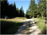
Zadnji travnik - Govca (Olševa)
Starting point: Zadnji travnik (1382 m)
| Lat/Lon: | 46,4601°N 14,6907°E |
| |
Time of walking: 1 h 45 min
Difficulty: easy marked way
Altitude difference: 547 m
Altitude difference po putu: 560 m
Map: Kamniške in Savinjske Alpe 1:50.000
Recommended equipment (summer):
Recommended equipment (winter): ice axe, crampons
Views: 53.810
 | 1 person likes this post |
Access to the starting point:
a) Drive to Črna na Koroškem (to get here from Ravenna na Koroškem or from Šoštanj via the Spodnje Sleme pass), then continue to Koprivna. We continue to climb along the Meži River, and we "miss" all the left and right turns until we reach a sharp left turn. At this turn, turn right towards Olševa (continue along the asphalt road Sveti Jakob) onto a macadam road which gradually begins to climb steeply. Continue climbing along the Meži River for a while, and then the slightly worse macadam road turns sharp left. A little higher up, there is a sharp right turn, and then the road climbs cross-country to the right. When we are already quite high, a slightly narrower road turns off to the right towards the nearby Govševa planina, and we continue straight ahead and follow the macadam road to a clearing where we see mountain direction signs for Olševa and the Kumer Mountain Home. Park in a suitable place next to the mountain direction signs.
b) Drive to Luce (to get here from Mozirje or from Kamnik via the Volovljek (Kranjski Rak) pass), then continue driving towards the Logar valley. In the village Solčava, leave the main road towards the Logar valley and turn right towards Podolševa, the pass Spodnje Sleme and Črna na Koroškem. The road then loses its asphalt surface, and after a few kilometres we turn right at the junction in Podolševa towards Črna na Koroškem. The road, which continues to climb mainly in a transverse direction, leads us after a while to the Spodnje Sleme Pass. From the pass, the road starts to descend and we follow it towards Črna na Koroške. After a few kilometres, we descend into the valley, turn left at a crossroads and then climb along the Meži River. A little higher up, the road to Kumru branches off to the right, and we follow the main road for about 1 km, or a sharp left turn. At the beginning of the bend we see signs for Olševo, which direct us to the right onto the macadam road. Continue climbing along the Meži River for a while and then the slightly worse dirt road turns sharp left. A little higher up, there is a sharp right turn, and then the road climbs cross-country to the right. When we are already quite high, a slightly narrower road turns off to the right towards the nearby Govševa planina, and we continue straight ahead and follow the macadam road to a clearing where we see mountain direction signs for Olševa and the Kumer Mountain Home. Park in a suitable place next to the mountain direction signs.
Path description:
From the unregulated parking lot, continue left towards Olševa along the path cart track, which goes into the forest after only a few metres. Walk along cart track for about 3 minutes, and then the signs will direct you slightly to the left onto a well-trodden footpath marked with arrows. A little higher up, the markings reappear and the path returns to cart track. The ascent continues on the gradually steeper cart track, which becomes slightly steeper and turns right. From the point where cart track turns to the right, walk along it for only a few more 10 metres, and then the markings will direct you to the left onto another steeper footpath, which will quickly lead you to the Foršnerca hunting bivouac.
From the hunting bivouac, continue straight ahead and then, after a few metres, turn left up the bank. The path starts to climb steeply through a partly larch forest, which thins out higher up. After a few minutes' ascent, the path becomes more gentle and leads to a small cirque. A few minutes of moderate ascent follow, and then the path becomes slightly steeper again, but this leads us over the increasingly scenic slopes of Olševa. Higher up, the path turns left and crosses a small ravine, which leads over rubble to the ridge of Olševa.
The ridge is reached at a marked crossroads, where you continue to the right in the direction of Govce, the highest peak of the ridge (to the left, the Spodnje Sleme and Raduha preval). The path continues along the left, mostly southern side of the ridge, where it crosses some steeper and in two places also exposed slopes (especially in wet and snow, a risk of slipping). Further on, the slope becomes slightly flatter and the path climbs a little steeper towards the ridge (on the left, the Spodnje Sleme and Raduha preval). With beautiful views of the mountains above the Logarska dolina valley, you quickly reach a kind of side ridge, which takes you up to the main ridge of Olševa in a few minutes. Here the path turns to the left and after some 10 steps of further walking leads us to Govca.

Pictures:
 1
1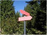 2
2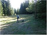 3
3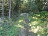 4
4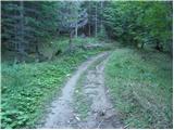 5
5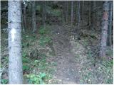 6
6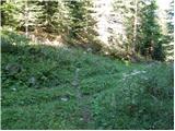 7
7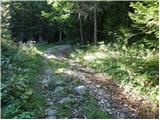 8
8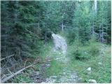 9
9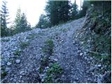 10
10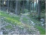 11
11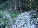 12
12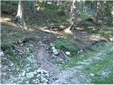 13
13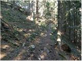 14
14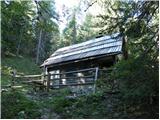 15
15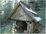 16
16 17
17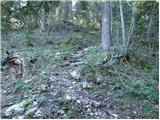 18
18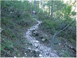 19
19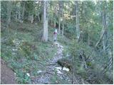 20
20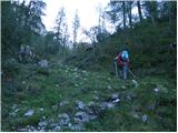 21
21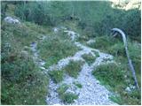 22
22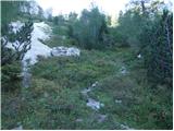 23
23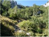 24
24 25
25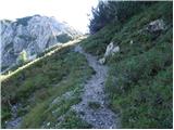 26
26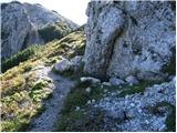 27
27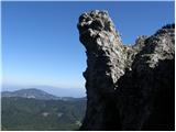 28
28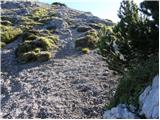 29
29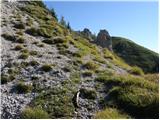 30
30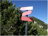 31
31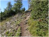 32
32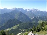 33
33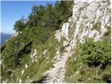 34
34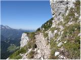 35
35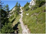 36
36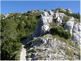 37
37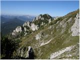 38
38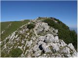 39
39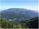 40
40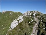 41
41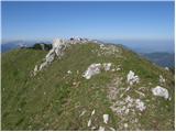 42
42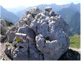 43
43 44
44
Discussion about the trail Zadnji travnik - Govca (Olševa)
|
| Janezs15. 05. 2014 |
Na tej poti je bilo danes teden še veliko "starega" snega, ko se pot "preseli na južno stran je bila kopna. Od izhodišča do lovskiga bivaka je veliko podrtega drevja čez pot.Seveda je tudi zapadlo precej novega snega, ki se nebo dolgo obdržal. Lp.
|
|
|
|
| balon31. 05. 2014 |
Ali je pot primerna za 5 in 7 letnika? Hvala za odgovor. Balončki 
|
|
|
|
| franca31. 05. 2014 |
Hej, Balonček. Za vrsto poti sprašuješ, če so primerne za 5-letnika. Kakor za katerega, enako kot za 20-letnike, 30-letnike, ..., pa še marsikateri 80-letnik tudi ni za odpis. Ti najbolje poznaš svoje otroke. Nikoli naj ti ne bo odveč obrniti ali spremeniti cilja, če bo malo preveč naporno ali predolgočasno.
|
|
|
|
| balon1. 06. 2014 |
Hej, franca hvala in res je otroka najbolj poznam, obrniti se ali spremeniti cilj ni poraz, temveč začetek nove zmage.
|
|
|
|
| borutpovse1. 06. 2014 |
Pomoje, če so navajeni nebi smel imeti težav. Moj 6 letnik komaj čaka, da vidi kako zajlo, tako mu tudi obisk Skute ni predstavljal nobenih težav. Pa srečno, lp.
|
|
|
|
| balon2. 06. 2014 |
Hvala in varen korak v naših gorah. Balončki
|
|
|
|
| Marko8313. 07. 2014 |
Js glede na opis nimam pojma, kje bi se prišlo do izhodišča, čeprav sem se včeri peljal tule v bližini, ker sem šel na Raduho. S katere stani se gre tule? Jug ali sever?
|
|
|
|
| Domch13. 07. 2014 |
Pelješ se naprej po cesti proti Lužam do konec Koprivne potem, pa v križišču, kjer so oznake za Olševo in izvir Meže levo, pa potem se držiš glavne ceste do vrha in prideš na zadnji travnik, potem pa samo po markacijah na greben in na Govco, gre za najmanj oblegano pot na Olševo, ampak je sedaj uradno zaprta zaradi podrtega drevja na poti, se pa da z malo poplezavnja med vejami priti skozi, če te praske ne motijo, slike s poti imaš pa pod Trenutne razmere - Olševa.
|
|
|
|
| Marko8315. 07. 2014 |
Mogoče kje na teh koordinatah?
46.443351, 14.675164
Sm v google maps vpiši.
Ponavadi grem iz smeri Črne gor.
Hvala
|
|
|
|
| VesnaJager22. 11. 2014 |
Zdravo, Mogoče kdo ve kakšne so trenutno snežne razmere na Govci? Hvala.
|
|
|
|
| balon9. 06. 2016 |
Ali je cesta do izhodišča primerna za enoprostorca? Thx,
|
|
|
|
| xxxyx9. 06. 2016 |
Cesta je čisto primerna tako da ni kakšne panike res pa da ni to neka avtocesta najslabši je prvi klanec od kmetije Pečnik vendar ne kaj hudega.
|
|
|
|
| mathei11. 06. 2018 |
Da malo osvežim komentarje na zgoraj opisan izlet. Opis poti več ali manj ustreza edino dodal bi, da pot ni glih lahka saj se cel čas poti vzpenjaš. Sicer jo je brez večjih naporov zmogel naš 4,5 letnik vendar ima kar nekaj prehojenih poti in je tega navajen. Dostop do izhodišča je kar jasno označen, vendar cesta je gozdna in na čase luknjasta.
Je pa potrebno imeti zraven blazinico za žig, saj drugače ni mogoče dati žiga v knjižico.
|
|
|
|
| NinaH29. 12. 2018 |
Cesta na Spodnji travnik je trenutno neprevozna zaradi drevja na cesti in skal na cestiscu, zato je treba avto pustit ali na odcepu, kjer cesta zavije na desno (ob znaku Olseva, desno je kmetija) ali pa ubrat katero drugo pot.
|
|
|
|
| barbarahribovka31. 03. 2019 |
Danes cesta na Olševo malo naprej od konca koprivne ni bila prevozna z osebnim avtomobilom
|
|
|
|
| glorija29. 06. 2019 |
Pozdravljeni..mi lahko kdo pove kako je dostopno po cesti do doma Kumer z avtomobilom,da startam iz Zadnjega travnika,so se podrta drevesa ...?
|
|
|
|
| balon20. 07. 2022 14:02:38 |
Pozdravljeni,
zanima me ali je pot primerna za psa (40 kg).
Za odgovor se zahvaljujem.
|
|
|
|
| balon11. 09. 2023 10:30:17 |
Hvala za odgovor milesdavis.
|
|
|
|
| balon20. 09. 2023 14:19:18 |
Kako je z dostopom iz smeri Solčava po poplavah? Je cesta prevozna za osebni avto?
Za odgovore se zahvaljujem.
|
|
|