Ogris - Ogrisalm/Vgrizeva planina
Starting point: Ogris (1180 m)
Time of walking: 1 h 15 min
Difficulty: easy marked way
Altitude difference: 389 m
Altitude difference po putu: 389 m
Map: Karavanke - osrednji del 1:50.000
Recommended equipment (summer):
Recommended equipment (winter): ice axe, crampons
Views: 4.611
 | 1 person likes this post |
Access to the starting point:
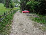
We drive to the Ljubelj border crossing and on to the Austrian side. Shortly after, when you see a small church on the left side of the road, the road to the village of Žabnica / Bodental branches off to the left. At the crossroads after Slovenji Plajberk / Windisch Bleiberg turn left towards Žabnica / Bodental. In Žabnica / Bodental you will reach the mountain signs for Klagenfurter Hütte on the left and right. Turn right and follow the road until the next crossroads where you turn left. Follow this road to a small parking area where the unmarked trail from the Podnar / Bodenbauer Inn joins (no further driving).
Path description:
From the parking lot, we continue past the lock along the road, which offers us some views in the initial part. The road then goes into the forest and leads to a crossroads where you turn left at cart track. Follow Cart track slightly upwards to a crossroads of two cart tracks. Take the slightly marked track to the right, which then turns into a footpath that climbs steeply. After a short climb, the path leads to a ridge where it turns left and continues first along and then along the ridge. The path then moves on to steep slopes which we cross without any major climbs. Next we cross a shorter partly overgrown scree slope, after which the path starts to climb again and soon leads us to the grazing fence mountain pasture Vgriz which is reached in a few minutes of further walking. At mountain pasture, where the shepherd's hut is situated, a beautiful view opens up.
Pictures:
 1
1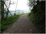 2
2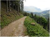 3
3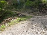 4
4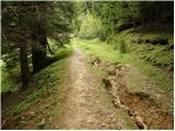 5
5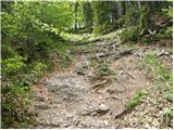 6
6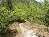 7
7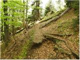 8
8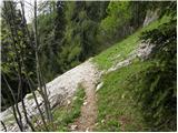 9
9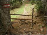 10
10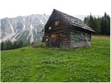 11
11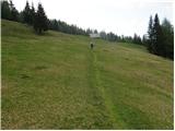 12
12
Discussion about the trail Ogris - Ogrisalm/Vgrizeva planina
|
| Guest16. 05. 2007 |
Tale izlet imam v načrtu spet za konec meseca, me pa nekoliko čudijo tule uporabljena imena.
Beseda "Vgriz" je sicer res zapisana na našem zemljevidu Karavank, mi pa zveni nekam nenaravno. V avstrijskih zemljevidih tega priimka in krajevnega imena ni, pač pa je zapisano Ogris (npr. Ogrisalm - Ogrisova planina). (tudi vabilo mojega društva na izlet vabi na Ogrisovo planino). Nasprotno pa je tule uporabljen samo nemški izraz za Podnarja (Bodenbauer), ki je pa pri nas čisto udomačen in uporabljan, prav tako velja za Celovško kočo (Klagenfurthütte). Po mojem mnenju bi bilo v primerih opisov poti v tujejezičnem področju najbolje vsako krajevno ime zapisati v jeziku tamkajšnjih prebivalcev in v slovenščini (za obmejne kraje v Avstriji in Italiji, ki nosijo tudi slovensko ime).
|
|
|
|
| Lunca9. 05. 2018 |
Kako iz te planine najdem pot na Kosmatico? Hvala za odgovore, LP
|
|
|