Na Sušeh - Ajdna (easier way)
Starting point: Na Sušeh (1085 m)
| Lat/Lon: | 46,4247°N 14,1343°E |
| |
Name of path: easier way
Time of walking: 20 min
Difficulty: easy marked way
Altitude difference: -39 m
Altitude difference po putu: 50 m
Map: Karavanke - osrednji del 1:50.000
Recommended equipment (summer):
Recommended equipment (winter): ice axe, crampons
Views: 11.538
 | 3 people like this post |
Access to the starting point:
From the motorway Ljubljana - Jesenice take the exit Vrba and follow the road towards Jesenice. Soon the road to the village of Žirovnica will turn right. Take this road and then follow it through the village, after which it climbs steeply for a short time and then, at the point where the asphalt ends, brings us to a crossroads. Continue left in the direction of Valvasor's home and Potoška planina (straight ahead Završnica). The relatively well-maintained road then leads to a crossroads where you continue left in the direction of Potoška planina and Valvasor's home. At the next crossroads, continue left along the lower road towards the trail mountain pasture (right up Valvasor's House). After a while you reach the next crossroads, where Ajdna is down on the left (marked) and Potoška planina is straight ahead. Ajdna is down on the left (marked) and Potoška planina is down on the right. Park here in the roadside parking lot.
Path description:
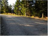
From the parking lot, take the lower left path towards Ajdna. After a short descent down the road, a signpost directs you left downhill to cart track. Follow Cart track descending to a saddle between Ajdna on the right and an unnamed peak on the left. Here we are at a crossroads where we go slightly down to the right (straight up the climbing route). Our right path continues across the slopes of Ajdna to where the path from the village of Potoki joins us. Here we head left up a steep path which is dangerous to slip on in the mud and ice. After a few minutes of ascent, the path leads to a viewpoint where you turn left along a small ridge. This path leads in a few steps to the archaeological settlements. The path goes left over the old settlements in this part and leads us to a ridge where we join a climbing path. From here to the top we have only a few metres of easy walking.
Pictures:
 1
1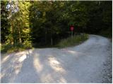 2
2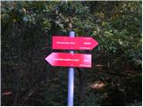 3
3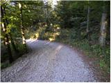 4
4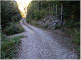 5
5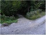 6
6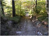 7
7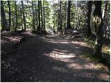 8
8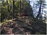 9
9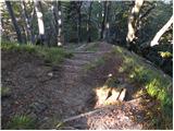 10
10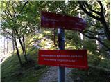 11
11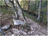 12
12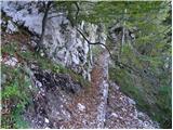 13
13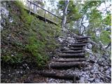 14
14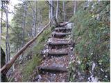 15
15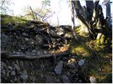 16
16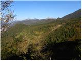 17
17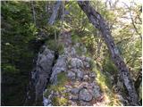 18
18 19
19 20
20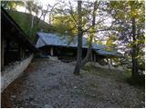 21
21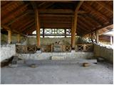 22
22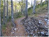 23
23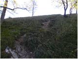 24
24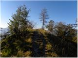 25
25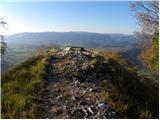 26
26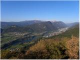 27
27
Discussion about the trail Na Sušeh - Ajdna (easier way)
|
| birch19. 05. 2009 |
Že bila,ampak pred dnevi,ko še nisem vedela za HRIBI.NET,zato sem se izgubila(premalo gledala naokoli) in najprej prišla na Potoško planino.Čudovit razgled 
|
|
|
|
| heinz24. 05. 2009 |
Trenutno glede hoje na Ajdno velja opozorilo splošne nevarnosti zaradi uničene poti. Občina Žirovnica je postavila posebne opozorilne table, na katerih tudi odsvetuje vzpon. Obljubljajo, da bodo stvar v kratkem sanirali.
|
|
|
|
| andrejjerina26. 07. 2010 |
Pot je normalno prehodna, vsa pohvala za lepo urejeno pot. LP Andrej
|
|
|
|
| HENRIK BRODNJAK1. 09. 2017 |
Glede na opis, bo treba iti čimprej, seveda ob lepem vremenu.
|
|
|