Vitanje - Golež castle (upper path)
Starting point: Vitanje (452 m)
| Lat/Lon: | 46,38393°N 15,29819°E |
| |
Name of path: upper path
Time of walking: 40 min
Difficulty: easy unmarked way
Altitude difference: 53 m
Altitude difference po putu: 100 m
Map: Pohorje 1:50.000
Recommended equipment (summer):
Recommended equipment (winter): ice axe, crampons
Views: 323
 | 1 person likes this post |
Access to the starting point:
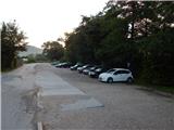
From Vojnik, Mislinja or Slovenske Konjice, drive to Vitanje, where you can park in the parking lot in the centre of the village in the marked parking lot at Hudinja (the parish church of St Peter and St Paul is at the starting point). It is also possible to park elsewhere in the village.
Path description:
From the parking lot, walk to the bridge over Hudinja, where you turn left at the crossroads towards Slovenske Konjice and the path to Stenica. After the nearby chapel at the pedestrian crossing, cross the main road carefully and continue along the pavement towards Slovenske Konjice for a few more 10 steps, then the signs lead you slightly right onto a steeper narrower road, which quickly ascends to the nearby hill where the Church of the Assumption is located.
Before the church, turn left and follow the asphalt path back to the main road, where you continue along the pavement for a few steps before the signs for Stenica point you to the right. Just a little further on, cross the Hočno stream over a bridge, and a narrower asphalt path with a slight to moderate incline past a trough leads to a crossroads, where you go left towards Stenice. At the next crossroads go slightly right, then follow the asphalt road up to the left turn, where you continue along the right-hand road, which begins to descend through the forest (on the left is the village of Stenica).
A little lower down, the signs for Golež castle direct you slightly left from the asphalt road onto a less good dirt road, which initially continues parallel to the asphalt road and then turns left. At this point a fine view of part of Vitanje opens up, and the path gradually turns into an overgrown cart track. Cart track ends a few minutes further on, and we continue on the beaten but still overgrown track, which joins the better beaten lower track a little further on.
When you reach the path, go left, initially climb a little more, and when the path is laid, you will quickly reach the viewpoint of Goležev castle.
The climb up to the ruins is dangerous, partly because of the steepness, but mainly because of the high risk of falling rocks.
The description and pictures refer to the situation in July 2022.

Pictures:
 1
1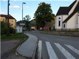 2
2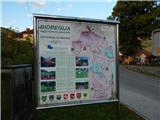 3
3 4
4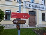 5
5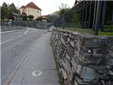 6
6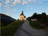 7
7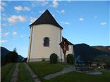 8
8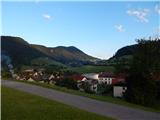 9
9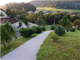 10
10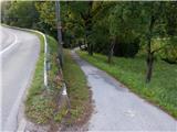 11
11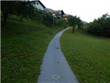 12
12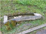 13
13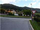 14
14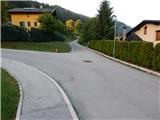 15
15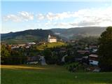 16
16 17
17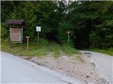 18
18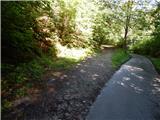 19
19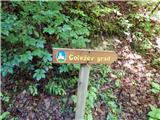 20
20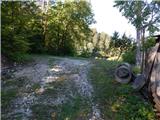 21
21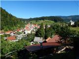 22
22 23
23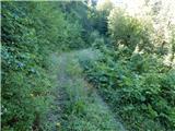 24
24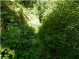 25
25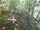 26
26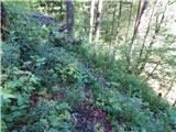 27
27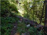 28
28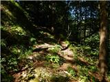 29
29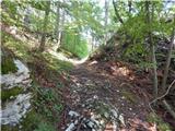 30
30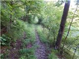 31
31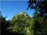 32
32
Discussion about the trail Vitanje - Golež castle (upper path)
|
| Lisica27. 09. 2022 14:52:24 |
Pred kratkim sem raziskovala Vitanje. Najprej Krajnikov grad potem se na tega Golezevega. Parkirala sem pri Mercatorju, pot pa zacela cez cesto pri Gasilskem domu desno po poti...so lokalne oznake povsod do vrha. Zelo impresivno na kaksni skali ta grad stoji. Jaz sem sla okrog pod skalo po levi strani in do vrha. Pri tem opisu zgoraj bi jaz sla pri sliki 21 dol cez gozd in potem takoj levo mimo kmetije s konji, tista pot zgleda bolj shojena saj gre naprej na Stenico.
|
|
|