Na kopiš - Planina Spodnja Konjščica (by road)
Starting point: Na kopiš (1023 m)
| Lat/Lon: | 46,3799°N 14,3429°E |
| |
Name of path: by road
Time of walking: 2 h
Difficulty: easy marked way
Altitude difference: 428 m
Altitude difference po putu: 515 m
Map: Karavanke - osrednji del 1:50.000
Recommended equipment (summer):
Recommended equipment (winter): ice axe, crampons
Views: 1.505
 | 1 person likes this post |
Access to the starting point:
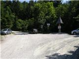
From the Ljubljana - Jesenice motorway, take the Ljubelj exit (Tržič) and then continue towards Ljubelj. Just before the petrol station in Bistrica pri Tržiču, leave the main road and turn right towards Tržiča. Continue through Tržič in the direction of Dolžanove gorge, then turn right at the end of the town in the direction of Lom pod Storžičem and Grahovš. At the part between Lom pod Storžič and Grahovše, the road turns left towards the Tič farm and the hamlet of Potarje. Continue in the direction of Tič on a slightly narrower asphalt road until the crossroads below Tič Farm, where the asphalt ends. This is our starting point, called "Na kopiš" (On the kopišču), where there is also a signpost and an ecological island for waste from mountain farms. Park in a suitable place at the crossroads (the road for Tič and Strmec farms branches off to the right, the road for Pinč and Urh farms to the left). On the signpost there are also signs for mountain pasture Konjščica (on the left for the access option along the macadam road up to mountain pasture Sp. Konjščica, which is shown below and is more suitable for cycling, and on the right for the option past the Tič farm-see the access option and the description of the route "To the Lower Konjščica kopiš-plan (past Tič)").
Path description:
From the starting point continue along the dirt road in the route mountain pasture Konjščica (on the sign mountain pasture Konjšca), which first climbs moderately to the pass to the east of Vratný vrh (1081 m). After the pass, the road flattens out and then leads without any major changes in elevation along the western to north-western slopes. Soon you reach the next crossroads, where you continue slightly right (slightly left along the lower Urh-Pinč homestead road).
From the crossroads onwards the road starts to climb steeply through the forest. Higher up, the path leads us past a few small streams and then completely lays down after a short lookout point, from where a beautiful view opens up towards Košuta and the other surrounding mountains. Behind the pass south of Zadnji vrh (1218 m), the road starts to descend moderately, and after a few minutes leads to the next crossroads, where we continue in the direction of Konjščice (straight mountain pasture Vetrh). A steep climb of a few minutes ensues, along a road that gradually turns to the right. Then cross the slopes to the right, where the path leads us first past a small wooden hut, and a little higher up, past a bench by the Žegnanem studencu (Blessed Well). Just above the bench you reach a crossroads where you continue left (straight Grahovše), then start climbing steeply again. Higher up, the path leads us over a scenic and steep slope, and at the end of the above-mentioned section, the marked path from Lom pod Storžičem and Grahovš joins us from the right.
Continue along the road, which leads us past the pasture fence, and beyond it we quickly arrive out of the forest and consequently at the shepherd's hut at mountain pasture Spodnja Konjščica.
Description and pictures refer to the situation in 2015 (July).

Pictures:
 1
1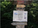 2
2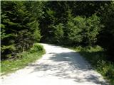 3
3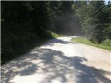 4
4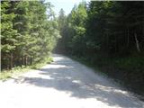 5
5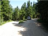 6
6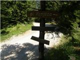 7
7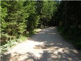 8
8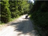 9
9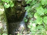 10
10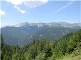 11
11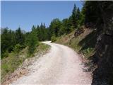 12
12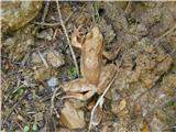 13
13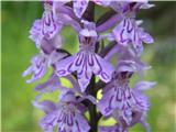 14
14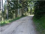 15
15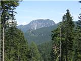 16
16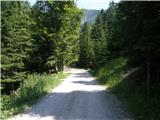 17
17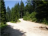 18
18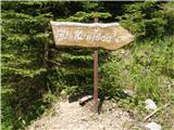 19
19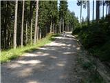 20
20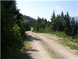 21
21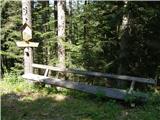 22
22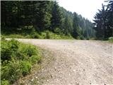 23
23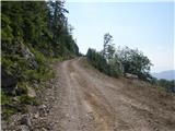 24
24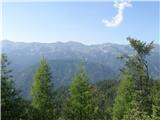 25
25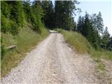 26
26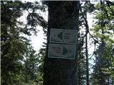 27
27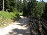 28
28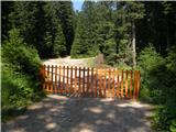 29
29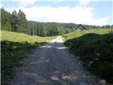 30
30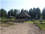 31
31
Discussion about the trail Na kopiš - Planina Spodnja Konjščica (by road)