 | Markova raven - Veliki Zvoh (on unmarked path via Razor)
Veliki Zvoh is the highest point of the Krvavec ski resort. The cable car does not quite reach the top, but it is only a few metres short of the ...
3 h |
 | Gozd - Tolsti vrh (Ovčja pot over Kriška gora)
Tolsti vrh, located to the west of Storžič, is also the highest peak of the Kriška Gora, a mountain range rising steeply above the central Gorenj...
2 h 30 min |
 | Tominčev slap Waterfall - Dobrča
Dobrča is a 1634 m high mountain located between Begunje and Tržič. From the top, where the registration box with the stamp is located, we can se...
3 h |
 | Draga - Dobrča (via Ledena trata)
Dobrča is a 1634 m high mountain located between Begunje and Tržič. From the top, where the registration box with the stamp is located, we can se...
3 h |
 | Hudi Graben - Dobrča (via Lešanska planina)
Dobrča is a 1634 m high mountain located between Begunje and Tržič. From the top, where the registration box with the stamp is located, we can se...
2 h 35 min |
| Hudi Graben - Dobrča
Dobrča is a 1634 m high mountain located between Begunje and Tržič. From the top, where the registration box with the stamp is located, we can se...
2 h 30 min |
 | Grahovše - Veliki Javornik (Ženiklovec)
Veliki Javornik or Ženiklovec is a 1716 m high peak located between Storžič and Stegovnik. From the grassy summit, where the registration box is ...
2 h 45 min |
 | Grahovše - Veliki Javornik (Ženiklovec) (via Rekar)
Veliki Javornik or Ženiklovec is a 1716 m high peak located between Storžič and Stegovnik. From the grassy summit, where the registration box is ...
2 h 45 min |
 | Kraljev hrib - Rzenik (west path)
Rzenik is a grassy peak surrounded by dwarf pines, which descends precipitously towards the Kamniška Bela valley. From the top, in fine weather, ...
3 h 40 min |
 | Volaka - Blegoš (on unmarked path)
Blegoš is a 1562 m high mountain located between Selška and Poljane Sora. From the grassy summit, on which there is a stamp and a registration bo...
2 h 35 min |
 | Planina pod Golico - Barentaler Kotschna/Struška
Barentaler Kotschna is a small mountain range located between Stolo or Belščica and Golica. From Veliki vrh, as the highest peak of the mountain ...
3 h |
 | Dom Pristava in Javorniški Rovt - Barentaler Kotschna/Struška (via Dobravske rovte)
Barentaler Kotschna is a small mountain range located between Stolo or Belščica and Golica. From Veliki vrh, as the highest peak of the mountain ...
2 h 30 min |
 | Dom Pristava in Javorniški Rovt - Barentaler Kotschna/Struška (footpath)
Barentaler Kotschna is a small mountain range located between Stolo or Belščica and Golica. From Veliki vrh, as the highest peak of the mountain ...
3 h 15 min |
| Dom Pristava in Javorniški Rovt - Barentaler Kotschna/Struška (by road)
Barentaler Kotschna is a small mountain range located between Stolo or Belščica and Golica. From Veliki vrh, as the highest peak of the mountain ...
3 h |
 | Planina pod Golico - Kahlkogel/Golica (via Ovčarska koča - eastern way)
Kahlkogel is an unvegetated peak located north of Jesenice. From the top, which has a registration box, there is a beautiful view of the western ...
2 h 45 min |
 | Dom Pristava in Javorniški Rovt - Kahlkogel/Golica (on ridge)
Kahlkogel is an unvegetated peak located north of Jesenice. From the top, which has a registration box, there is a beautiful view of the western ...
2 h 45 min |
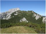
 | Mače - Bašeljski vrh (via valley of Suha and via Kališče)
Bašeljski vrh is a 1744 m high mountain located between Mali Grintovec and Storžič. From the top, where there is a bench and a registration box w...
3 h 15 min |
 | Smrečje - Pečovnik (survey point 1668) (by road)
Pečovnik) is a 1668 m high mountain located between Plešivec (1801 m) and Virnik's Grintovec (1654 m). The grassy peak, located on the border bet...
2 h 45 min |
 | Smrečje - Plešivec (by road)
Plešivec is an 1801 m high peak located south of the eastern part of Košuta. The summit, on which the border signpost stands, offers a beautiful ...
3 h 30 min |
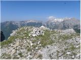
 | Za Loncem - Deska (Veža)
Deska is a scenic peak located in the heart of the Dleskovška Plateau or Veža. From the top, where a large cairn stands, we have a beautiful view...
3 h 30 min |
 | Za Loncem - Tolsti vrh (Veža)
Tolsti vrh is a 1985 m high mountain located in the heart of the Dleskovská Plateau - Veže. The summit, which is covered with dwarf pines, offers...
3 h 35 min |
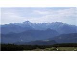
 | Ribčev Laz - Rodica (via Lepa Suha)
The mountain is located above Bohinj in the Lower Bohinj Mountains. From the top there is a beautiful view of Julian Alps and Škofjeloško and the...
4 h |
 | Rosenbach - Klek
Klek is a 1753 m high mountain located between Rosenkogel and the more famous Golica. The summit, which borders between Slovenia and Austria, off...
3 h 40 min |
 | Log - Vošca
Vošca is a 1737 m high peak located west of Trupe's Non. From the grassy summit, we have a beautiful view of Julian Alps, the western Karawanks, ...
2 h 30 min |
 | Srednji Vrh - Vošca (via Zajčnik)
Vošca is a 1737 m high peak located west of Trupe's Non. From the grassy summit, we have a beautiful view of Julian Alps, the western Karawanks, ...
2 h 35 min |
 | Srnjak - Vošca
Vošca is a 1737 m high peak located west of Trupe's Non. From the grassy summit, we have a beautiful view of Julian Alps, the western Karawanks, ...
2 h 45 min |
 | Srednji vrh - Techantinger Mittagskogel (Trupejevo poldne) (via Železnica)
The mountain is located on the border with Austria and is above Gozd Martuljko. From the uncultivated summit there is a beautiful view of Julian ...
2 h 30 min |
| Srednji vrh - Techantinger Mittagskogel (Trupejevo poldne) (via Grajšca)
The mountain is located on the border with Austria and is above Gozd Martuljko. From the uncultivated summit there is a beautiful view of Julian ...
4 h |
 | Srednji Vrh - Techantinger Mittagskogel (Trupejevo poldne) (via valley of stream Žlebnica)
The mountain is located on the border with Austria and is above Gozd Martuljko. From the uncultivated summit there is a beautiful view of Julian ...
2 h 45 min |
 | Srednji Vrh - Kresišče (via Grajšca)
Kresišče is a 1839 m high peak located in the main ridge of Karawanks, more precisely between Kepa and Trupe's Non. From the summit, on which sta...
2 h 50 min |
 | Kraljev hrib - Koritni vrh (Velika planina)
Koritni vrh is a 1648 m high mountain located in the northern part of Velika planina. From the top, on which stands a small cross, a beautiful vi...
3 h |
 | Dom Trilobit - Weinasch/Vajnež (via Rida)
Weinasch is the highest peak of Belščice, a mountain range located to the west of the better known Stoľa. From the top, where the cross and the S...
4 h |
 | Mojstrana - Vrtaški vrh (old path)
Vrtaški vrh is a scenic mountain overloking the Vrata valley. From the grassy summit, which is covered around and around with dwarf pines, there ...
3 h 30 min |
 | Srednji vrh - Mallestiger Mittagskogel (Via Grajšca)
Mallestiger Mittagskogel, or Mallestiger Mittagskogel in German, is an 1801 m high mountain located on the northern side of the main Karavanke mo...
3 h 10 min |
 | Source of Ljubija - Smrekovec (via Leskovškova pustota)
Smrekovec is a volcanic mountain on the eastern edge of the Smrekov Mountains. The extensive grassy summit, on which stands a pyramid with a regi...
2 h 20 min |
| Source of Ljubija - Smrekovec (by road)
Smrekovec is a volcanic mountain on the eastern edge of the Smrekov Mountains. The extensive grassy summit, on which stands a pyramid with a regi...
2 h 30 min |
 | Ivarčko jezero - Uršlja gora (Plešivec) (Grofovska pot)
Uršlja gora or Plešivec is a lookout mountain between Slovenj Gradec and Črna na Koroškem. On the top or just below it stands the Church of St Ur...
2 h 50 min |
 | Trbiž / Tarviso - Svete Višarje / Monte Lussari (on transport road)
Svete Višarje is a pilgrimage site for Slavs, Germans and Romans. As early as the 16th century, the mountain was called the God's Way of the Thre...
3 h 25 min |
 | Tolminske Ravne - Žabiški Kuk (on mule track)
Žabiški Kuk is located on the southern side ridge of the Lower Bohinj Mountains near the better known Vogel and above mountain pasture Razor. Fro...
3 h 45 min |
 | Ukanc - Vrh Planje (above Globoko) (via Globoko)
Vrh Planje is a less distinct peak in the ridge of the Lower Bohinj Mountains, which has recently become more and more visited. Vrh Planje (above...
4 h |
 | Jevšček - Monte Mataiur/Matajur
Monte Mataiur is a scenic mountain located on the border between Slovenia and Itali. From the top, you have a beautiful view of the Kobarid or Br...
2 h 30 min |
 | Draga - Šentanski vrh (via Ledena trata)
Šentanski vrh, located in the Dobrča mountain range, only 5 minutes away from the main peak, offers a beautiful view of the central Karawanks, th...
3 h 5 min |
 | Hudi Graben - Šentanski vrh (via Lešanska planina)
Šentanski vrh, located in the Dobrča mountain range, only 5 minutes away from the main peak, offers a beautiful view of the central Karawanks, th...
2 h 40 min |
| Hudi Graben - Šentanski vrh
Šentanski vrh, located in the Dobrča mountain range, only 5 minutes away from the main peak, offers a beautiful view of the central Karawanks, th...
2 h 35 min |
 | Weissensee - Kopasnock (via Karalm)
Kopasnock is a lesser known peak in the Latschur group reached by an unmarked route. The grassy peak offers a beautiful view of Gailtaler Alps, C...
4 h |
 | NC Planica - Glave (by ski jumping hill)
Glave are an undistinguished side ridge of the Ponce, rising steeply to the west of Planica. The highest peak of Glav, which measures 1760m, is c...
2 h 30 min |
| Rateče (Ledine) - Glave
Glave are an undistinguished side ridge of the Ponce, rising steeply to the west of Planica. The highest peak of Glav, which measures 1760m, is c...
2 h 50 min |
 | Markova raven - Krvavec (on unmarked path via Razor)
Krvavec is an 1853 m high peak located in the heart of the ski resort of the same name. The summit, which is criss-crossed with cable cars, offer...
2 h 45 min |
 | Podbreg - Logarska peč
Logarska peč is a peak or viewpoint a few metres below the summit, rising steeply above the Logarska dolina valley. Logarska peč offers a very ni...
2 h 20 min |
 | Gozd Martuljek - Kurji vrh
Kurji vrh is a little visited mountain located southeast of Kranjska Gora. From the summit, which has a registration box, we have a beautiful vie...
3 h |
 | Grant - Jehlc (Špičasta kupa)
For Jehlc we will get different names on different maps, which also differ in height. The locals call the peak Jehlc (1625 m), but on more recent...
2 h 45 min |
| Stržišče - Jehlc (Špičasta kupa)
For Jehlc we will get different names on different maps, which also differ in height. The locals call the peak Jehlc (1625 m), but on more recent...
3 h 30 min |
 | Srednji Vrh - Maloško poldne / Mallestiger Mittagskogel
Maloško poldne or Mallestiger Mittagskogel in German is a 1823 m high peak located on the border between Slovenia and Austria, more precisely bet...
2 h 55 min |
 | Vas na Skali - Čisti vrh
Čisti vrh is a 1875 m high mountain located north of the Špičje ridge, more precisely on the lookout above the Čez Drt saddle. From the summit, w...
3 h 30 min |
 | Stara Fužina - Krsteniški Stog
Krsteniški or Little Stog is a 1879 m high mountain rising steeply above mountain pasture Krstenica. From the top, on which stands a stone cairn,...
4 h |
 | Kal - Rušni vrh
Rušni vrh is a 1786 m high peak located to the east of Črna prsti. From the summit, which is the boundary stone of the old Rapallo border, we hav...
2 h 20 min |
 | Srnjak - Tamarča
Tamarča is a lesser known peak located northwest of Voška. The summit, surrounded by a larch forest, offers a beautiful view of the Martuljka gro...
2 h 30 min |
 | Radovna - Vošni vrh
Vošni vrh is a 1621 metre high mountain located in the ridge of mountains starting at Radovna and ending at Tosc. The peak itself is located in a...
3 h |
 | Ribčev Laz - Hunting cottage Na Glinu
Hunting cottage Na Glinu is located on a lookout between the mountains Suha and Poljana. The hut offers a beautiful view of Triglav and most of t...
3 h 30 min |
 | Srednji Vrh - Bele peči (Lepi vrh) (via Železnica)
Bele peči, also Peči or Na Pečeh (on maps the name Lepi vrh appears, which is a misnomer - Lepi vrh is in fact a forest shoulder at 1478 m, locat...
2 h 30 min |
| Srednji Vrh - Bele peči (Lepi vrh) (via valley of stream Žlebnica)
Bele peči, also Peči or Na Pečeh (on maps the name Lepi vrh appears, which is a misnomer - Lepi vrh is in fact a forest shoulder at 1478 m, locat...
2 h 45 min |
 | Jasna - Visoka peč (via Mojčin dom)
Visoka peč is a 1,749-metre-high mountain located south-west of Ciprnik. From the top, which descends steeply towards Planica and on which a smal...
3 h 30 min |
| Kranjska Gora - Visoka peč (via Bedančev dom)
Visoka peč is a 1,749-metre-high mountain located south-west of Ciprnik. From the top, which descends steeply towards Planica and on which a smal...
3 h 25 min |
 | Trbiž / Tarviso - Florjanka / Monte Florianca (on transport road)
Florjanka is a 1,653-metre-high mountain on the Italian side of the Julian Alps. At the top or just below it, there is a reservoir for snowmaking...
2 h 30 min |
 | Dom v Lepeni - Velika Montura
Velika Montura is a scenic peak located between Velika Baba, Lanževica, Bogatin and Veliki Šmohorje. Just below the summit are old Italian carava...
3 h 55 min |
 | Rebrca / Rechberg - Stara gora / Altberg (via Bukovnik)
Stara gora is a 1552 m high peak located north-east of Hochobir, the highest peak of the Obir. A wooden cross and a bench are placed on the summi...
2 h 50 min |
| Rebrca / Rechberg - Stara gora / Altberg (via Rokov vrh)
Stara gora is a 1552 m high peak located north-east of Hochobir, the highest peak of the Obir. A wooden cross and a bench are placed on the summi...
3 h 10 min |
 | Vranček - Hajnžev Praprotnik / Zeller Prapotnik
Hajnžev Praprotnik is a 1727 m high peak located on the Austrian side of Karawanks, more precisely between Loibler Baba and the village of Sele-Z...
3 h 20 min |
| Sele-Zvrhnji Kot (Male) / Zell-Oberwinkel (Male) - Hajnžev Praprotnik / Zeller Prapotnik
Hajnžev Praprotnik is a 1727 m high peak located on the Austrian side of Karawanks, more precisely between Loibler Baba and the village of Sele-Z...
3 h 55 min |
 | Spodnja Trenta - Na Glavi
Na Glavi or Na Glavi is a 1666-metre-high peak above Stari Utr. From the top, which is covered with dwarf pines, there is a very beautiful view o...
3 h 25 min |
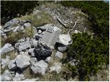
 | Ombrico - Monte Gosadon
Monte Gosadon is a slightly less visited peak in the Naborjeta group. There are also a number of World War I remains in the vicinity of the peak....
3 h 40 min |