Šajda / Schaidasattel - Kravji vrh / Kuhberg (via Obirsko sedlo)
Starting point: Šajda / Schaidasattel (1069 m)
| Lat/Lon: | 46,4794°N 14,4676°E |
| |
Name of path: via Obirsko sedlo
Time of walking: 2 h 45 min
Difficulty: easy unmarked way
Altitude difference: 948 m
Altitude difference po putu: 948 m
Map: Karavanke - osrednji del 1:50.000
Recommended equipment (summer):
Recommended equipment (winter): ice axe, crampons
Views: 3.987
 | 2 people like this post |
Access to the starting point:
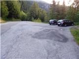
a1) From the motorway Ljubljana - Jesenice take the exit Ljubelj (Tržič) and then continue driving towards Klagenfurt / Klagenfurt. After the Ljubelj tunnel, the road starts to descend and we follow it to a crossroads where the road to Borovlje / Ferlach branches slightly to the right and downwards. The road continues to descend and quickly leads us to the aforementioned place, where we soon cross the railway line. Just after the railway line, we join another road, which we follow to the right, and we follow it in the direction of Sele pri Cerkvi / Zell - Pfarre. The road then begins to climb towards the above-mentioned settlement, which is situated at about 950 m above sea level. It then descends gradually to the settlement of Sele - Borovnica / Zell - Freibach and to a crossroads where the road joins the road past the Borovnica dam lake (description a2). Here we continue to the right towards Sele - Schajda / Zell - Schaida and Železna Kapli / Bad Eisenkappel. Follow the road to Železna Kapla only as far as the Schajda / Schaidasattel Alpine Pass, where you park in a well maintained asphalt parking lot. From the tunnel entrance to the starting point is about 33 km
a2) From the motorway Ljubljana - Jesenice take the exit Ljubelj (Tržič) and then continue driving towards Klagenfurt / Klagenfurt. After the Ljubelj tunnel, the road starts to descend and we follow it to a crossroads where the road to Borovlje / Ferlach branches off slightly to the right and downwards. The road continues to descend and quickly leads to the aforementioned place, where we soon cross the railway line. Just after the railway line, we join another road, which we follow to the left (right Sele near Cerkva / Zell - Pfarre (description a1)) and then right at the next slightly larger junction. At the end of Borovlje you reach a roundabout, from which you continue again in the direction of Železna Kaple. Continue driving through the villages of Medborovnica / Unterferlach, Ostrovca / Ostrouza, Trata / Tratten, Glinje / Glainach, Vesca / Dörfl, Ždovlje / Seidolach, Dobrova / Dobrowa, Kočuha / Gotschuchen, Šmarjeta v Rož / Sankt Margareten and Rosental, Dolnja vas / Niederdörfl to the village of Zgornja Vesca / Oberdörfl. Just after the last mentioned village, you will reach a slightly larger crossroads, where you will turn right towards Sele / Zell (Pri Cerkvi / Zell - Pfarre, Borovnica / Freibach and Šajda / Schaida). Continue past the Borovnica dam / Freibach - Stausee, after which the road becomes slightly narrower, and then quickly reaches a point where you join the road from Sele pri Cerkvi (description a1). Here we continue to the left towards Sele - Schajda / Zell - Schaida and Železna Kapli / Bad Eisenkappel. Follow the road to Železna Kapla only as far as the Schajda / Schaidasattel Alpine Pass, where you park in a well maintained asphalt parking lot. From the tunnel entrance to the starting point is about 38. 5 kmb) Via Border crossing Jezerski vrh or Pavličev vrh, drive into Austria and continue to Železna Kapla / Bad Eisenkappel. In Železna Kapla, leave the main road and continue driving to the left in the direction of Obirsko / Ebriach and Sele - Šajda / Zell Schaida. After a few kilometres, we reach a crossroads where the road to Korte / Trögern branches off to the left, and we continue straight ahead and follow the ascending road to the Schaidasattel / Schajda Pass, where we park in the parking lot on the left-hand side of the road. From Border crossing Jezerski vrh to the starting point is just over 28 km and from Border crossing Pavličev vrh about 30 km.
c) First drive to Dravograd, then continue to Border crossing Vič and Labot / Lavamünd in Austria. In the aforementioned town, turn left and then drive towards Pliberk / Bleiburg and Železna Kapla / Bad Eisenkappel. In Železna Kapla turn right towards Obirsko / Ebriach and Sele - Schajda / Zell Schaida. After a few kilometres, we reach a crossroads where the road to Korte / Trögern branches off to the left, and we continue straight ahead and follow the ascending road to the Schaidasattel / Schajda Pass, where we park in the parking lot on the left-hand side of the road. From Border crossing Vič to the starting point is just over 64 km.
Path description:
From the parking lot, walk to the nearby pass, and from there continue right towards the Hochobir peak (Hochobir is the highest peak of the Obir). The route takes you past a pleasant rest area at the very beginning, and then along a dirt road, which opens up a beautiful view of the northern walls of the Košuta, Freiberg / Freiberg and beyond. Follow the dirt road from the main road at the Šajda Pass to signposts pointing to the right onto a path that begins to climb through the forest. The trail, which crosses the macadam road 8 times, climbs through the forest most of the time, but in between there are enough clearings, grassy slopes and sparse forest to give us a nice view, especially to the south and west. When you finally leave the road, climb the wooden steps and then emerge from the forest into a larger meadow, where you will see Kacmun's Cross on the right.
At Kacmun's Cross, the path first turns left and leads past the entrance to the tunnel. After the tunnel, the steep path continues straight on to Kravji vrh (across the meadow, a trackless path), and we continue on the marked path, which turns right into the forest. After a few minutes, the mostly spruce forest begins to thin out, and then the path leads us over a pasture fence to a view of the increasingly grassy slopes. The path continues along an undistinguished grassy valley towards Obirsattel. A few steps before reaching the saddle, the marked path turns right and we continue to the ridge, from where a beautiful view opens up to the north, where we can see the Borovnica barrier lake, part of the Drava Valley, Mali Obir, Ojstrc. . .
If we pay attention on the saddle, we can see the old faded sign "Kuhberg", which points us to the left. Find the continuation of the path in the dwarf pines zone a few metres below the ridge, then follow the unmarked but cut path through the dwarf pines towards Kravje Top. The path to Kravji vrh continues along and along the ridge and first takes us to the summit of Kravji vrh, which is higher than the summit on which the cross is located. There is a moderate descent and then a shorter climb to the cross and the registration box on Kravje vrh.

Pictures:
 1
1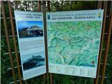 2
2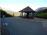 3
3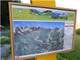 4
4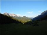 5
5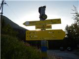 6
6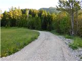 7
7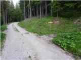 8
8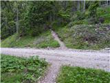 9
9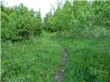 10
10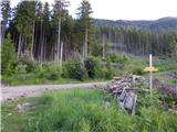 11
11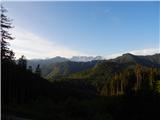 12
12 13
13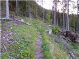 14
14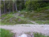 15
15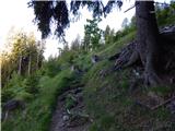 16
16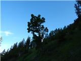 17
17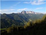 18
18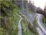 19
19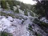 20
20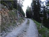 21
21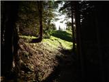 22
22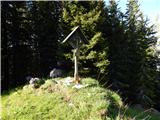 23
23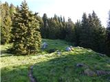 24
24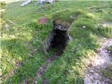 25
25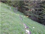 26
26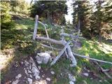 27
27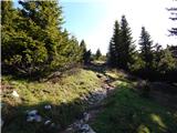 28
28 29
29 30
30 31
31 32
32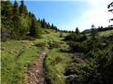 33
33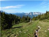 34
34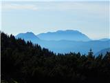 35
35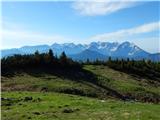 36
36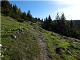 37
37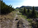 38
38 39
39 40
40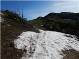 41
41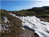 42
42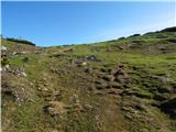 43
43 44
44 45
45 46
46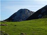 47
47 48
48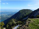 49
49 50
50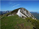 51
51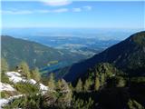 52
52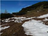 53
53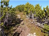 54
54 55
55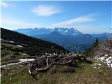 56
56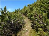 57
57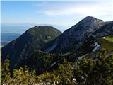 58
58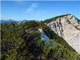 59
59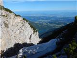 60
60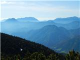 61
61 62
62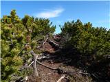 63
63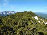 64
64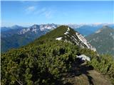 65
65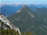 66
66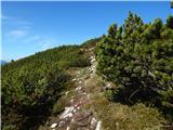 67
67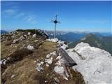 68
68 69
69
Discussion about the trail Šajda / Schaidasattel - Kravji vrh / Kuhberg (via Obirsko sedlo)