Planina Vetrh - Veliki Javornik (Ženiklovec)
Starting point: Planina Vetrh (1185 m)
| Lat/Lon: | 46,3967°N 14,3858°E |
| |
Time of walking: 1 h 30 min
Difficulty: easy unmarked way
Altitude difference: 531 m
Altitude difference po putu: 531 m
Map: Karavanke - osrednji del 1:50.000
Recommended equipment (summer):
Recommended equipment (winter): ice axe, crampons
Views: 2.316
 | 1 person likes this post |
Access to the starting point:
a) First drive to Tržič, then continue driving towards Dovžana Gorge. Towards the end of Tržič, leave the road towards Dovžana Gorge and continue right towards Loma pod Storžič. Above Lom pod Storžič, at the right-hand serpentine, leave the main road, which leads higher towards Grahovše and Dom pod Storžič, and continue left towards Potarje. Follow the asphalt road to the crossroads below the tourist farm pr Tič, where you turn left towards mountain pasture Konjščica. Follow the macadam road, from which the road to the Pinč farm soon branches off to the left. Here go right along the upper road, which becomes visibly worse, and follow it for some time to the next crossroads. From the crossroads continue straight on the lower road (right up mountain pasture Konjščica), which crosses the Vetrnik stream a little further on. At the next crossroads, go left, and after 50 metres park in the marked parking area at the edge of mountain pasture Vetrh. From the junction at the Lepenka factory in Tržič to the starting point is about 11 km, of which 6 km are macadam.
b) a) First drive to Tržič, then continue to Dovžana Gorge. Continue through Dovžanovo gorge, Dolina, to Jelendol, where at the triangular crossroads continue on the right road towards Medvodje. A few kilometres further on, the road to mountain pasture Zala potok branches off to the left, and we continue along Tržiška Bistrica for some time, more precisely to the first carriageway to the right, which crosses the Tržiška Bistrica River via a bridge. After the bridge, we start climbing on a worse macadam road, which is often in a rather bad condition in some parts. At the crossroads, continue straight ahead, and then, when the road is level, you will quickly reach a marked parking area on the outskirts of mountain pasture Vetrh, where you will park. From the junction at the Lepenka factory in Tržič to the starting point is about 12. 5 km, of which 3. 7 km is very bad macadam road, and there is some more macadam.
Path description:
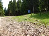
On the east side of the parking lot, cart track is seen climbing through the forest to a nearby forest road, which is followed to the left. The road quickly leads to a serpentine on the right, which offers a beautiful view towards Košuta, Plešivec and the surrounding mountains. The path then passes into a fairly dense forest, through which it climbs up the western slopes of Pečice (1421 m) and later Maljevec (1502 m). It does not take long to walk up the slopes of Maljevec, as the road leads into the valley of the Vetrnik stream. Crossing a bridge, the road quickly crosses over to the left bank of the stream and then climbs directly along the stream for a few minutes. Once higher up, the road crosses the stream again (this time without a bridge), but leave it and before crossing the stream continue right on the wider cart track, which begins to climb through the forest. At a fork in the track, bear slightly left and then, a few minutes higher up, return to the dirt road, which you follow to the right.
While walking along the road, you will quickly reach a marked crossroads, from which you continue straight ahead in the direction of mountain pasture Javornik (to the right Bela peč, mountain pasture Konjščica and the cottage pr Zdravc). From the crossroads continue along cart track, then climb through lane of a forest to mountain pasture Javornik, which is reached after a few minutes of further walking.
From mountain pasture continue straight ahead (left Stegovnik, right Storžič, Kanonir and Dom pod Storžičem) along a moderately steep grassy slope, where at first you can still follow the path, but from mountain pasture onwards it is no longer marked, and it turns into an easier trackless path higher up. When the track ends, we continue along a grassy slope, which rather resembles a ski slope. This "path", from which we can enjoy ever more beautiful views, is followed all the way to the registration box at Veliki Javornik or Ženiklovac, which is reached after a climb of less than 30 minutes from mountain pasture Javornik.
Planina Vetrh - mountain pasture Javornik 1:00, mountain pasture Javornik - Ženiklovec 30 minutes.

Pictures:
 1
1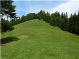 2
2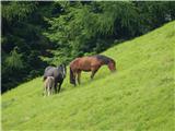 3
3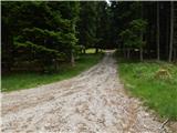 4
4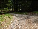 5
5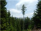 6
6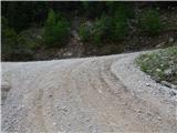 7
7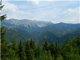 8
8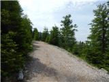 9
9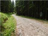 10
10 11
11 12
12 13
13 14
14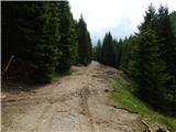 15
15 16
16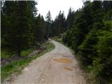 17
17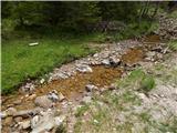 18
18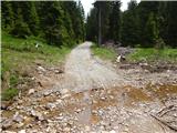 19
19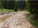 20
20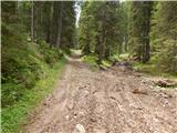 21
21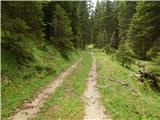 22
22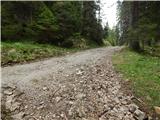 23
23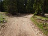 24
24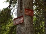 25
25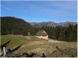 26
26 27
27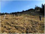 28
28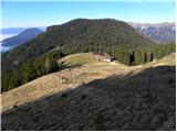 29
29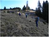 30
30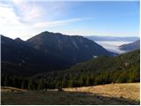 31
31 32
32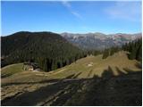 33
33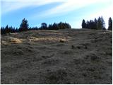 34
34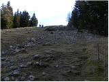 35
35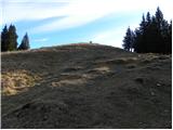 36
36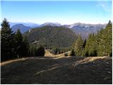 37
37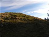 38
38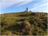 39
39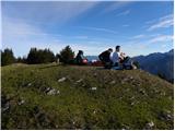 40
40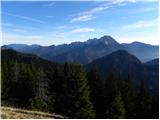 41
41 42
42
Discussion about the trail Planina Vetrh - Veliki Javornik (Ženiklovec)