Starting point: Podbrdo (508 m)
| Lat/Lon: | 46,2132°N 13,9717°E |
| |
Time of walking: 3 h 15 min
Difficulty: easy marked way
Altitude difference: 1336 m
Altitude difference po putu: 1336 m
Map: Škofjeloško in Cerkljansko hribovje 1:50.000
Recommended equipment (summer):
Recommended equipment (winter): ice axe, crampons
Views: 39.638
 | 1 person likes this post |
Access to the starting point:
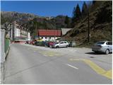
a) First drive to Škofja Loka, then continue to Železniki, Podbrdo and Tolmin. When you arrive in Podbrdo, park in a suitable place in the centre of the town.
b) From the road Idrija - Most na Soči, turn right at Bača pri Modreju, or left if you are coming from the route of Posočje, and drive towards Podbrdo. When you arrive in Podbrdo, park in a suitable place in the centre of the town.
Path description:
From the Podbrdo centre, continue along the main road towards Tolmin. The road first leads under the railway, then leads to a crossroads where the road to the village Porezen branches off to the left, and the road to the right leads to Bača pri Podbrdu. From here, continue along the main road for only a few more 10 m, and then the signs for the villages Trtnik and Črna prst direct you to a narrower and ascending road. Follow the slightly narrower road ascending west of Podbrdo until you reach the village of Trtnik, which is reached after about 20 minutes' walk.
At Trtnik, the signs for Črna prst direct you straight up a marked footpath, which first leads you up the steps of a nearby dwelling house, then onto a grassy slope where it climbs steeply alongside an orchard. The path goes higher into the woods and gradually flattens out. The path continues through the forest and soon joins the partly stone cart track, which is followed to the right. The cart track continues ascending cross-country to the right, occasionally leading over steeper slopes. As the path is wide enough, the steepness of the slope does not cause us any major problems, but we have to be careful especially in one place where it is usually full of leaves and the path is consequently quite slippery. Higher up, we cross a slightly larger ravine, and then cart track leads us to a forest road, which we climb in a few minutes to the nearby Sedlo, where there is a marked crossroads.
From Sedlo, from where the path from the village of Kal and the path from Kocenpohar join, continue straight on the cart track, which is followed for only a short time, as the signs then direct us to the left onto a footpath which begins to climb steeply through the forest. Higher up, the path transitively lays down a little, and then leads to a lookout with a bench. A little beyond the bench, the path splits into two (the right-hand path is the more beaten track), and then after about 15 minutes they join again. Just above the merging of the two paths, you reach the next bench, which offers a beautiful view towards Kobla and the peaks above Soriška mountain pasture.
From the bench, continue through the forest for a short distance, and then the trail switches to the grassy slopes, which are becoming more and more scenic. Once out of the forest, the path slowly starts to turn slightly to the right, then turns left and climbs cross-country to the Čez Suho saddle, where it joins the path from the Bohinj side. Continue left here and, with views of Baška grapa, Bohinj and the highest peaks of Julian Alps, climb in a few minutes to the Doma na Črna prst, located just a few metres below the summit.
Go around the Zorko Jelinčič House on the left and climb the short steep slope to the summit in a few steps.

Pictures:
 1
1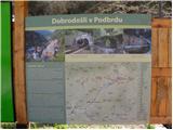 2
2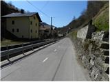 3
3 4
4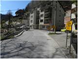 5
5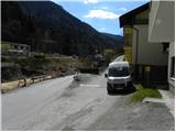 6
6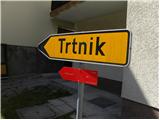 7
7 8
8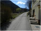 9
9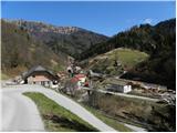 10
10 11
11 12
12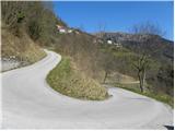 13
13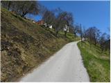 14
14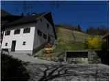 15
15 16
16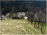 17
17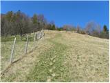 18
18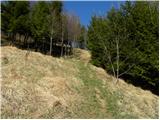 19
19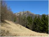 20
20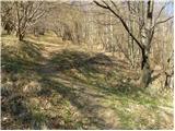 21
21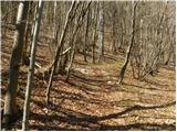 22
22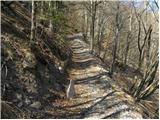 23
23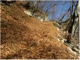 24
24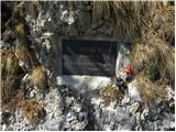 25
25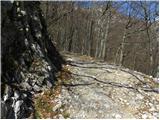 26
26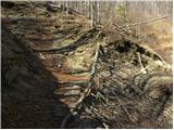 27
27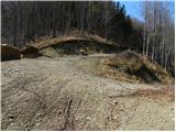 28
28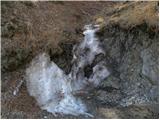 29
29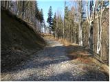 30
30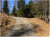 31
31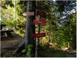 32
32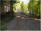 33
33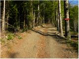 34
34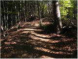 35
35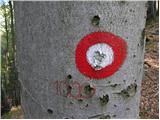 36
36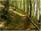 37
37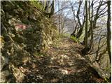 38
38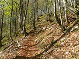 39
39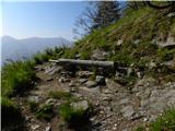 40
40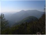 41
41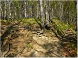 42
42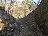 43
43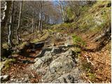 44
44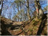 45
45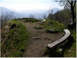 46
46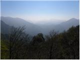 47
47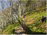 48
48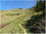 49
49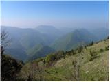 50
50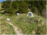 51
51 52
52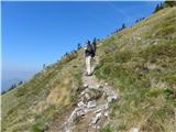 53
53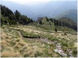 54
54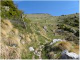 55
55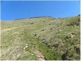 56
56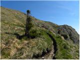 57
57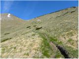 58
58 59
59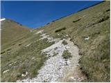 60
60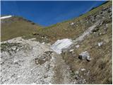 61
61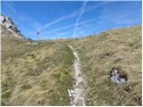 62
62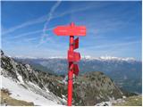 63
63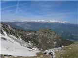 64
64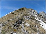 65
65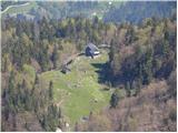 66
66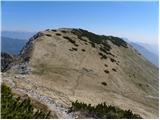 67
67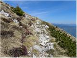 68
68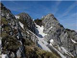 69
69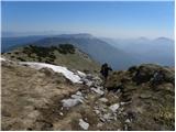 70
70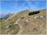 71
71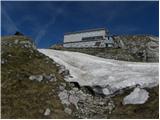 72
72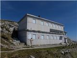 73
73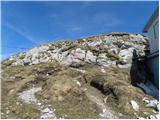 74
74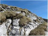 75
75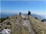 76
76 77
77
Discussion about the trail Podbrdo - Črna prst
|
| darinka416. 04. 2018 |
Mene pa zanima Podbrdo - Črna prst, če kdo kaj ve kakšne so razmere?
|
|
|
|
| darinka418. 04. 2018 |
Bo treba še malo počakat  Hvala.
|
|
|
|
| darinka419. 12. 2018 |
Danes smo bili na Črni prsti iz Podbrda. Imeli smo zimsko opremo s sabo a je nismo uporabili. Na poti precej listja višje je sneg a ga ni dosti. Bivak je zgledno urejen. Ko smo ga zapuščali okrg 14 ure se je temperatura naenkrat spustila nekaj pod ničlo in prvikrat se mi je zgodilo, da mi je crknil telefon od mraza. Spodaj nižje pa ni bilo več tako hladno.
|
|
|
|
| ejas123417. 07. 2019 |
Včeraj smo šli iz Podbrda na Črno prst in dol na Bohinjsko bistrico mino Orožnove koče.
V domu Zorka Jelinčiča pojedli odlično mineštro in spili kozarček odličnega črnega vina.
Oskrbnika zelo prijazna.
Čas hoje od 6.45 do 15 ure, z vsemi postanki in ogledi res prelepe okolice.
|
|
|
|
| darinka45. 05. 2022 07:41:41 |
4.5. 2022. Iz Podbrda mimo Trtnika do Črne prsti . Nekaj zaplat snega je pod vrhom. Na drugi strani proti Orožnovi koči, pa ni bilo videt nobene stopinje razen sledi smuči. Je še sneg. Žleb je kopen. Bilo nas je nekaj na poti in na vrhu. Če ne bi bilo vetra , bi bilo verjetno pretoplo.
|
|
|
|
| KARAMELICA25. 06. 2023 18:59:22 |
Danes šli po tej poti. Čudovit dan, prekrasno vreme, neprecenljiv razgled.
|
|
|
|
| sbirsa28. 08. 2023 08:09:32 |
Včeraj štartala v Podbrdu - pot lepo markirana do vrha, v domu Zorka J. spila kavo in pojedla palačinke, posedela na soncu in počasi nazaj mimo Orožnove koče v Bohinjsko B. Šla sem po desni poti na Ravne in zgrešila nekje pot, zato sem morala po asfaltni cesti kar lep kos poti. Kje sem zgrešila?
Res je bil lep dan, prekrasni razgledi, malo ljudi
|
|
|