Starting point: Brezje (600 m)
| Lat/Lon: | 46,3494°N 14,0565°E |
| |
Time of walking: 2 h
Difficulty: easy marked way
Altitude difference: 665 m
Altitude difference po putu: 665 m
Map: TNP 1:50.000
Recommended equipment (summer):
Recommended equipment (winter):
Views: 10.593
 | 1 person likes this post |
Access to the starting point:
From the motorway Ljubljana - Jesenice take the exit Lesce and follow the road towards Bled and on to Bohinjska Bistrica. 1km after Bled, you will reach a crossroads where you turn right towards Bohinjska Bela. Follow this road for only a short distance as just after the church the road to Brezje (Brezje nad Bohinjsko Belo) branches off to the right. Park in the parking lot at the end of the village.
Path description:
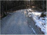
From the parking lot, continue along the road, which takes you slightly higher to a crossroads, where you turn right. The road through the forest leads us higher up to the lower slopes of Slamniki. Here, we first go around the cottage on the left, and then the path leads us to a crossroads where we continue to the left in the direction of Galetovec and Slamniki. The path then crosses the lane of a forest and leads us to the viewing slope Slamniki on which there are a few houses. The road then goes into the forest and leads to a smaller crossroads, where it continues to the right. This road is soon abandoned as faint signs direct us left into the forest. Next, we climb steeply along a destroyed path (fallen trees) through the forest. When the path changes from deciduous to coniferous forest, the fallen trees also end. The climb ahead is much easier than among the fallen trees. A little higher up, the path leads to a forest road, which you follow to the left. After a few minutes' walk along the road, you will come to a crossroads where you continue sharp left in the direction of Galetovec. Leave the road at the place where the signs for Galetovec direct you left across the meadow, first down and then up. The path then goes into the forest, where it goes all the way to the last metres below the summit, from which a beautiful view opens up.

Pictures:
 1
1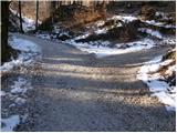 2
2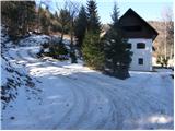 3
3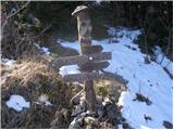 4
4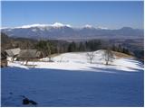 5
5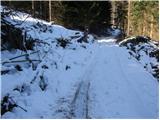 6
6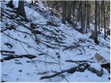 7
7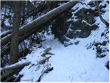 8
8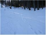 9
9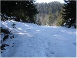 10
10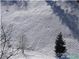 11
11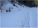 12
12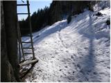 13
13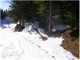 14
14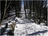 15
15 16
16
Discussion about the trail Brezje - Galetovec
|
| Breda28. 06. 2010 |
Na Galetovec se da priti tudi s Pokljuke, kar je krajša pot. Napotite se s ceste, ki pelje od Mrzlega studenca proti Gorjušam. Zavijete levo proti Belski planini (smerokaz) ali pa levo preko Kranjske doline (smerokaz). Jaz sem šla preko Kranjske doline. Hoje je za 45 minut. Z vrha je krasen razgled. 
|
|
|
|
| darh24. 04. 2011 |
Prejšnjo nedeljo smo približno tej poti sledili pri vzponu na Galetovec, le da smo avto pustili kar v Bohinjski Beli in se do Brezij povzpeli prek Iglice. Smo pa hodili precej manj po cestah. V ovinku na prvi sliki smo nadaljevali kar naravnost skozi gozd, v razcepu na drugi sliki smo zavili levo in se tu opisani cesti ponovno pridružili tik pred Slamniki. Tam smo še enkrat zavili levo in se cesti naslednjič pridružili tik nad mestom na šesti sliki. V nadaljevanju smo sledili tu opisani poti, v dolino pa smo se spustili po zahodni poti prek Planine za Jamo. Podrobnejši opis naše poti s slikami vred najdete tule.
|
|
|
|
| karlin6. 12. 2017 |
V ponedeljek prehodil to pot- zgažena,lepo prehodna.
|
|
|