Jevšček - Monte Mataiur/Matajur
Starting point: Jevšček (805 m)
| Lat/Lon: | 46,1915°N 13,5799°E |
| |
Time of walking: 2 h 30 min
Difficulty: easy unmarked way
Altitude difference: 837 m
Altitude difference po putu: 850 m
Map: Julijske Alpe - zahodni del 1:50.000
Recommended equipment (summer):
Recommended equipment (winter): ice axe, crampons
Views: 3.130
 | 1 person likes this post |
Access to the starting point:
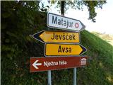
a) Drive to Tolmin, then continue driving to Kobarid. When you reach Idrsko, turn left in the direction of Livek and follow the signs for Avsa and Matajur from Livko. At a slightly higher altitude, leave the road towards Avsa and turn left in the direction of Jevščko and Nježna hiša. Continue through the hamlet of Piki and then reach the pastures before the settlement of Jevšček. Here, at the ecological island, the route described above begins, and you can park a little earlier, in a suitable place along the road.
b) From Kobarid, drive towards Tolmin, but only as far as Idrsko, where you turn right towards Livek, and from Livko follow the signs for Avsa and Matajur. A little higher up, leave the road towards Avsa and continue left towards Jevščko and Nježna hiša. Continue through the hamlet of Piki and then reach the pastures before the settlement of Jevšček. Here, at the ecological island, the route described above begins, and you can park a little earlier, in a suitable place along the road.
Path description:
At the ecological island, leave the road and take a sharp right onto cart track, which continues parallel to the road for some time and passes under the power lines for some time. Cart track soon passes the edge of the forest and leads into a small valley where it turns right. At this point, leave cart track and continue straight up the path, which is less easy and continues to climb along the edge of the forest. Higher up, when you finally leave the pastures and hay fields and the path enters the forest, blue "markers" appear along the path, which accompany you on the cross-climb to the right, or until you reach the forest road. Follow the road coming from the village Avsa to the left, and then quickly turn right onto the footpath, which returns to the road after a few minutes' climb. Continue ascending on the dirt road, which turns right after a few minutes and leads you along the edge of the abandoned mountain pasture Slemma, which you can see on the left below you. There is some walking on a fairly slippery dirt road, and then the old path from the village of Avsa joins us on the right.
Following the road, which is marked, we then quickly reach a marked crossroads, located in a small valley between Mrzli vrh and Srednji vrh.
At the crossroads, a marked but unmarked trail branches off to the right to Mrzli vrh, Srednji vrh and Idrska planina, and we continue along the road which splits on the west side of Mrzli vrh.
Continue on the left road (Idrska planina on the right), which is joined by the "new" trail from Avsa or Livko just a little further on.
From the less visible crossroads, walk along the road for a few minutes, then leave it at the next marked crossroads and continue right towards Monte Mataiur (straight Home to Monte Mataiure).
Further on, the path begins to climb again over a partly grassy slope, from which we can enjoy increasingly beautiful views of the surrounding mountains. Higher up, as the path gradually passes onto the northern slopes, the path from the village of Svino joins us from the right, and we continue towards Matajur. A few minutes of traversing and we arrive at a crossroads below Glava, where the "Slovenian direction" to Matajur and the path to reach Visoko Glava continue straight ahead, and we continue upwards to the left and quickly climb to the scenic eastern ridge of Monte Mataiur, where we are joined by the path from Itali (starting point Mašera / Masseris). Continue along the ridge, climbing gently to moderately along the Slovenian-Italian border. A few more minutes of increasingly scenic walking and you will reach the Monte Mataiur summit, from where you will have a beautiful view to the west.
Description and pictures refer to 2018 (October).

Pictures:
 1
1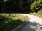 2
2 3
3 4
4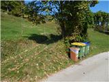 5
5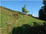 6
6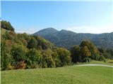 7
7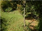 8
8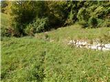 9
9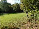 10
10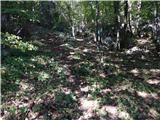 11
11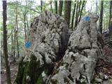 12
12 13
13 14
14 15
15 16
16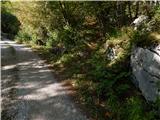 17
17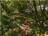 18
18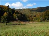 19
19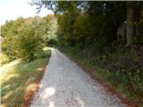 20
20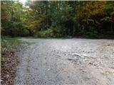 21
21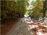 22
22 23
23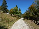 24
24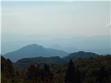 25
25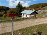 26
26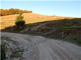 27
27 28
28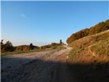 29
29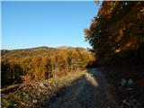 30
30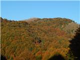 31
31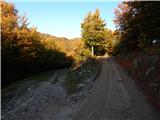 32
32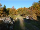 33
33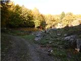 34
34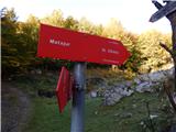 35
35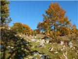 36
36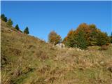 37
37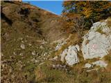 38
38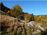 39
39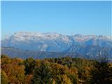 40
40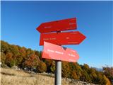 41
41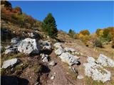 42
42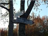 43
43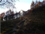 44
44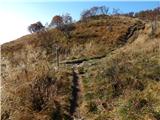 45
45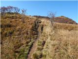 46
46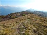 47
47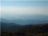 48
48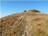 49
49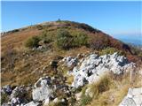 50
50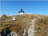 51
51 52
52 53
53
Discussion about the trail Jevšček - Monte Mataiur/Matajur