Dom v Tamarju - Jalovec (on scree and over Kotovo sedlo)
Starting point: Dom v Tamarju (1108 m)
| Lat/Lon: | 46,476°N 13,7241°E |
| |
Name of path: on scree and over Kotovo sedlo
Time of walking: 5 h 15 min
Difficulty: very difficult marked way
Altitude difference: 1537 m
Altitude difference po putu: 1537 m
Map: Kranjska Gora 1:30.000
Recommended equipment (summer): helmet, self belay set
Recommended equipment (winter): helmet, self belay set, ice axe, crampons
Views: 17.795
 | 1 person likes this post |
Access to the starting point:
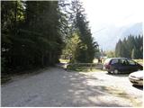
First drive to Kranjska Gora, then continue to Rateče. At the junction where the road to Rateče turns right and the road to Itali continues straight ahead, turn left towards Planica. After a short climb, you will reach the ski jumps in Planica, where there are a few large car parks.
As the road to Dom v Tamarju is now closed to public traffic, we have to park already in Planica, which extends the journey by about 45 minutes.
Path description:
First, walk to Dom v Tamarju, and from there continue along the marked mountain trail in the direction of Jalovec and Ponec (Slemen's Spit on the left). The way forward leads us through the forest, which quickly leads us to the next crossroads, where the path to Ponce branches off to the right. Continue in the direction of Jalovec and continue the ascent along the path, which climbs gently through the forest for a short time. When you come out of the forest, you first climb for a while on extensive partly overgrown gravel, and then gradually reach a scree slope that continues towards Jalovec's frost heap. Follow the scree to a marked crossroads, where you continue left (right Kotovo sedlo and Jalovec past the bivouac under Kotovo sedlo) in the direction of Jalovška škrbina. The trail continues to climb the scree and then leads to the next crossroads, where it continues to the right in the direction of Kotovo sedlo (slightly left Jalovec over the Jalovška notch).
The path continues to climb crosswise to the right and gradually changes to less steep slopes. Higher up, the path is further laid and leads us past several large boulders to a crossroads where a slightly more difficult path joins from the right. Continue left and after a few minutes of further ascent, climb up to Kotovo sedlo.
From the saddle, where the path from Loška Koritnica joins and from where the path towards Mangart continues, turn left in the direction of Jalovec. Continue along and along the ridge, then the path turns slightly to the right and leads to the western slopes of Jalovec. Here we climb up an increasingly rocky slope, and we follow a technically not too difficult path up to a height of about 2400 metres. Here the path becomes upright and the first fixed safety gear (the first fixed safety gear on the route from Kotovo sedlo) help us.
At the start of the climbing section the route crosses the exposed western slopes of the mountain, then turns left, where some easier climbing is required along a rope. There is a short descent into a steep gully, which is traversed, and then on the other side, with the aid of a rope, the climb begins up an exposed slope. There is some more easy climbing on broken rocks, and then we reach the main ridge, where we join the route via Jalovška škrbina, Vršič, Trenta, Bavšica and Loška Koritnica. Here we continue to the left and after just a few minutes of climbing along an increasingly scenic ridge, the path leads us to the top of Jalovec.

Pictures:
 1
1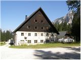 2
2 3
3 4
4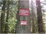 5
5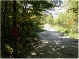 6
6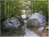 7
7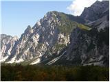 8
8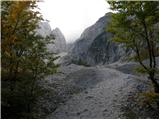 9
9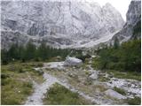 10
10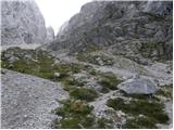 11
11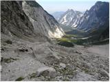 12
12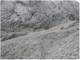 13
13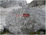 14
14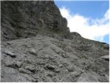 15
15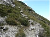 16
16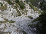 17
17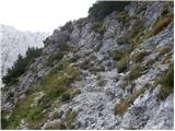 18
18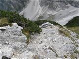 19
19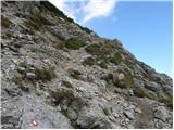 20
20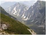 21
21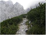 22
22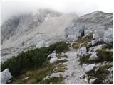 23
23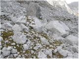 24
24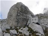 25
25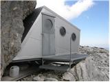 26
26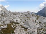 27
27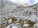 28
28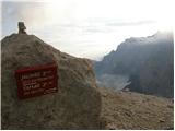 29
29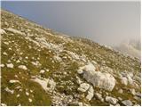 30
30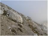 31
31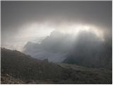 32
32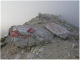 33
33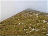 34
34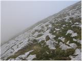 35
35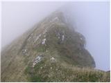 36
36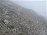 37
37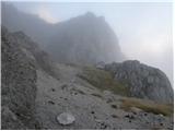 38
38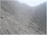 39
39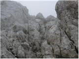 40
40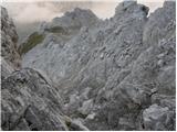 41
41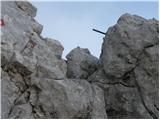 42
42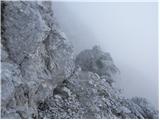 43
43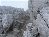 44
44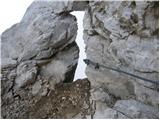 45
45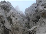 46
46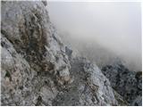 47
47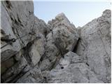 48
48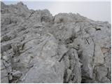 49
49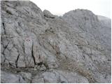 50
50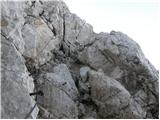 51
51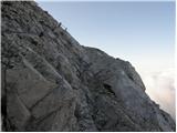 52
52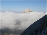 53
53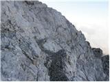 54
54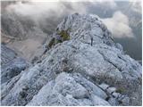 55
55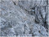 56
56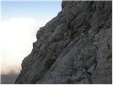 57
57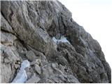 58
58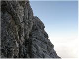 59
59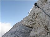 60
60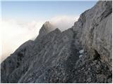 61
61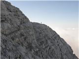 62
62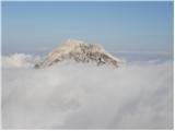 63
63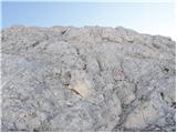 64
64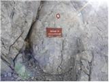 65
65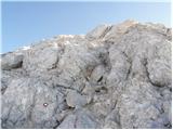 66
66 67
67 68
68
Discussion about the trail Dom v Tamarju - Jalovec (on scree and over Kotovo sedlo)
|
| garmont4. 10. 2023 09:14:48 |
Slike od št.15 do št.29, ne ustrezajo opisu. Opis govori o poti čez melišče, slike pa prikazujejo pot mimo bivaka, ki se omenjenemu melišču izogne.
|
|
|
|
| phobos12. 10. 2023 06:34:31 |
Pot po tem melišču odsvetujem. Za vzpon itak vemo kakšna so melišča, za spust pa je to melišče po zadnjem podoru z Jalovca pravo mučenje. Ves čas iščeš primerno podlago za hojo, ki je ne najdeš. Povsod so večji, ostri kamni, ali pa popolnoma spucana podlaga z malo peska.
|
|
|
|
| garmont12. 10. 2023 18:04:21 |
In, kot sem že napisal…slike ne ustrezajo opisu.
|
|
|