Ruski križ - Špik (via Kačji graben)
Starting point: Ruski križ (1000 m)
| Lat/Lon: | 46,4444°N 13,7746°E |
| |
Name of path: via Kačji graben
Time of walking: 4 h 50 min
Difficulty: difficult marked way
Altitude difference: 1472 m
Altitude difference po putu: 1585 m
Map: TNP 1:50.000
Recommended equipment (summer): helmet
Recommended equipment (winter): helmet, ice axe, crampons
Views: 32.092
 | 1 person likes this post |
Access to the starting point:
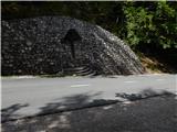
First drive to Kranjska Gora, then continue driving towards the Vrh Leh pass just before the 3rd serpentine of the Ruska or vršiška road, you will see the Russian Cross on the right and a small parking lot on the left, where you park. As the parking lot is relatively small and quickly full, you can also park a little higher up in the larger parking lot just above the 4th serpentine (in this case we have to descend a little to our starting point at the Russian Cross).
The starting point can also be reached from the coastal side via the Vršič Pass.
Path description:
Just before the 3rd serpentine of the Ruska cesta, we will notice the mountain signs for Koča v Krnici along the road, which direct us slightly to the left to the wide cart track, which immediately starts to descend moderately. Soon we cross a torrential stream over a bridge, and we descend all the way to the bed of the Dry Pišnica, where we have two options for continuing.
The start of the trail to Špik through Kačji graben can be reached if, just a few metres before the marked trail or road crosses the Suha Pišnica, we turn left onto the wide unmarked cart track, which first continues through the forest and then leads us to a larger meadow. Cross the meadow in a north-easterly direction, and we follow it all the way to the Velika Pišnica riverbed. Cross the river at a suitable place, then take the marked road to the left (Koča v Krnici on the right), and follow it to the marked trail through Kačji graben.
Alternatively, we can simply cross the Suho Pišnica (not so easy when there is a lot of water) and continue along the road leading to the Cottage in Cirque. Just after crossing the aforementioned stream, the path turns slightly to the left and leads us out of the forest onto the vast grassy slopes of mountain pasture in Klin, where we see a secluded cottage on the right and the small memorial park of Mali Tamar on the left. The path ahead is completely laid out and then joins the forest road coming from the former Hotel Erika or the bridge over the Velika Pišnica. Here, continue left (right Koča v Krnici) and follow the road to the marked trail junction through Kačji graben.
From the crossroads, the path leaves the road and initially climbs through overgrown forest, but higher up it crosses the lower part of the above-mentioned graben and then climbs steeply. The ascent along the Kačji graben is very steep and dangerous to slip in wet conditions (some fixed safety gear will help). The path then becomes slightly easier and passes into a dense forest, through which you climb to an altitude of about 1600 m. The forest then becomes thinner and thinner and the path leads to the foot of mighty scree. Once you reach the scree, the path turns slightly to the left and starts to climb through the scree. Walking on the relatively steep scree takes some energy. Higher up, the path turns to the right, crosses a ravine exposed to falling rocks and leads us into a smaller cirque between Špik on the left and Liprtica (Lipnica) on the right. Here the path is slightly laid for a short time and in the next few steps leads us to the place where we join the path over Grunt or the path over Lipnica.
Here, continue to the left, following the path which climbs very steeply up the top slope of Špik (without fixed safety gear). After walking for about 15 minutes along the top slope, over which you climb on the broken rocks, you reach the summit, which is visible from the top.
There is a very high risk of falling rocks in the last part of the path.

Pictures:
 1
1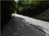 2
2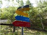 3
3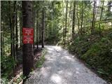 4
4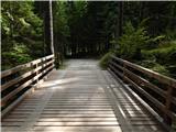 5
5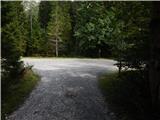 6
6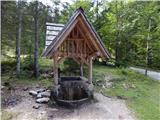 7
7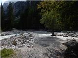 8
8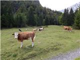 9
9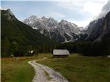 10
10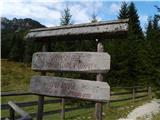 11
11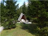 12
12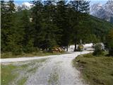 13
13 14
14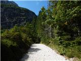 15
15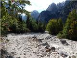 16
16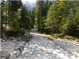 17
17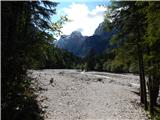 18
18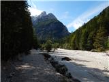 19
19 20
20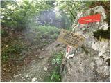 21
21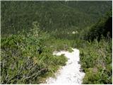 22
22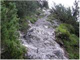 23
23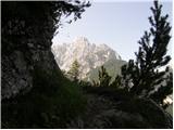 24
24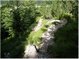 25
25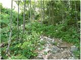 26
26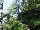 27
27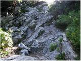 28
28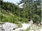 29
29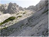 30
30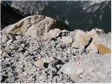 31
31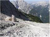 32
32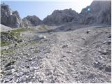 33
33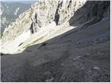 34
34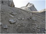 35
35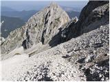 36
36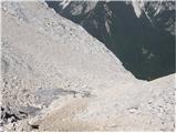 37
37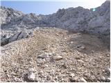 38
38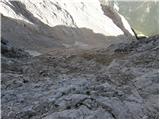 39
39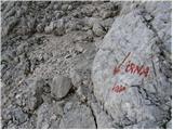 40
40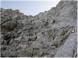 41
41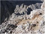 42
42 43
43
Discussion about the trail Ruski križ - Špik (via Kačji graben)
|
| emze8. 08. 2014 |
Od Ruskega križa: Prvi smerokaz za Kačji graben je v vstopu v Kačji graben.
Tudi pot iz Kačjega grabna proti Ruskemu križu ni nobenega smerokaza. Samo ofucane table za kočo v Krnici.
V starejših zemljevidih vrisana prečna pot med Krnico in Kačjim grabnom, ki nam prihrani spust in vzpon, je porušena. Iz grabna jo je lahko vdeti, iz Krnice nisem našel.
Bližnjica do parkirišča: Ko na poti Kačji graben -- Krnica zagledate travnik s kočo na drugi strani in uspete prečkati rečico, pojdite levo na vrh travnika. Cesta pelje mimo neuradnega parkirišča z izvirom proti 3. serpentini.
|
|
|
|
| Gregorvu28. 10. 2014 |
V četrtek se odpravljamo na Špik..
A ve kdo kakšna je pot...Je sneg?
Rabimo dereze itd... Je varno iti?
|
|
|
|
| Lenore3. 10. 2021 20:38:23 |
Jaz sem šla čez Krnico gor, čez Kačji graben dol.. in če bi se še 1x odločala, bi šla čez kočo na Krnici tudi dol (čeprav ne bi bila krožna).
Kačji graben je super za dol, dokler je melišče.. ko pa melišča ni več.. je grozno strmo po gozdu, kamni drsijo, korenine drsijo, dolga in neprijetna pot je za dol tam.
Si pa ne predstavljam tam it gor (zarad melišča).
|
|
|