Sella Nevea - Rombon (via 636)
Starting point: Sella Nevea (1170 m)
| Lat/Lon: | 46,3874°N 13,4734°E |
| |
Name of path: via 636
Time of walking: 6 h 45 min
Difficulty: partly demanding marked way
Altitude difference: 1038 m
Altitude difference po putu: 1400 m
Map: Julijske Alpe - zahodni del 1:50.000
Recommended equipment (summer): helmet
Recommended equipment (winter): helmet, ice axe, crampons
Views: 9.045
 | 1 person likes this post |
Access to the starting point:
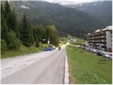
a) First, we drive to Kranjska Gora, then we continue our journey via Border crossing Rateče to Itali. Drive towards Trbiž / Tarvisio, then turn left at the beginning of the town in the direction of Bovec. Continue along the regional road towards Border crossing Predel, and follow the main road to the crossroads near Lake Rabeljsko / Lago del Predil. Here we continue to the right in the direction of the Neveje Pass (V Žlebeh) / Sella Nevea and follow the asphalt road to the aforementioned pass. Park in the large parking lot at the bottom station of the circular cable car leading to the Rifugio Gilberti hut.
b) First drive to Bovec and then continue to Border crossing Predel, via which you will enter Itali. We then descend to Lake Rabel, after which we leave the main road leading to Trbiz and continue driving to the left towards the Nevejski Pass (V Žlebeh). The road then starts to climb again and we follow it to the aforementioned pass. Park in the large parking lot at the bottom station of the circular cable car leading to the Rifugio Gilberti hut.
Path description:
From the parking lot, follow the narrow asphalted road that leads to the Hotel Nevea. After about 100 metres of walking, you will reach a signpost for route No 636, which directs you to the left across a meadow onto a marked footpath. The path soon leads into the woods, through which you continue to climb along an old military causeway. Higher up, the forest becomes thinner and thinner, and the path leads us to the ruins of the Poviz barracks, with increasingly frequent fine views.
The path continues to climb for some time, then leads to a marked crossroads, where we continue to the left in the direction of the Prevala saddle (to the right, the Rifugio Gilberti hut).
The way forward is slightly smoother and becomes more and more scenic. Just a little further on, we come to the next crossroads. This time continue right towards the Prevala saddle (straight ahead saddle Vrh Laških brežičev / Sella Robon) on a path that begins to climb moderately. A wide and well-preserved old military trail quickly leads us into a rockier world, where it begins to turn slightly more to the right. Higher up, the path leads to the scree of Lope, where the path climbs slightly more steeply. A little further on, the marked path comes quite close to the top station of the pendulum, the cable car linking the Slovenian and Italian sides of the ski slope. Here you will see a sign indicating that the old route is not passable, so turn right onto the poorly trodden path marked with red dots. The path ahead descends gently at first and then climbs up to a newly built ski slope, which takes you down to the Prevala saddle in a few minutes.
From Prevala, where there is a crossroads of five trails, continue left in the direction Rombon (straight down Bovec, right Prestreljenik). Continue eastwards along the path, which gradually passes onto the slopes of Lopa (2406 m), and we follow it in a few ascents and descents to a small saddle between Lopa and Kotl (1881 m). Here the path turns slightly to the left and continues along the numerous potholes that are characteristic of the Kanin Mountains. The way ahead quickly leads us to a crossroads where the path to Črnelská špica (2332 m) branches off to the left, and we continue to the right in the direction of Rombon and the Speleological bivouac. A short climb follows and the path leads us to a small saddle between Črnelska Spica and Vrh Ribežnov. From the saddle, descend gently to a crossroads near the Speleological bivouac. The right path leads over Rupa to Bovec, and we continue on the left path towards Rombon. The path then crosses the slopes below Prišná glava and leads to a small spring with drinking water, which dries up during the dry season. The trail, which later on reveals the remains of the First World War, descends gently at first and is followed by a climb of about one hour towards the top of Rombon. The path becomes steeper in the last part and a little exposed just below the summit.

Pictures:
 1
1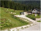 2
2 3
3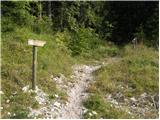 4
4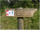 5
5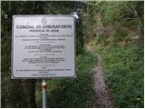 6
6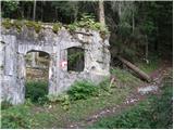 7
7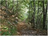 8
8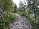 9
9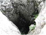 10
10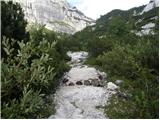 11
11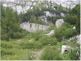 12
12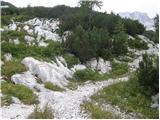 13
13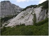 14
14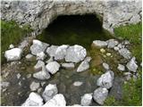 15
15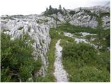 16
16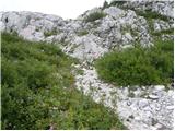 17
17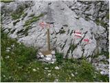 18
18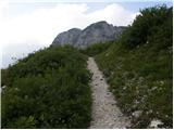 19
19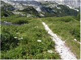 20
20 21
21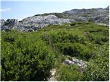 22
22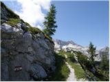 23
23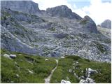 24
24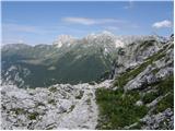 25
25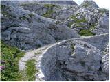 26
26 27
27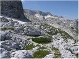 28
28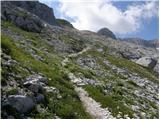 29
29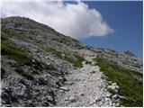 30
30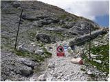 31
31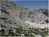 32
32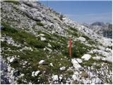 33
33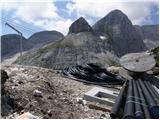 34
34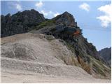 35
35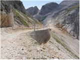 36
36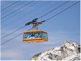 37
37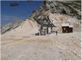 38
38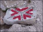 39
39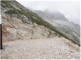 40
40 41
41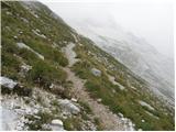 42
42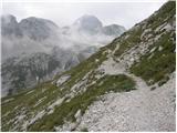 43
43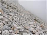 44
44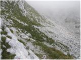 45
45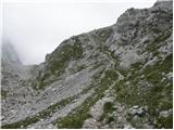 46
46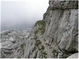 47
47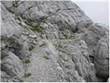 48
48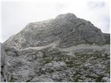 49
49 50
50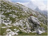 51
51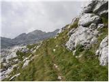 52
52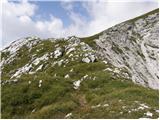 53
53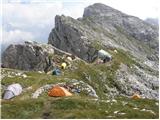 54
54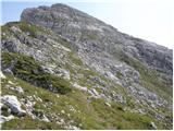 55
55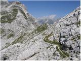 56
56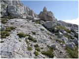 57
57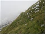 58
58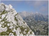 59
59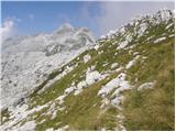 60
60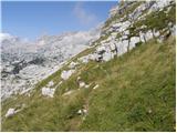 61
61 62
62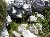 63
63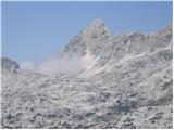 64
64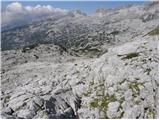 65
65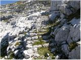 66
66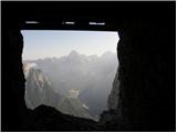 67
67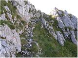 68
68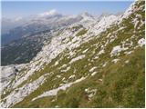 69
69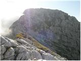 70
70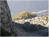 71
71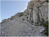 72
72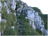 73
73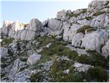 74
74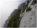 75
75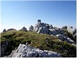 76
76
Discussion about the trail Sella Nevea - Rombon (via 636)
|
| darinka430. 01. 2018 |
Je kdo hodil poleti po tej poti na Rombon? Je daljša od ostalih, ampak najbrž zanimiva.
|
|
|
|
| B230. 01. 2018 |
Kot prvo moraš računati tudi na povratek. To pot od Nevejskega prevala do Rombona in nazaj na Nevejski preval težko opraviš v enem dnevu. Bolj ti priporočam vzpon z žičnico iz Bovca na Kanin in potem peš na Prevalo ter dalje na vrh Rombona.Ta pot se začne na točki, ki je na sliki 39. Sicer se markacije začnejo že pri zadnji postaji žičnice na Kaninskih podih (postaja D). Pot se nadaljuje vseskozi po južni strani Lope in Černelske špice več ali manj skoraj vodoravno.Sledi še skoraj direkten vzpon na vrh Rombona. Ne smemo pozabiti, da nas čaka še spust v Bovec, ki ga zaključimo v Kaninski vasi in nadaljujemo po cesti do spodnje postaje žičnice (ali do mesta, kjer smo pustili vozilo).V poletni vročini bo te poti vrh glave. Vode ni nikjer na celi turi...
|
|
|
|
| darinka430. 01. 2018 |
Hvala. Če me spomin ne vara je na italianski strani Kanina bivak, kjer lahko prespiš. Ali se motim?
|
|
|
|
| B230. 01. 2018 |
Ne, da bi vedel. Je pa tam koča Gilberti.
|
|
|
|
| miri30. 01. 2018 |
@darinka4,a si mogoče mislila na bivak Marušič?
|
|
|
|
| darinka430. 01. 2018 |
Se spomnim pred dosti leti smo šli na Prestreljenik s Sella Nevea. Takrat smo srečali eno punco- planinko ob sestopu s Prestreljenika in je rekla, da gre prespat v bivak, ki je tam nekje.Ne spomnim se točno.
|
|
|
|
| BT8830. 01. 2018 |
Darinka ja bivak je bolj za silo pastirski v nekakšnji luknji vdolbina že bližje Rombonu.Je že tri leta kar sem šel tam mimo.Izgledalo je bolj klavrno sem pa v dobil tudi vodo,ki je v bližini steze.Je pa ni v izobilju.
Srečno
|
|
|
|
| mirank30. 01. 2018 |
Bivak Modonutti-Savoia, ma ne pomaga prav dosti, ker je "malo" izven običajne smeri. Prehodil sem turo z D-ja na Rombon in v Bovec. Če bi se zdaj odločal bi začel na B postaji do Krnice in malo nad planino po stezici na sedlo Pri banderi in potem čez Rombon dol. Gneče tu ne pričakuj  ...
|
|
|
|
| darinka430. 01. 2018 |
Hvala za koristne informacije. Mi bodo prišle prav. Ko sneg skopni. 
|
|
|