Koča pri Savici - Batognica (via Prehodci)
Starting point: Koča pri Savici (653 m)
| Lat/Lon: | 46,2896°N 13,8022°E |
| |
Name of path: via Prehodci
Time of walking: 7 h 5 min
Difficulty: easy marked way
Altitude difference: 1511 m
Altitude difference po putu: 1765 m
Map: TNP 1:50.000
Recommended equipment (summer):
Recommended equipment (winter): ice axe, crampons
Views: 6.320
 | 1 person likes this post |
Access to the starting point:
From the motorway Ljubljana - Jesenica, take the Lesce exit and follow the road towards Bled and on to Bohinjska Bistrica. Continue driving towards Bohinjsko jezero (Ribčev laz), at which you will come to a crossroads, where you will continue straight along the left (south) side of the lake in the direction of Ukanec and the Savica waterfall. Follow this increasingly narrow road to the large parking lot at the Savica cottage. There is a charge for parking.
Path description:
From the parking lot, follow the wide footpath towards the Savica waterfall and the Komna home. After a short ascent, the path leads us to a marked crossroads where the tourist path to the right branches off towards the Savica waterfall, and we continue slightly to the left or straight along the wide footpath in the direction of Komna. The path continues to climb for a short time along Savica, and then leads us to the first of the 48 marked serpentines. After an hour and a half of moderate ascent through the forest, the path leads us to the 48 serpentine from which we have a beautiful view of Lake Bohinj. Here the path turns slightly to the right and passes into the valley called Pekel, where it climbs gently for a while, then turns to the right and climbs slightly steeper again. After only a few 10 paces, the path turns left again and continues to climb parallel to the valley. The path, which is steep to moderately steep, gradually turns into a more sparse forest, from which you can soon see the house on Komna. The way forward leads us past a small man-made cave, and higher up, past a natural abyss, which is fenced off to prevent any of the hikers from falling into it. Next, the path climbs a little more and after a few steps of further walking leads us to a crossroads where the path to the right branches off to the Black Lake.
Continue straight ahead on the wide path (mulatjeri), which takes you just a little higher to the next crossroads. Continue again to the left (to the right the cottage at Triglav Lakes) along the path, which climbs a little more steeply and after a few minutes of further walking leads us to the hut at Komna.
From the home, continue right (left Vogel, Tolminski Kuk and mountain pasture Govnjač) along the marked path towards the hut below Bogatin. Next, a pleasant and completely sloping path leads us in 15 minutes' walk to Mountain pasture na Kraju, in the middle of which stands the hut under Bogatino.
On the other side of Mountain pasture, a path branches off to the right towards Mountain pasture Za Skalo, and we continue straight ahead along a wide mulatier towards Bogatinsko sedlo and Krno. The path continues to climb crosswise over the relatively steep slopes of Srednji vrh, passing the valley of Gracija on the right. The trail then climbs considerably further to the left, where it approaches the steep slopes of Bogatino. The path then turns to the right and leads to Bogatinsko sedlo, which offers a beautiful view of Krn. At the saddle, continue straight ahead in the direction of Krno and Krnsko jezero (Bogatin and Mahavšček on the left, Lanževica on the right) on a path that gradually begins to descend. After a few minutes of descent, the path, which follows an old military causeway, leads to slopes partly covered with dwarf pines. A little lower still, we arrive at the next crossroads, at which we leave the path leading to Krnsko jezero and continue to the left in the direction of Prehodci.
Continue along the small valley Za Lepočami, where you will see a number of buildings built by the Italians between the two wars to serve the needs of the belaying Rapallo frontier. We continue along the scenic route, which joins the path leading from Prehodci to the mountain pasture Razor hut. Follow this path to the right, and we will descend it to the marked crossroads at Prehodci.
Continue straight on in the direction of Krno (left down mountain pasture Polog) and follow the winding and scenic route. A little further on, another path from Krnsko jezero joins us from the right, and we continue in the same direction. The path ahead takes us from the plateau world to the steep eastern slopes, from which we have a fine view of the Tolmin side (the area is called Na Tminskem). The path then turns slightly to the right and gradually leads us into a small valley in the high mountains. Here it begins to climb steeply and after about 20 minutes of further walking leads us to a large memorial to the fallen in World War I.
Here, continue to the right along the marked path, which crosses the foothills of Mali Peskov. Higher up, the path leads to a number of WW1 remains, and then climbs slightly further to reach a small saddle between Mali Peski and Vrh nad Peski (and a little further to the right is Veliki Peski). Continue on the marked path, which soon turns off to the right onto the unmarked path to Vrh nad Peski, and we continue straight ahead, skirting the summit across the scree on its southern side. After a short crossing, we reach Prag, where we join the path from the lake in Lužnice.
At Prag, where there is a marked crossroads, continue straight on in the direction Batognica (left down the lake in Lužnice, right down Krnsko jezero) along the path which climbs moderately up the upper slope of Batognica. Follow this increasingly scenic path to the summit, which is reached after 15 minutes of further walking.

We can extend the trip to the following destinations: Krn ( 45 min)
Pictures:
 1
1 2
2 3
3 4
4 5
5 6
6 7
7 8
8 9
9 10
10 11
11 12
12 13
13 14
14 15
15 16
16 17
17 18
18 19
19 20
20 21
21 22
22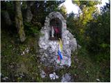 23
23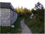 24
24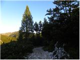 25
25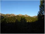 26
26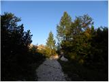 27
27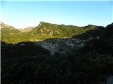 28
28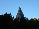 29
29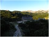 30
30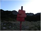 31
31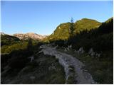 32
32 33
33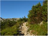 34
34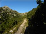 35
35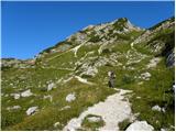 36
36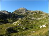 37
37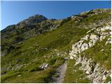 38
38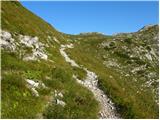 39
39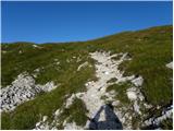 40
40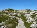 41
41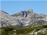 42
42 43
43 44
44 45
45 46
46 47
47 48
48 49
49 50
50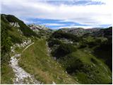 51
51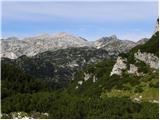 52
52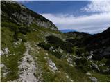 53
53 54
54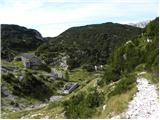 55
55 56
56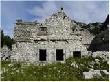 57
57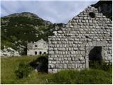 58
58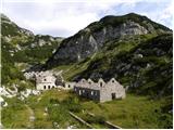 59
59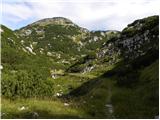 60
60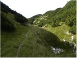 61
61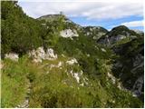 62
62 63
63 64
64 65
65 66
66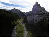 67
67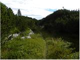 68
68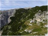 69
69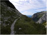 70
70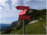 71
71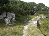 72
72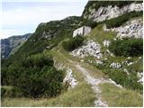 73
73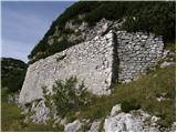 74
74 75
75 76
76 77
77 78
78 79
79 80
80 81
81 82
82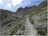 83
83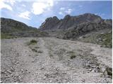 84
84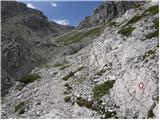 85
85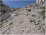 86
86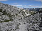 87
87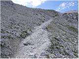 88
88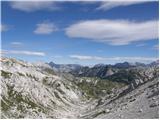 89
89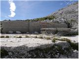 90
90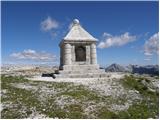 91
91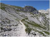 92
92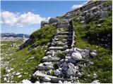 93
93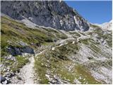 94
94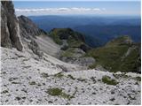 95
95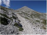 96
96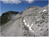 97
97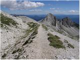 98
98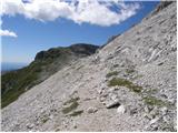 99
99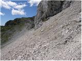 100
100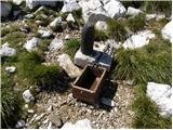 101
101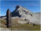 102
102 103
103 104
104 105
105 106
106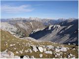 107
107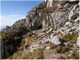 108
108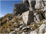 109
109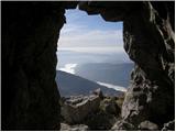 110
110 111
111 112
112 113
113 114
114
Discussion about the trail Koča pri Savici - Batognica (via Prehodci)