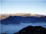
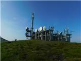
 | Tomčeva koča na Poljški planini - Begunjščica
Begunjščica is a mountain range in Karawanks east of Stol. The highest peak is Veliki vrh, which at over 2000m offers a beautiful view of central...
2 h 50 min |
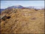
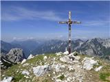
 | Mrzli studenec - Veliki vrh (Košuta)
Veliki vrh, with a height of 2088 m, is the westernmost two-thousander in the longest Slovenian ridge - the Košuta. From the summit, where there ...
2 h 15 min |
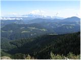
 | Rudno polje - Viševnik
Viševnik is a 2050 m high mountain rising north-west of Rudno polje on Pokljuka. From the top of the peak where the stamp is located, you have a ...
2 h |
 | Šport hotel - Mrežce
Mrežce is a prominent peak near Lipanski vrh which can be seen on the other side of the ravine between the two peaks. As the slopes towards Poklj...
2 h 40 min |
 | Pri Rupah - Lipanski vrh
The summit is located above Blejska koča on the mountain pasture of Lipanca. From the summit, which descends precipitously towards the Krma valle...
1 h 45 min |
 | Medvedova konta - Debela peč
Debela peč is a 2014 m high mountain that rises steeply above the Krma valley on one side and descends gently towards the vast Pokljuka forests o...
2 h 15 min |
 | Pri Rupah - Debela peč
Debela peč is a 2014 m high mountain that rises steeply above the Krma valley on one side and descends gently towards the vast Pokljuka forests o...
2 h 15 min |
| Strmec - Debela peč (via Spodnja Brda)
Debela peč is a 2014 m high mountain that rises steeply above the Krma valley on one side and descends gently towards the vast Pokljuka forests o...
2 h 45 min |
| Strmec - Debela peč
Debela peč is a 2014 m high mountain that rises steeply above the Krma valley on one side and descends gently towards the vast Pokljuka forests o...
2 h 30 min |
 | Strmec - Debela peč (old path)
Debela peč is a 2014 m high mountain that rises steeply above the Krma valley on one side and descends gently towards the vast Pokljuka forests o...
2 h 15 min |
 | Rudno polje - Debela peč
Debela peč is a 2014 m high mountain that rises steeply above the Krma valley on one side and descends gently towards the vast Pokljuka forests o...
3 h 15 min |
 | Vrh Bače - Črna prst
On the northern slope of the Črna prst summit head, you can see the black soil from which the mountain takes its name. Črna prst is known for its...
3 h 10 min |
 | Pod Luknjo - Črna prst
On the northern slope of the Črna prst summit head, you can see the black soil from which the mountain takes its name. Črna prst is known for its...
2 h 30 min |
 | Dom pod Storžičem - Tolsti vrh
Tolsti vrh, located to the west of Storžič, is also the highest peak of the Kriška Gora, a mountain range rising steeply above the central Gorenj...
2 h |
 | Sviščaki - Snežnik (footpath)
Snežnik or Veliki Snežnik is the highest peak in the near and far surroundings with a height of 1796 m. It offers a beautiful view over most of S...
2 h |
 | Sviščaki - Snežnik (variant through forest)
Snežnik or Veliki Snežnik is the highest peak in the near and far surroundings with a height of 1796 m. It offers a beautiful view over most of S...
2 h |
 | Sviščaki - Snežnik (by road)
Snežnik or Veliki Snežnik is the highest peak in the near and far surroundings with a height of 1796 m. It offers a beautiful view over most of S...
1 h 55 min |
| Grda draga - Snežnik (via Mali Snežnik)
Snežnik or Veliki Snežnik is the highest peak in the near and far surroundings with a height of 1796 m. It offers a beautiful view over most of S...
1 h 55 min |
| Sviščaki - Snežnik (via Mali Snežnik)
Snežnik or Veliki Snežnik is the highest peak in the near and far surroundings with a height of 1796 m. It offers a beautiful view over most of S...
2 h 15 min |
 | Hibje - Dobrča (by road)
Dobrča is a 1634 m high mountain located between Begunje and Tržič. From the top, where the registration box with the stamp is located, we can se...
1 h 45 min |
 | Planina Loka - Velika Raduha
At 2062 m, Velika Raduha is the highest peak of Raduha, a mountain range rising steeply to the east of Robanov Kot. From the summit, which has a ...
1 h 55 min |
 | Snežna jama - Velika Raduha
At 2062 m, Velika Raduha is the highest peak of Raduha, a mountain range rising steeply to the east of Robanov Kot. From the summit, which has a ...
1 h 45 min |
 | Bukovnik - Velika Raduha (via Durce)
At 2062 m, Velika Raduha is the highest peak of Raduha, a mountain range rising steeply to the east of Robanov Kot. From the summit, which has a ...
2 h 50 min |
| Planina Vodol - Velika Raduha
At 2062 m, Velika Raduha is the highest peak of Raduha, a mountain range rising steeply to the east of Robanov Kot. From the summit, which has a ...
2 h 40 min |
 | Hunting cottage (Davča) - Porezen
Porezen is a 1630 m high mountain located between Davča and Baška Grapa. From the top, where a large NOB monument stands, we have a beautiful vie...
1 h 45 min |
| Cimprovka (Davča) - Porezen (by road)
Porezen is a 1630 m high mountain located between Davča and Baška Grapa. From the top, where a large NOB monument stands, we have a beautiful vie...
2 h 15 min |
 | Tuškov Grič - Porezen (by road)
Porezen is a 1630 m high mountain located between Davča and Baška Grapa. From the top, where a large NOB monument stands, we have a beautiful vie...
3 h 5 min |
 | Raspet - Porezen (on ridge of Cimprovka)
Porezen is a 1630 m high mountain located between Davča and Baška Grapa. From the top, where a large NOB monument stands, we have a beautiful vie...
2 h 45 min |
 | Podhočar - Porezen
Porezen is a 1630 m high mountain located between Davča and Baška Grapa. From the top, where a large NOB monument stands, we have a beautiful vie...
1 h 50 min |
 | Planina pod Golico - Kahlkogel/Golica
Kahlkogel is an unvegetated peak located north of Jesenice. From the top, which has a registration box, there is a beautiful view of the western ...
2 h 10 min |
| Planina pod Golico - Kahlkogel/Golica (via Suha saddle)
Kahlkogel is an unvegetated peak located north of Jesenice. From the top, which has a registration box, there is a beautiful view of the western ...
3 h |
 | Križovec - Kahlkogel/Golica (via mountain hut)
Kahlkogel is an unvegetated peak located north of Jesenice. From the top, which has a registration box, there is a beautiful view of the western ...
2 h |
| Dom Pristava in Javorniški Rovt - Kahlkogel/Golica (via mountain hut)
Kahlkogel is an unvegetated peak located north of Jesenice. From the top, which has a registration box, there is a beautiful view of the western ...
2 h 45 min |
 | Planina Blato - Pršivec
Lookout Mountain is located above Lake Bohinj. The view is extensive on all sides. Triglav and the mountains around it can be seen, and on the ot...
2 h 30 min |
 | end of road on Vogar - Pršivec (via planina Viševnik)
Lookout Mountain is located above Lake Bohinj. The view is extensive on all sides. Triglav and the mountains around it can be seen, and on the ot...
2 h 20 min |
 | Planina Blato - Pršivec
Lookout Mountain is located above Lake Bohinj. The view is extensive on all sides. Triglav and the mountains around it can be seen, and on the ot...
2 h 30 min |
 | Medvedova konta - Brda (west path)
Brda is a scenic peak located between Pokljuka and Krma. From the top, where a stamp is attached to a metal pole, we have a beautiful view toward...
2 h |
| Medvedova konta - Brda (east path)
Brda is a scenic peak located between Pokljuka and Krma. From the top, where a stamp is attached to a metal pole, we have a beautiful view toward...
2 h |
 | Šport hotel - Brda (east path)
Brda is a scenic peak located between Pokljuka and Krma. From the top, where a stamp is attached to a metal pole, we have a beautiful view toward...
3 h 15 min |
 | Rudno polje - Brda (east path)
Brda is a scenic peak located between Pokljuka and Krma. From the top, where a stamp is attached to a metal pole, we have a beautiful view toward...
3 h |
 | Rudno polje - Brda (west path)
Brda is a scenic peak located between Pokljuka and Krma. From the top, where a stamp is attached to a metal pole, we have a beautiful view toward...
3 h |
| Pri Rupah - Brda (west path)
Brda is a scenic peak located between Pokljuka and Krma. From the top, where a stamp is attached to a metal pole, we have a beautiful view toward...
2 h |
| Pri Rupah - Brda (east path)
Brda is a scenic peak located between Pokljuka and Krma. From the top, where a stamp is attached to a metal pole, we have a beautiful view toward...
2 h |
 | Jekarica - Bašeljski vrh
Bašeljski vrh is a 1744 m high mountain located between Mali Grintovec and Storžič. From the top, where there is a bench and a registration box w...
2 h 5 min |
 | Ravne - Frauenkogel/Dovška Baba (footpath)
Frauenkogel is an 1891 m high peak located on the border ridge between Slovenia and Austria. The summit, which has a registration box and a stamp...
1 h 45 min |
| Ravne - Frauenkogel/Dovška Baba (by road)
Frauenkogel is an 1891 m high peak located on the border ridge between Slovenia and Austria. The summit, which has a registration box and a stamp...
1 h 50 min |
 | Erjavčev rovt - Frauenkogel/Dovška Baba (via Brvog)
Frauenkogel is an 1891 m high peak located on the border ridge between Slovenia and Austria. The summit, which has a registration box and a stamp...
2 h 45 min |
 | Tinčkova koča - Srednji vrh (above Završnica) (via Smokuška planina)
Srednji vrh is a scenic and dwarf pines mountain located between Stol, Vertatscha and Begunjščica. From the summit, which descends precipitously ...
2 h |
| Ljubelj - Srednji vrh (above Završnica) (via source of Završnica)
Srednji vrh is a scenic and dwarf pines mountain located between Stol, Vertatscha and Begunjščica. From the summit, which descends precipitously ...
2 h 40 min |
 | Ljubelj - Srednji vrh (above Završnica) (on the slope of Vrtača)
Srednji vrh is a scenic and dwarf pines mountain located between Stol, Vertatscha and Begunjščica. From the summit, which descends precipitously ...
3 h |
 | Ljubelj - Srednji vrh (above Završnica) (on a slope of Vrtača)
Srednji vrh is a scenic and dwarf pines mountain located between Stol, Vertatscha and Begunjščica. From the summit, which descends precipitously ...
2 h 40 min |
 | Makekova Kočna - Veliki vrh
Veliki vrh is located on the north-west ridge of Koča. The summit is not so overgrown that it offers a very fine view of the neighbouring Kočna. ...
2 h 15 min |
 | Javorje - Rodica (marked way)
The mountain is located above Bohinj in the Lower Bohinj Mountains. From the top there is a beautiful view of Julian Alps and Škofjeloško and the...
2 h 45 min |
 | Ski hotel Vogel - Rodica
The mountain is located above Bohinj in the Lower Bohinj Mountains. From the top there is a beautiful view of Julian Alps and Škofjeloško and the...
3 h |
 | Trögern - Virnikov Grintovec
Virnikov Grintovec is a 1654 m high mountain located north of Jezersko, on the border ridge between Slovenia and Austria. From the top, where the...
2 h 15 min |
 | Kriška planina - Vrh Korena (via Planina Koren)
Vrh Korena is located between Zvoh and Kalški greben near the Krvavški ski slopes. From the top there is a beautiful view towards the highest pea...
2 h 15 min |
| Dom na Gospincu - Vrh Korena (via Dolga njiva)
Vrh Korena is located between Zvoh and Kalški greben near the Krvavški ski slopes. From the top there is a beautiful view towards the highest pea...
2 h 25 min |
| Planina Jezerca - Vrh Korena (via planina Koren)
Vrh Korena is located between Zvoh and Kalški greben near the Krvavški ski slopes. From the top there is a beautiful view towards the highest pea...
2 h 30 min |
 | Kriška planina - Kompotela
Kompotela is a peak near Mokrica and the summit of Koren. The grass and dwarf pines covered peak has a beautiful view towards Grintovec, Skuta, B...
2 h 15 min |
| Planina Jezerca - Kompotela
Kompotela is a peak near Mokrica and the summit of Koren. The grass and dwarf pines covered peak has a beautiful view towards Grintovec, Skuta, B...
2 h 30 min |
 | Kriška planina - Mokrica (via Kompotela)
Mokrica is a scenic peak to the east of Kompotele. On the top, which is partly covered with dwarf pines, there is a registration book....
2 h 45 min |
| Planina Jezerca - Mokrica (via Kompotela)
Mokrica is a scenic peak to the east of Kompotele. On the top, which is partly covered with dwarf pines, there is a registration book....
3 h |
 | Dom pod Storžičem - Bela peč
The mountain, which is known mainly by climbers, is located north of Storžič on the slopes of Konjščice. From the top there is a beautiful view o...
2 h |
| Dom pod Storžičem - Bela peč (via Javorniški preval)
The mountain, which is known mainly by climbers, is located north of Storžič on the slopes of Konjščice. From the top there is a beautiful view o...
2 h 5 min |
 | Na kopiš - Bela peč (via Spodnja and Zgornja Konjščica)
The mountain, which is known mainly by climbers, is located north of Storžič on the slopes of Konjščice. From the top there is a beautiful view o...
2 h |
 | Ravne - Rosenkogel/Hruški vrh (direct way)
Rosenkogel is a 1776 m high mountain located between Frauenkogel and the slightly less known Klek. From the top, where there is a small chapel de...
2 h |
 | Planina pod Golico - Rosenkogel/Hruški vrh
Rosenkogel is a 1776 m high mountain located between Frauenkogel and the slightly less known Klek. From the top, where there is a small chapel de...
2 h 30 min |
 | Ravenska Kočna - Goli vrh (slovenian way)
Goli vrh is a 1787 m high mountain located between the valleys of Ravena and Belska Koča. From the uncultivated summit, on which there is a regis...
2 h 15 min |
 | Ravenska Kočna - Goli vrh (austrian way)
Goli vrh is a 1787 m high mountain located between the valleys of Ravena and Belska Koča. From the uncultivated summit, on which there is a regis...
2 h 30 min |
| Velacher Kotschna/Belska Kočna - Goli vrh
Goli vrh is a 1787 m high mountain located between the valleys of Ravena and Belska Koča. From the uncultivated summit, on which there is a regis...
2 h 45 min |
 | Baumgartnerhof - Kresišče
Kresišče is a 1839 m high peak located in the main ridge of Karawanks, more precisely between Kepa and Trupe's Non. From the summit, on which sta...
3 h |
 | Planina Podvežak - Veliki vrh (Veža) (via Prag)
Velika vrh is a 2110 m high mountain located in the central part of the Dleskovška plateau. From the top of the peak, where there are two registr...
2 h 20 min |
 | Planina Ravne - Veliki vrh (Veža) (via Zelene trate)
Velika vrh is a 2110 m high mountain located in the central part of the Dleskovška plateau. From the top of the peak, where there are two registr...
2 h 15 min |
| Planina Ravne - Veliki vrh (Veža) (via Dolga trata)
Velika vrh is a 2110 m high mountain located in the central part of the Dleskovška plateau. From the top of the peak, where there are two registr...
2 h 30 min |
| Kraljev dol - Veliki vrh (Veža) (via Planina Vodole)
Velika vrh is a 2110 m high mountain located in the central part of the Dleskovška plateau. From the top of the peak, where there are two registr...
2 h 35 min |
 | Javorje - Šija (via Zadnja Suha)
The peak is located above the Vogel ski slope in the Lower Bohinj Mountains. From the top there is a beautiful view of the neighbouring peaks in ...
2 h 30 min |
 | Baumgartnerhof - Mallestiger Mittagskogel
Mallestiger Mittagskogel, or Mallestiger Mittagskogel in German, is an 1801 m high mountain located on the northern side of the main Karavanke mo...
3 h 15 min |
 | Andrejev dom na Slemenu - Smrekovec
Smrekovec is a volcanic mountain on the eastern edge of the Smrekov Mountains. The extensive grassy summit, on which stands a pyramid with a regi...
3 h |
 | Dom na Smrekovcu - Komen (direct way)
At 1684m, Komen is the highest peak of the Smrekov Mountains, a mountain range bordering Styria and Carinthia. From the top, in good weather, we ...
1 h 55 min |
 | Planina Vodol - Komen
At 1684m, Komen is the highest peak of the Smrekov Mountains, a mountain range bordering Styria and Carinthia. From the top, in good weather, we ...
3 h 15 min |
 | Rifugio Nordio - Osternig (Ojstrnik) (direct way)
Osternig) is the easternmost peak in Carnic Alps, exceeding 2000m. It is located on the border between Austria and Itali, near Trbiž (Tarvisio). ...
2 h 10 min |
| Rifugio Nordio - Osternig (Ojstrnik) (via Lom)
Osternig) is the easternmost peak in Carnic Alps, exceeding 2000m. It is located on the border between Austria and Itali, near Trbiž (Tarvisio). ...
2 h 15 min |
| Rifugio Nordio - Osternig (Ojstrnik) (via Sella Pleccia)
Osternig) is the easternmost peak in Carnic Alps, exceeding 2000m. It is located on the border between Austria and Itali, near Trbiž (Tarvisio). ...
2 h 10 min |
 | Johannsenruhe - Ovčji vrh (Kozjak) / Geissberg (Kosiak) (southwest path)
Ovčji vrh or Kozjak, or Geissberg or Kosiak in German, is a 2024 m high peak located north of the main ridge of the Karavanke Mountains. The peak...
2 h 30 min |
| Trate / Johannsenruhe - Ovčji vrh (Kozjak) / Geissberg (Kosiak) (southeast path)
Ovčji vrh or Kozjak, or Geissberg or Kosiak in German, is a 2024 m high peak located north of the main ridge of the Karavanke Mountains. The peak...
2 h 35 min |
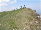
 | Planina Kuk - Vogel (direct way)
When you hear the name Vogel, many people first think of the Vogel ski resort, which is located near the peak of the same name. From the north si...
2 h 45 min |
 | Ski hotel Vogel - Vogel (via planina Zadnji Vogel)
When you hear the name Vogel, many people first think of the Vogel ski resort, which is located near the peak of the same name. From the north si...
2 h 30 min |
 | Ciganija - Uršlja gora (Plešivec) (winter way)
Uršlja gora or Plešivec is a lookout mountain between Slovenj Gradec and Črna na Koroškem. On the top or just below it stands the Church of St Ur...
2 h 30 min |
 | Koča na Naravskih ledinah - Uršlja gora (Plešivec)
Uršlja gora or Plešivec is a lookout mountain between Slovenj Gradec and Črna na Koroškem. On the top or just below it stands the Church of St Ur...
1 h 45 min |
 | Ciganija - Uršlja gora (Plešivec)
Uršlja gora or Plešivec is a lookout mountain between Slovenj Gradec and Črna na Koroškem. On the top or just below it stands the Church of St Ur...
2 h 15 min |
 | Andrejev dom na Slemenu - Uršlja gora (Plešivec)
Uršlja gora or Plešivec is a lookout mountain between Slovenj Gradec and Črna na Koroškem. On the top or just below it stands the Church of St Ur...
2 h 45 min |
 | Planina Zapleč - Krasji vrh (via Koluji)
Krasji vrh is located between Bovec and Kobarid on the Polovnik mountain ridge. At 1773m, Krasji vrh is also the highest peak of the ridge, offer...
2 h |
| Planina Zapleč - Krasji vrh (via snežna jama)
Krasji vrh is located between Bovec and Kobarid on the Polovnik mountain ridge. At 1773m, Krasji vrh is also the highest peak of the ridge, offer...
2 h |
 | Koutschitz Alm/Kočiška planina - Poludnig/Poludnik
Poludnig is located in the eastern part of the Carnic Alps. As there is no higher peak in the vicinity, Poludnik/Poludnig offers a very nice view...
3 h |
 | Waldheim Hütte - Fuchskogel (Seetal Alps) (via Wildsee)
Fuchskogel is a peak south of Zirbitzkogel in the Seetaler Alps. The summit is vast and mostly covered with grass. More precisely, the summit is ...
2 h 30 min |
| Tonnerhütte - Fuchskogel (Seetal Alps)
Fuchskogel is a peak south of Zirbitzkogel in the Seetaler Alps. The summit is vast and mostly covered with grass. More precisely, the summit is ...
2 h 20 min |
 | Walischeben - Weißenstein (Packalpe)
Weissenstein is a grassy mountain interspersed with wire fences. From its inconspicuous summit there is a fine view of the neighbouring Ameringko...
1 h 45 min |
 | Salzstiegelhaus - Weißenstein (Packalpe)
Weissenstein is a grassy mountain interspersed with wire fences. From its inconspicuous summit there is a fine view of the neighbouring Ameringko...
2 h 20 min |
 | Walischeben - Ameringkogel (Packalpe)
Ameringkogel is a grassy peak on which a cross is placed and on which a registration box is placed. At 2187m, it is also the highest peak in the ...
1 h 55 min |
| Salzstiegelhaus - Ameringkogel (Packalpe)
Ameringkogel is a grassy peak on which a cross is placed and on which a registration box is placed. At 2187m, it is also the highest peak in the ...
2 h 30 min |
 | Walischeben - Großenberg (Packalpe) (via Ameringkogel)
Großenberg is the northernmost of the two-thousanders in the Packalp chain. The vast grassy summit on which the triple cross stands offers a beau...
2 h 25 min |
| Walischeben - Großenberg (Packalpe)
Großenberg is the northernmost of the two-thousanders in the Packalp chain. The vast grassy summit on which the triple cross stands offers a beau...
2 h 20 min |
| Salzstiegelhaus - Großenberg (Packalpe) (via Ameringkogel)
Großenberg is the northernmost of the two-thousanders in the Packalp chain. The vast grassy summit on which the triple cross stands offers a beau...
3 h |
| Salzstiegelhaus - Großenberg (Packalpe)
Großenberg is the northernmost of the two-thousanders in the Packalp chain. The vast grassy summit on which the triple cross stands offers a beau...
2 h 55 min |
 | Walischeben - Hofalmkogel (Packalpe) (via Weissenstein)
Hofalmkogel is a less prominent peak in the ridge from Großenberg to Speikkogel. The summit is broad and mostly covered with grass. From the top ...
2 h 5 min |
 | Walischeben - Hofalmkogel (Packalpe) (past the cross)
Hofalmkogel is a less prominent peak in the ridge from Großenberg to Speikkogel. The summit is broad and mostly covered with grass. From the top ...
2 h 5 min |
| Salzstiegelhaus - Hofalmkogel (Packalpe)
Hofalmkogel is a less prominent peak in the ridge from Großenberg to Speikkogel. The summit is broad and mostly covered with grass. From the top ...
1 h 50 min |
 | Jakobe - Petzen (Kordeschkopf) (Peca (Kordeževa glava)) (easy path)
Kordeževa glava, better known as Peca is the highest summit in the mountain chain Peca. It is located on the border with Austria above Mežiška do...
2 h 15 min |
 | Rudnik v Topli - Mala Peca
Mala Peca is the peak above the lodge on the eastern slopes of Pec. From the top, where the viewing platform stands, there is a beautiful view of...
2 h 10 min |
 | Spodnje Sleme - Govca (Olševa)
Govca is the highest peak of the Olševa, a mountain range rising above Koprivna, Solčava and Remschenik (Remschenik / Remschenig is a valley on t...
3 h |
 | Zadnji travnik - Govca (Olševa)
Govca is the highest peak of the Olševa, a mountain range rising above Koprivna, Solčava and Remschenik (Remschenik / Remschenig is a valley on t...
1 h 45 min |
 | Jezerski vrh - Kärntner Storschitz / Pristovški Storžič
Kärntner Storschitz is an extremely scenic peak above Jezersko. It offers a beautiful view of the northern flanks of the Grintovci Mountains, thr...
1 h 50 min |
 | Trögern - Kärntner Storschitz / Pristovški Storžič
Kärntner Storschitz is an extremely scenic peak above Jezersko. It offers a beautiful view of the northern flanks of the Grintovci Mountains, thr...
2 h |
 | Planina Ravne - Velika Zelenica (via Zelene trate)
Velika Zelenica is the highest peak of the Dleskovská Plateau and the view is accordingly. The most beautiful is the nearby Ojstrica, below which...
2 h 15 min |
 | Planina Podvežak - Velika Zelenica (via Prag)
Velika Zelenica is the highest peak of the Dleskovská Plateau and the view is accordingly. The most beautiful is the nearby Ojstrica, below which...
2 h 30 min |
| Planina Ravne - Velika Zelenica (via Dolga trata)
Velika Zelenica is the highest peak of the Dleskovská Plateau and the view is accordingly. The most beautiful is the nearby Ojstrica, below which...
2 h 30 min |
 | Koutschitz Alm/Kočiška planina - Starhand (by road)
Starhand is a scenic peak on the eastern part of Carnic Alps near the better known Ojstrnik. From the top you can enjoy a beautiful view of the J...
2 h 15 min |
 | Franzbauer - Ferlacher Horn / Grlovec
Ferlacher Horn is a mountain with a large cross on top. From the top, you have a beautiful view of Karawanks, part of the Julian and Carnic Alps....
2 h 15 min |
 | Rifugio Pelizzo - Monte Mataiur/Matajur (via Ledina)
Monte Mataiur is a scenic mountain located on the border between Slovenia and Itali. From the top, you have a beautiful view of the Kobarid or Br...
2 h |
 | Windisch Bleiberg / Slovenji Plajberk - Singerberg / Žingarica
Singerberg is a peak located on the Austrian side of Karawanks above the village of Slovenji Plajberk / Windisch Bleiberg. The summit, which is p...
2 h |
 | Slovenji Plajberk / Windisch Bleiberg - Singerberg / Žingarica (via saddle Albink / Halbingsattel)
Singerberg is a peak located on the Austrian side of Karawanks above the village of Slovenji Plajberk / Windisch Bleiberg. The summit, which is p...
2 h 20 min |
| Plajberški graben / Bleiberger Graben - Singerberg / Žingarica
Singerberg is a peak located on the Austrian side of Karawanks above the village of Slovenji Plajberk / Windisch Bleiberg. The summit, which is p...
2 h 20 min |
 | Windische Hohe - Kobesnock
Kobesnock is a lesser-known peak located to the west of the massive Dobratsch mountain range. From the summit on which the cross stands, there is...
2 h 45 min |
 | Windische Hohe - Tschekelnock
Tschekelnock in German, Tschekelnock, is a mountain rising steeply above the idyllic mountain village of Venetski hill/Windische Hohe. From the t...
2 h 30 min |
 | Waldrast - Großer Speikkogel (Koralpe)
At 2140m, Großer Speikkogel is the highest peak of the Golice/Koralpe, a mountain range located east of Wolfsberg. From the top, where a cross an...
2 h |
 | Weinebene - Großer Speikkogel (Koralpe) (panoramic path)
At 2140m, Großer Speikkogel is the highest peak of the Golice/Koralpe, a mountain range located east of Wolfsberg. From the top, where a cross an...
3 h |
| Weinebene - Großer Speikkogel (Koralpe) (via Schäferkreuz)
At 2140m, Großer Speikkogel is the highest peak of the Golice/Koralpe, a mountain range located east of Wolfsberg. From the top, where a cross an...
3 h 15 min |
 | parking below Weinebene - Großer Speikkogel (Koralpe) (panoramic path)
At 2140m, Großer Speikkogel is the highest peak of the Golice/Koralpe, a mountain range located east of Wolfsberg. From the top, where a cross an...
3 h |
| parking below Weinebene - Großer Speikkogel (Koralpe) (via cross Schäferkreuz)
At 2140m, Großer Speikkogel is the highest peak of the Golice/Koralpe, a mountain range located east of Wolfsberg. From the top, where a cross an...
3 h 15 min |
| parking below Weinebene - Großer Speikkogel (Koralpe) (via Grünangerhütte)
At 2140m, Großer Speikkogel is the highest peak of the Golice/Koralpe, a mountain range located east of Wolfsberg. From the top, where a cross an...
3 h 10 min |
 | Waldrast - Großer Speikkogel (Koralpe) (ob robu planote Großes Kar)
At 2140m, Großer Speikkogel is the highest peak of the Golice/Koralpe, a mountain range located east of Wolfsberg. From the top, where a cross an...
2 h 45 min |
 | Lading - Speikkogel (Saualpe)
Speikkogel is an unmarked peak in the long mountain pasture ridge of the Sow. The expansive summit offers a fine view of the nearby Großer Sauofe...
2 h 25 min |
 | Lading - Großer Sauofen (Saualpe)
Großer Sauofen is one of the most prominent peaks on the mountain pasture of the Sow/Saualpe, due to its position and its short precipitous south...
2 h 30 min |
 | Lading - Ladinger Spitze (Saualpe) (via Ladinger Hütte)
Ladinger Spitze, or Ladinger Spitze in German, is the highest peak of the mountain pasture Sow/Saualpe at 2079m. From the summit on which the cro...
3 h |
 | Lading - Ladinger Spitze (Saualpe) (via Wolfsberger Hütte)
Ladinger Spitze, or Ladinger Spitze in German, is the highest peak of the mountain pasture Sow/Saualpe at 2079m. From the summit on which the cro...
2 h 45 min |
 | Rifugio Tolazzi - Monte Floriz
Monte Floriz is a 2184m high grassy peak located south of the Marinelli hut. From the summit there is a very fine view of the Coglians group, and...
2 h 25 min |
 | Pri Rupah - Okroglež
Okroglež is a dwarf pines vegetated peak located between Debela peč and Brdy. From the summit, which has a stamp (without a registration book), w...
1 h 55 min |
 | Rudno polje - Okroglež
Okroglež is a dwarf pines vegetated peak located between Debela peč and Brdy. From the summit, which has a stamp (without a registration book), w...
2 h 55 min |
 | Korensko sedlo - Kamnati vrh/Steinberg (by road)
Kamnati vrh is a 1621 m high mountain located north of Kranjska Gora. The grassy summit, on which the bench is located, is not visible due to the...
2 h |
 | Bukovnik - Lanež
Lanež is a less distinct peak located in the eastern part of Raduha. The spacious peak offers a beautiful view of the nearby Mala Raduha, Olševa,...
2 h 20 min |
 | Planina Kosmačeve Rastke - Lanež (via Durce)
Lanež is a less distinct peak located in the eastern part of Raduha. The spacious peak offers a beautiful view of the nearby Mala Raduha, Olševa,...
2 h 25 min |
| Planina Kosmačeve Rastke - Lanež (east path)
Lanež is a less distinct peak located in the eastern part of Raduha. The spacious peak offers a beautiful view of the nearby Mala Raduha, Olševa,...
2 h 25 min |
 | Koprein-Petzen - Wackendorfer Spitze
Wackendorfer Spitze is the northernmost two-thousander in the Pec mountain range. From this inconspicuous peak, in fine weather, we can enjoy a m...
2 h 30 min |
| Koprivna (Kumer) - Wackendorfer Spitze
Wackendorfer Spitze is the northernmost two-thousander in the Pec mountain range. From this inconspicuous peak, in fine weather, we can enjoy a m...
2 h 55 min |
 | Koprein-Petzen - Feistritzer Spitze
Feistritzer Spitze is a 2113 m high peak located on the Austrian side of Pec. From the top on which the cross stands, you have a beautiful view o...
2 h 30 min |
 | Jakobe - Končnikov vrh (easy path)
Končnikov vrh is a 2109 m high mountain located in the central part of Pec. The grassy peak offers a beautiful view along the Pec ridge and the m...
2 h 45 min |
 | Mangartska planina - Šober / Monte Sciober Grande (via Stože)
Šober is a 1845 m high peak located between Remšendol and the Jezersko Valley. From the top you can enjoy a beautiful view of the nearby Rabeljsk...
2 h 20 min |
 | Ledine - Gladki vrh (Ratitovec) (via planina Klom)
Gladki vrh is the most visited peak in the Ratitovec mountain range with an altitude of 1667 m. The uncultivated summit, on which the viewing pla...
1 h 55 min |
| Ledine - Gladki vrh (Ratitovec) (via Kosmati vrh)
Gladki vrh is the most visited peak in the Ratitovec mountain range with an altitude of 1667 m. The uncultivated summit, on which the viewing pla...
2 h 10 min |
 | Bitenjska planina - Gladki vrh (Ratitovec)
Gladki vrh is the most visited peak in the Ratitovec mountain range with an altitude of 1667 m. The uncultivated summit, on which the viewing pla...
2 h 25 min |
 | Razglednik - Gladki vrh (Ratitovec)
Gladki vrh is the most visited peak in the Ratitovec mountain range with an altitude of 1667 m. The uncultivated summit, on which the viewing pla...
3 h 5 min |
 | Prtovč - Altemaver (Ratitovec) (via Razor)
Altemaver is the highest peak of Ratitovec at 1678 m. The grassy peak offers a beautiful view of Julian Alps, Jelovica, Karawanks, Kamnik Savinja...
1 h 50 min |
| Prtovč - Altemaver (Ratitovec) (via Po(v)den)
Altemaver is the highest peak of Ratitovec at 1678 m. The grassy peak offers a beautiful view of Julian Alps, Jelovica, Karawanks, Kamnik Savinja...
1 h 50 min |
 | Zgornje Danje - Altemaver (Ratitovec)
Altemaver is the highest peak of Ratitovec at 1678 m. The grassy peak offers a beautiful view of Julian Alps, Jelovica, Karawanks, Kamnik Savinja...
1 h 45 min |
 | Bohinjsko sedlo - Altemaver (Ratitovec)
Altemaver is the highest peak of Ratitovec at 1678 m. The grassy peak offers a beautiful view of Julian Alps, Jelovica, Karawanks, Kamnik Savinja...
3 h 15 min |
| Bitenjska planina - Altemaver (Ratitovec)
Altemaver is the highest peak of Ratitovec at 1678 m. The grassy peak offers a beautiful view of Julian Alps, Jelovica, Karawanks, Kamnik Savinja...
2 h 30 min |
 | Razglednik - Altemaver (Ratitovec)
Altemaver is the highest peak of Ratitovec at 1678 m. The grassy peak offers a beautiful view of Julian Alps, Jelovica, Karawanks, Kamnik Savinja...
3 h 10 min |
| Rotek - Altemaver (Ratitovec)
Altemaver is the highest peak of Ratitovec at 1678 m. The grassy peak offers a beautiful view of Julian Alps, Jelovica, Karawanks, Kamnik Savinja...
2 h 30 min |
| Soriška peč - Altemaver (Ratitovec)
Altemaver is the highest peak of Ratitovec at 1678 m. The grassy peak offers a beautiful view of Julian Alps, Jelovica, Karawanks, Kamnik Savinja...
3 h |
 | Plockenpass - Creta di Collinetta / Cellon
Creta di Collinetta/Cellon is a 2238 m high mountain located west of the Plockenpass. From the top with a cross, you have a beautiful view of the...
3 h |
 | Planina Podvežak - Mala Ojstrica
Mala Ojstrica is a featureless peak located between Ojstrica, Molička mountain pasture and Korošica. From the top, where there is a registration ...
2 h 30 min |
 | Koprivna (Kumer) - Topitza
Topitza, or Topitza in German, is a 1649 m high peak located northeast of Železna Kapla. From the summit, on which the cross stands, we have a be...
2 h 10 min |
 | Baumgartnerhof - Maloško poldne / Mallestiger Mittagskogel
Maloško poldne or Mallestiger Mittagskogel in German is a 1823 m high peak located on the border between Slovenia and Austria, more precisely bet...
2 h 45 min |
 | Rifugio Selvapiana I.Lunelli - Croda Sora I Colesei / Arzalpenkopf (via Forcella Popera)
Croda Sora I Colesei or Arzalpenkopf in German is a 2321 m high mountain located on the eastern edge of the Sextens Dolomites / Dolomites di Sest...
2 h 30 min |
| Rifugio Selvapiana I.Lunelli - Croda Sora I Colesei / Arzalpenkopf (via Belvedere)
Croda Sora I Colesei or Arzalpenkopf in German is a 2321 m high mountain located on the eastern edge of the Sextens Dolomites / Dolomites di Sest...
2 h 30 min |
 | Zgornje Danje - Kremant (Ratitovec)
Kremant is a 1654 m high peak located in the western part of Ratitovec. From the top, where a stamp is attached to a metal pole, we have a beauti...
1 h 45 min |
 | Soriška peč - Kremant (Ratitovec)
Kremant is a 1654 m high peak located in the western part of Ratitovec. From the top, where a stamp is attached to a metal pole, we have a beauti...
2 h 30 min |
 | Bohinjsko sedlo - Kremant (Ratitovec)
Kremant is a 1654 m high peak located in the western part of Ratitovec. From the top, where a stamp is attached to a metal pole, we have a beauti...
2 h 45 min |
| Rotek - Kremant (Ratitovec)
Kremant is a 1654 m high peak located in the western part of Ratitovec. From the top, where a stamp is attached to a metal pole, we have a beauti...
2 h 30 min |
 | Forni di Sopra - Clap Varmost
Clap Varmost is a scenic peak located north to north-west of Forni di Sopra. From the top, where there is a cross and a registration box, there i...
2 h |
 | Hebalm (Gasthaus Zur Rehbockhütte) - Weberkogel
Weberkogel is a less prominent peak located north to north-west of the Weinebene Alpine Pass. On the 1805 m high summit is a medium-sized cairn a...
2 h 35 min |
 | Rute (Zavrh) / Bärental - Mačenski vrh / Matschacher Gupf (via 668)
Mačenski vrh is a lookout peak above Roz/Rosental. The summit has a registration box with a registration book....
2 h 15 min |
| Rute (Zavrh) / Bärental - Mačenski vrh / Matschacher Gupf (over saddle Mrzla raven / Gipssattel)
Mačenski vrh is a lookout peak above Roz/Rosental. The summit has a registration box with a registration book....
2 h 15 min |
 | Zadnji travnik - Obel kamen (Olševa)
Obel kamen is a 1911 m high peak located in the Olševa Ridge. On the summit there is a boundary stone marked RS XXII 1, the cross and the registr...
2 h 15 min |
 | Žabnica / Bodental - Kosmatica / Kosmatitza
Kosmatica is a 1659 m high peak located entirely on the Austrian side of Karawanks, north of Vrtača. The summit, which is partly covered by fores...
2 h 40 min |
| Bodenbauer - Kosmatica / Kosmatitza
Kosmatica is a 1659 m high peak located entirely on the Austrian side of Karawanks, north of Vrtača. The summit, which is partly covered by fores...
1 h 45 min |
 | Klippitztörl - Forstalpe (Saualpe) (via Geierkogel)
Forstalpe is an unstratified peak in the Svinja mountain pasture / Saualpe massif. The stamp for Forstalpe is located in an interesting natural w...
2 h 10 min |
 | Klippitztörl - Kienberg (Saualpe) (via Geierkogel)
Kienberg is a 2050 m high peak in the Svinja mountain pasture / Saualpe massif. The grassy summit offers a beautiful view over most of the Svinsk...
2 h 50 min |
 | Klippitztörl - Gertrusk (Saualpe)
Gertrusk is a prominent two-thousander in the central part of Svinjska mountain pasture. A cross stands at the top, and next to it is a registrat...
3 h 5 min |
| Vitlenica - Veliki Vilinac (Vitlenica - Vilinac)
Veliki Vilinac is one of the peaks of mountain pasture Čvrsnica, located to the west of Jablanica in the Blidinje Nature Park. Čvrsnica is bounde...
3 h |
 | Planina Zajzera - Krniška glavica / Jof di Sompdogna
Krniška glavica (Jof di Sompdogna) is a 1,889-metre-high peak in the Western Julian Alps, north of Jôf di Montasioa. There is a cross on the look...
2 h 30 min |
 | Planina Zajzera - Krniška glavica / Jof di Sompdogna (path 639 and 652)
Krniška glavica (Jof di Sompdogna) is a 1,889-metre-high peak in the Western Julian Alps, north of Jôf di Montasioa. There is a cross on the look...
3 h 10 min |
 | Pass Lius above Ligosullo - Tersadia (from Ligosullo)
Tersadia is a mountain in the heart of the Carnian Mountains, just far enough away from its higher neighbours to provide an excellent vantage poi...
3 h |
 | parking below Weinebene - Krakaberg (Golica / Koralpe) (panoramic path)
Krakaberg is a 2070 m high peak located to the south of Großer Speikkogel, the highest peak of Golica / Koralpa. The summit offers a fine view of...
3 h 10 min |
 | Mönichkirchen - Niederwechsel (via Steinerne Stiege)
Niederwechsel is a scenic peak in the Wechsel massif. The view from the top is spectacular, reaching far in all directions, as there are no highe...
2 h 25 min |
 | Pfaffensattel - Peter-Bergner-Warte (Pretul)
...
2 h 40 min |
 | Pfaffensattel - Amundsenhöhe
...
2 h 55 min |
 | Knödelhütte - Hirschegger Alm (severni vrh)
...
2 h 25 min |
 | Knödelhütte - Seinerkreuz
...
2 h 40 min |
 | parking below Weinebene - Steinschneider (čez planoto Großes Kar)
...
3 h 15 min |
| Waldrast - Steinschneider (ob robu planote Großes Kar)
...
2 h 20 min |
 | Seetal - Voisthalerhütte
...
2 h 50 min |
 | Alpengasthof Scheikl - Hohe Veitsch
...
2 h 20 min |