Koprivnik v Bohinju - Vodnikov razglednik
Starting point: Koprivnik v Bohinju (971 m)
| Lat/Lon: | 46,3059°N 13,9832°E |
| |
Time of walking: 15 min
Difficulty: easy marked way
Altitude difference: 46 m
Altitude difference po putu: 60 m
Map: TNP 1:50.000
Recommended equipment (summer):
Recommended equipment (winter): crampons
Views: 11.030
 | 2 people like this post |
Access to the starting point:
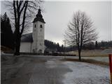
a) From the motorway Ljubljana - Jesenica, take the exit Lesce and then continue to Bled and then Bohinj. After Bitnje, which the main road passes on the left, take a sharp right in the direction of Jereka and Pokljuka. The road then climbs steeply at first, and then gradually flattens out after Koriti, leading to a crossroads by the bus station, where you turn right in the direction of Pokljuka, Koprivnik and Jereka (straight ahead Srednja vas). Just after the crossroads we arrive at Jereka, and from the crossroads in front of the church we continue straight on towards Pokljuka (left Podjelje). After Jereka the road starts to climb steeply again, and higher up it levels off and continues along the Mrzle potok. At the bus stop, the signs for Koprivnik direct us to the left, and we drive another 200 m from the junction, then park in the parking lot near the parish church.
b) From Železniki or Podbrdo, take Bohinjska Bistrica, then continue in the direction of Bled. Shortly after the Petrol station, which is located just after Bohinjska Bistrica, turn left in the direction of Pokljuka and Jereka. The road climbs steeply at first, then gradually flattens out behind Koriti, leading to a junction by the bus station, where you continue right in the direction of Pokljuka, Koprivnik and Jereka (straight ahead Srednja vas). Just after the crossroads we arrive at Jereka, and from the crossroads in front of the church we continue straight on towards Pokljuka (left Podjelje). After Jereka the road starts to climb steeply again, and higher up it levels off and continues along the Mrzle potok. At the bus stop, the signs for Koprivnik direct us to the left, and we drive another 200 m from the junction, then park in the parking lot near the parish church.
Path description:
From the parking lot at the church on Koprivnik, continue along the road in the direction of Vodnik's Lookout. The road first leads across a meadow, then after a small bridge, continue slightly left along the road, which is closed to public traffic by a road sign. After a short climb, you reach the fire house, after which the signs for Vodnikov razglednik direct you to the road on the right, which first loses its asphalt coating and then turns into a footpath. The way ahead leads through the woods for a short distance, and then across the hayfields to reach another asphalt road, which you follow to the right. Follow the road for a short distance and then, in front of a secluded house, continue slightly right on a path that passes a house and outbuildings on the right.
When the buildings behind the house are finished, the path from Jereka joins us from the right, and we continue straight ahead on the path that goes into the woods. A few minutes of steeper ascent follows, where we are helped by a wooden fence (not difficult) and the path leads us to Vodnikov razglednik (Vodnikov's lookout).
Description and pictures refer to the situation in 2016 (January).

Pictures:
 1
1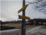 2
2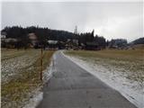 3
3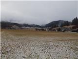 4
4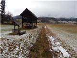 5
5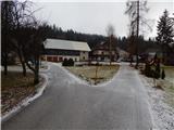 6
6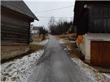 7
7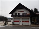 8
8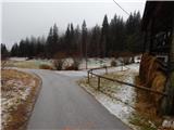 9
9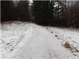 10
10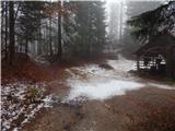 11
11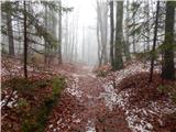 12
12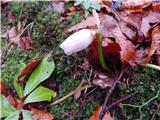 13
13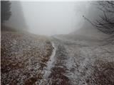 14
14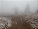 15
15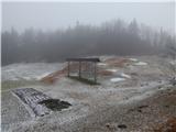 16
16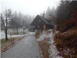 17
17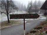 18
18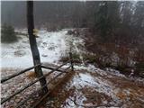 19
19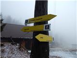 20
20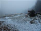 21
21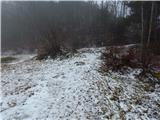 22
22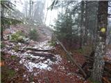 23
23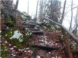 24
24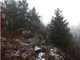 25
25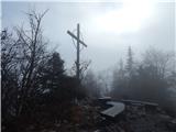 26
26 27
27
Discussion about the trail Koprivnik v Bohinju - Vodnikov razglednik
|
| modrook121. 01. 2017 |
Smo bili 29. 12. 2016 na razgledniku.čudovita pot, še lepši razgledi.otroci uživali.
|
|
|