Ukanc - Pršivec (Ferata Ožarjeni kamen)
Starting point: Ukanc (531 m)
| Lat/Lon: | 46,27926°N 13,82942°E |
| |
Name of path: Ferata Ožarjeni kamen
Time of walking: 5 h
Difficulty: extremely difficult marked way
Ferata: D/E
Altitude difference: 1230 m
Altitude difference po putu: 1250 m
Map: TNP 1:50.000
Recommended equipment (summer): helmet, self belay set
Recommended equipment (winter): helmet, self belay set, ice axe, crampons
Views: 9.356
 | 4 people like this post |
Access to the starting point:
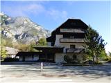
From the Ljubljana - Jesenice motorway, take the Lesce exit and follow the road towards Bled, Bohinjska Bistrica, Ribčev Laz and Ukanec. On the western side of the lake, leave the road towards Koča pri Savici and turn right towards Ukanec. Follow this road to the parking lot near the abandoned Hotel Zlatorog where you park. Parking is also possible in one of the other car parks on the west side of the lake. There is a charge for parking.
Path description:
The route described is CLOSED until further notice! Date of update 7. 7. 2021.
From the parking lot, continue along the main road to the first crossroads where you can take the footpath towards the lake. At the lake, continue north on the path that leads around the lake. At the north-western edge of the lake, where there is a crossroads, turn right and walk for a short distance along the path around the lake, then follow the signpost for the Uket climbing centre, which points left onto a narrow path.
Take the above-mentioned path, which first climbs a few times in the keys. There are also a few fallen trees on the path. Quickly reach a crossroads where a sign on a rock directs you to the right towards a climbing area, while a path to the left leads towards the Savica River.
The trail is marked with red dots and runs eastwards all the way. The path is relatively poorly trodden and mostly ascends gently, but in a few places it also descends slightly. Here, through the forest, there are occasional fine views towards Bohinjsko jezero and the Vogel. When you reach the climbing area, you will first see the sign "Uket" on the rock, we continue here for a short time on the path that crosses the slopes to the east, and then you will see the ropes on the left (46. 28826°N / 13. 83597°E).
Before entering the climbing route, be sure to equip yourself with a self-protection kit and a helmet. Climbing gloves are highly recommended. It is not recommended to climb the protected route in wet conditions.
The protected route is quite difficult from the start and initially climbs up the wall transversely. Soon the path turns left and you are facing the first difficult almost vertical climb. The path then climbs up a monolithic rock all the way, and there is often some grass and trees or bushes along the way. The trail offers magnificent views of Lake Bohinj the whole time. The path, which is very exposed throughout, climbs almost vertically a few more times and there are some short, difficult crossings along the way. This trail then goes all the way to the end of the protected trail where there is also a marked crossroads.
To the right, the path leads downhill, marked "bivouac" and secured with a rope. This path leads to a ravine surrounded by overhanging cliffs, which provides shelter.
At the crossroads we continue straight up and the path soon turns left and then crosses the slopes to the west. The path, which runs along mostly wooded slopes, then climbs slightly. The slope becomes more grassy and the path soon turns slightly to the right. There is a final short climb to the top where there is a registration box.
From the registration box, a quick descent into the valley is possible down steeply to the left. Alternatively, you can decide to continue towards the other part of the protected route. In this case, continue along the ridge at the registration box. The trail is mostly invisible further on, and the relatively few and small red arrows and dots are helpful for orientation. Here we climb a mostly grassy ridge that runs to the right of a deep ravine. In a few places the ascent is a little steeper and some very easy climbing (up to grade 1) is required.
A little higher up, the path leads us into the forest, and the gully on our left then soon runs out. We continue in the same direction and climb a few times a little steeper. We continue mostly ascending, crossing the slopes to the right, and when we reach a small clearing from where the view towards Bohinjsko jezero opens up, we will see the steel cables where the second part of the protected path begins (46. 29189°N / 13. 83411°E).
After a short crossing, continue left and then climb steeply along the steel cable for some time. The protected path is also mostly unpaved and in places slightly overgrown. The path does, however, once again offer beautiful views of Lake Bohinj. Later, the path turns to the right and leads us along a grassy ledge to a fork. Turn left and climb steeply up the path. The path then turns slightly to the left and becomes slightly more difficult. Continue left along the vertical slab, which leads under an overhang. Here you first traverse upwards along the overhang, followed by a short, very difficult climb over the overhang (difficulty D/E). Above the overhang there is a short traverse to the right and then another steep climb upwards along the overhang. Due to the long stretch, a little more caution is needed. Climb up along the steel for a short distance, then turn right and cross the exposed slope.
The path then becomes less demanding and then ascends for some time, crossing the slopes to the right. Here, though, we are still helped most of the time by the cable car. We continue in the same direction and the path then leads us past a larger pit, which can also provide shelter in case of bad weather. When the ropes end, we reach the forest where the slope is slightly less steep. The path is not visible here, and only a few burnt branches help us to find our way. In the forest, we cross the slope to the right for a short time, then continue left and quickly reach a wide marked trail leading from Vogar towards Pršivec (46. 29439°N / 13. 83699°E).
If you decide to climb to the top of Pršivec, continue left here. If you want to descend into the valley, continue right towards Vogar. It is also possible to descend via Planina Viševnik and then past Črno jezero and via Komarča into the valley. All descents to the starting point are relatively long. There is a short descent only if there is an organised shuttle from Mountain pasture to Vogar.
We continue to the left and initially follow the wide path westwards. When the path becomes a little narrower the path leads us past a marked lookout point from which a very nice view opens up towards Lake Bohinj. The path then soon starts to climb a little steeper up the slope where we will see many fallen trees along the way. Such a path then leads us to a crossroads where the right path branches off towards Mountain pasture Viševnik.
We continue to the left and climb for a while through a slightly thinner forest. A little higher up, the path turns to the left and leads us to a ridge from where we have wonderful views of the surrounding mountains. Continue to the right and climb up the ridge for a while. In the last part, the ascent becomes a little more gentle and, passing by few trees, we soon reach a lookout on which there is a registration box and a larger cairn.
Descend on the other side towards Planina Viševnik and from there towards Črno jezero and through Komarča into the valley.
The route described is of difficulty level D/E and is suitable only for experienced mountaineers with sufficient strength in their arms. Some additional difficulties may be caused by the rope, which is a bit thinner than usual on such difficult routes. The ropes are attached to drill bits and not to the usual rope pegs seen on most other protected routes. The rappel is often completely against the wall, which makes it a bit more difficult to get the self-protection kit on.
The climbing part of the route follows the southern slopes, which are very hot in summer. There may also be benches and snakes along the way.

Pictures:
 1
1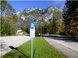 2
2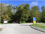 3
3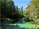 4
4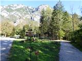 5
5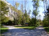 6
6 7
7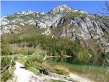 8
8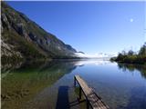 9
9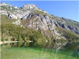 10
10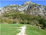 11
11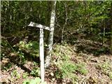 12
12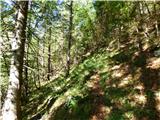 13
13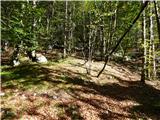 14
14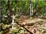 15
15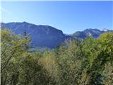 16
16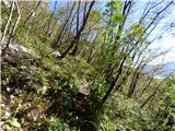 17
17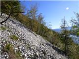 18
18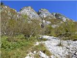 19
19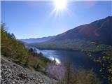 20
20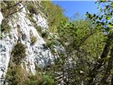 21
21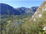 22
22 23
23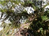 24
24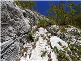 25
25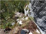 26
26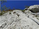 27
27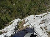 28
28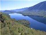 29
29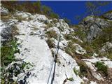 30
30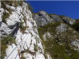 31
31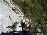 32
32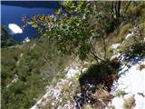 33
33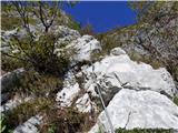 34
34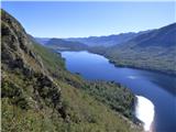 35
35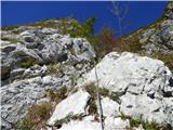 36
36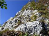 37
37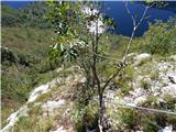 38
38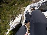 39
39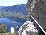 40
40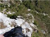 41
41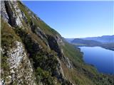 42
42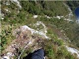 43
43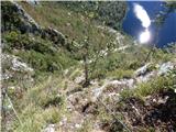 44
44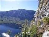 45
45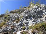 46
46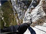 47
47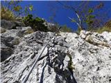 48
48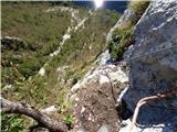 49
49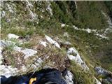 50
50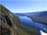 51
51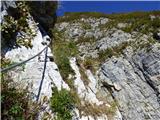 52
52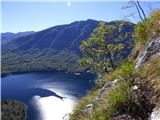 53
53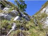 54
54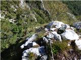 55
55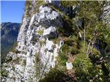 56
56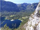 57
57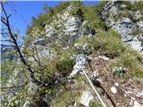 58
58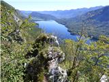 59
59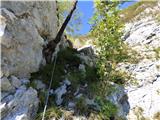 60
60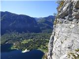 61
61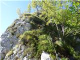 62
62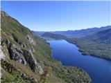 63
63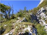 64
64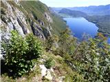 65
65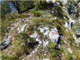 66
66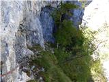 67
67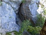 68
68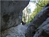 69
69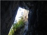 70
70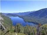 71
71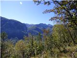 72
72 73
73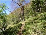 74
74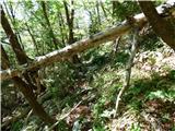 75
75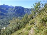 76
76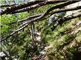 77
77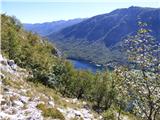 78
78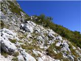 79
79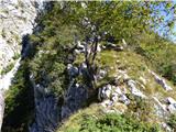 80
80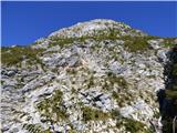 81
81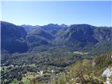 82
82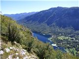 83
83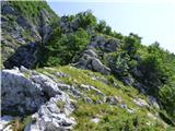 84
84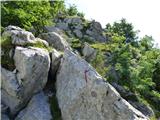 85
85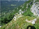 86
86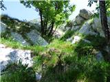 87
87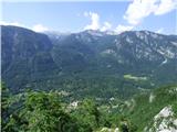 88
88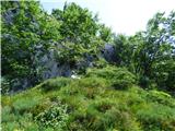 89
89 90
90 91
91 92
92 93
93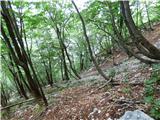 94
94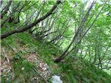 95
95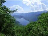 96
96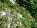 97
97 98
98 99
99 100
100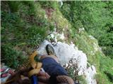 101
101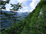 102
102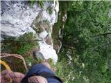 103
103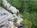 104
104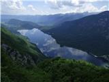 105
105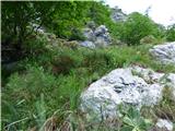 106
106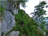 107
107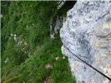 108
108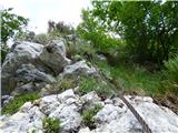 109
109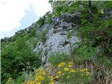 110
110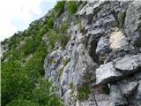 111
111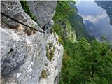 112
112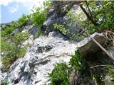 113
113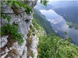 114
114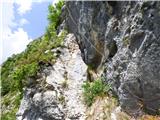 115
115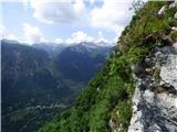 116
116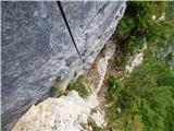 117
117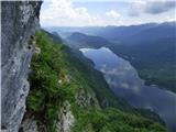 118
118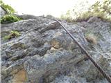 119
119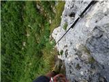 120
120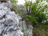 121
121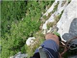 122
122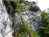 123
123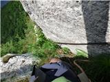 124
124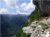 125
125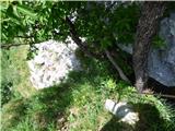 126
126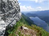 127
127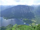 128
128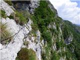 129
129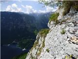 130
130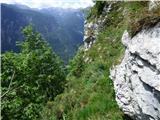 131
131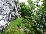 132
132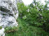 133
133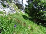 134
134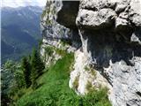 135
135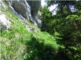 136
136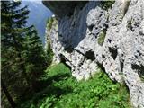 137
137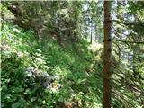 138
138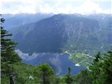 139
139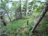 140
140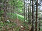 141
141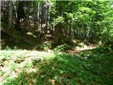 142
142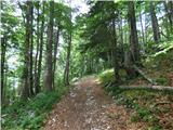 143
143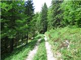 144
144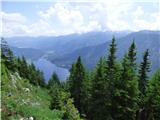 145
145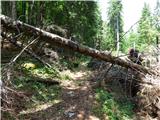 146
146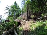 147
147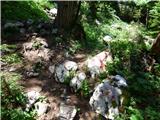 148
148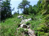 149
149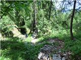 150
150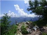 151
151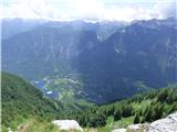 152
152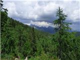 153
153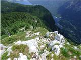 154
154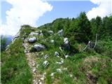 155
155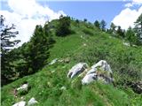 156
156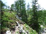 157
157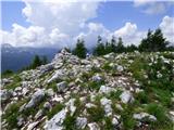 158
158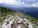 159
159 160
160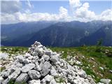 161
161
Discussion about the trail Ukanc - Pršivec (Ferata Ožarjeni kamen)
|
| Tadej8. 07. 2021 07:11:49 |
Opisana pot je do nadaljnjega ZAPRTA!
|
|
|