Bodešče - Gradišče (Bodešče)
Starting point: Bodešče (445 m)
| Lat/Lon: | 46,3452°N 14,1368°E |
| |
Time of walking: 15 min
Difficulty: easy marked way
Altitude difference: 54 m
Altitude difference po putu: 54 m
Map: Karavanke - osrednji del 1:50.000
Recommended equipment (summer):
Recommended equipment (winter): ice axe, crampons
Views: 2.122
 | 3 people like this post |
Access to the starting point:
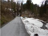
From the Ljubljana - Jesenice motorway, take the Lesce exit and then continue to Bled. At Bled, turn left onto Koritenska cesta and continue towards Koritno and later Bodešče. When you reach Bodešče, take the second street on the left and then gradually start descending through the village towards the Bodes Bridge. Before you reach the Bodeški Bridge over the Sava Bohinjka, you will come to a signpost marking the end of the settlement of Bodešče. Park in a suitable space next to the sign.
Path description:
From the starting point, go back a few steps and then continue on the narrower road towards Šobec, which continues past the house. The road soon turns into a forest through which it climbs moderately, and after about 5 minutes it leads us to another hamlet in the settlement Bodešče, where at a small crossroads we continue to the right in the direction of the church of St Martin and Gradišče. A short walk and you are at the Church of St Lenart, which is located at the edge of the village.
From the church, continue along the road in the direction of Gradišče, leaving the road just before the last house in the village and continuing to the left. The path continues up through a narrow lane of low forest and passes to the other side of the hill, where just a few metres below the top it crosses the relatively steep slopes above the Sava Bohinjka river. After a minute or two of crossing, the path turns sharply to the left and passes onto a ridge, which is quickly climbed to a viewpoint with a cross and a bench.

Pictures:
 1
1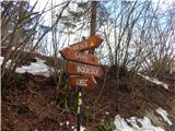 2
2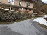 3
3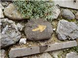 4
4 5
5 6
6 7
7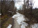 8
8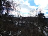 9
9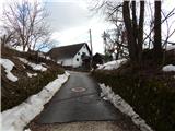 10
10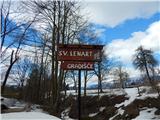 11
11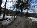 12
12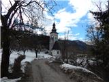 13
13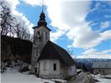 14
14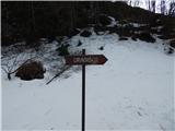 15
15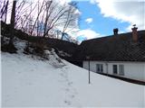 16
16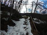 17
17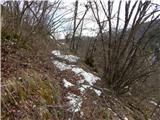 18
18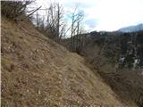 19
19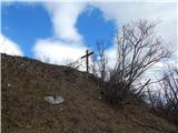 20
20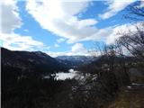 21
21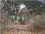 22
22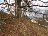 23
23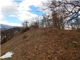 24
24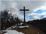 25
25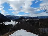 26
26
Discussion about the trail Bodešče - Gradišče (Bodešče)