Starting point: Rudno polje (1347 m)
| Lat/Lon: | 46,3458°N 13,9236°E |
| |
Time of walking: 1 h 15 min
Difficulty: easy marked way, easy unmarked way
Altitude difference: 443 m
Altitude difference po putu: 443 m
Map: TNP 1:50.000
Recommended equipment (summer):
Recommended equipment (winter):
Views: 11.822
 | 3 people like this post |
Access to the starting point:
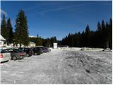
From the motorway Ljubljana - Jesenice take the exit Lesce and follow the road towards Bled. At the traffic lights in Bled, the signs for Pokljuka direct you to the right. Continue through Gorje and past the abandoned ski resort Zatrnik to Rudni Polje on Pokljuka (a large parking lot, a military barracks and a shooting range).
Path description:
At the end of the parking lot, a macadam road branches off to the right with signposts for Triglav. Take this road, which climbs gently and after 10 minutes leads to the ski resort.
On the other side of the ski slope, by the ski lift, you will see a marked footpath which continues off the road to the right. Take the path mentioned above, which leads us on a moderate ascent through the lane of a forest to a dirt road (possibly also by road), which we follow to the right, but only for a few steps. Just before the road crosses the ski slope, a marked footpath branches off to the left, first crossing a pasture fence and then climbing along the edge of the ski slope. At the top of the first lift, the marked path turns left and continues to climb steeply along the edge of the second steeper ski slope. The second lift also soon ends, and we continue along the path, which turns into a small, relatively steep valley. Towards the top of the valley, the path climbs relatively steeply, then suddenly dips and leads us past an abandoned hunting observation post to a crossroads.
Continue straight in the direction of Viševnik (right Lipanca and Viševnik over Kačji rob) along another steeper path, which after a few minutes of further walking leads us to a small saddle, from which we open a beautiful view of the Lower Bohinj Mountains.
At the saddle, leave the marked trail leading to Viševnik and continue the ascent to the left along a gently sloping and less visible path, which climbs through lane of dwarf pines. This path, which first leads to the Plesišče summit, is followed all the way to the summit, which is reached after less than 5 minutes' walk from the point where we left the marked path.

Pictures:
 1
1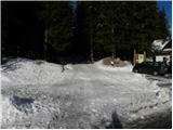 2
2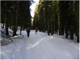 3
3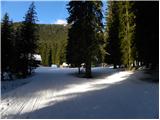 4
4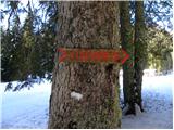 5
5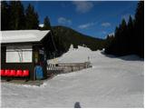 6
6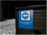 7
7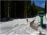 8
8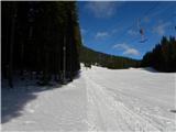 9
9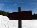 10
10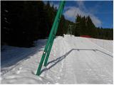 11
11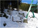 12
12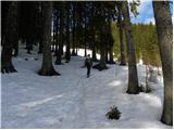 13
13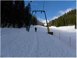 14
14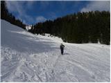 15
15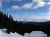 16
16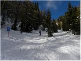 17
17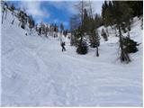 18
18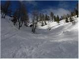 19
19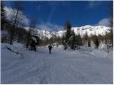 20
20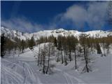 21
21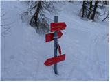 22
22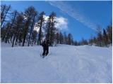 23
23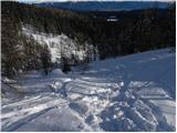 24
24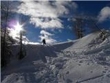 25
25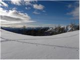 26
26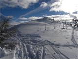 27
27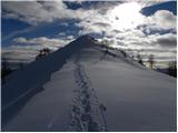 28
28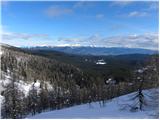 29
29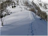 30
30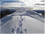 31
31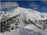 32
32
Discussion about the trail Rudno polje - Plesišče
|
| skiro12313. 08. 2020 |
Slabše videne stezice nisem našel. Pot s sedla je popolnoma zaraščena z ruševjem, zato je na vrh mogoče priti le ko je ruševje zalito s snegom.
|
|
|