End of road on Vogar - Planina Dedno Polje (via Griva)
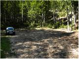
Starting point: End of road on Vogar (1350 m)
| Lat/Lon: | 46,2956°N 13,8412°E |
| |
Name of path: via Griva
Time of walking: 2 h 15 min
Difficulty: easy marked way
Altitude difference: 210 m
Altitude difference po putu: 450 m
Map: TNP 1:50.000
Recommended equipment (summer):
Recommended equipment (winter): ice axe, crampons
Views: 1.600
 | 2 people like this post |
Access to the starting point:
From the Ljubljana - Jesenice motorway, take the Lesce exit and follow the road towards Bled and on to Bohinjska Bistrica. Continue towards Bohinjsko jezero (Ribčev laz), at which you will come to a crossroads where you will turn right towards Stara Fužina. At Stara Fužina, at the crossroads by the chapel, turn sharp left onto the ascending road towards mountain pasture Blato, mountain pasture Vogar and the Voja valley. The road leads on to a place where tolls and parking fees are collected, and we follow it on to the next crossroads, where we continue left (right Voje). Follow the road to the next crossroads (take some time), where you continue straight on (sharp right mountain pasture Blato). Follow the road past mountain pasture Vogar and follow it to the parking area at the end of the road.
From the toll booth to the starting point is about 11 km drive, the last part of the road is gravel.
Path description:
At the parking lot we see the signs for mountain pasture Viševnik, which direct us to the right onto the wide and initially quite steep tractor track logging trail. After a few minutes of steep climbing, logging trail is laid down and then continues through the forest without any major changes in elevation. When logging trail turns to the right, continue straight on the marked footpath, which climbs gently for a short time. When the path becomes steeper, you will see cairn on the left and next to it a path leading to Pršivec (the path later joins the normal path from Vogar), and we continue straight on along the steep mountain path. The way forward climbs steeply for some time through the forest, then it is laid and leads us to the Abyss at Gamsova glavici (the abyss has been explored to a depth of 817 m). Above the abyss, the path turns into an undistinguished and, in the upper part, steeper valley, which ascends to a small pass between Pršivecm (1761 m) on the left and Gornji Viševnik (17022 m) on the right. Here the path completely flattens out and then continues for some time across the pastures of Gornji Viševnik. On the other side, the path returns to the forest and, after a few minutes of descent, leads to mountain pasture Viševnik, in the middle of which stands Bregar's shelter.
From mountain pasture Viševnik continue slightly left (sharp left Pršivec, left Črno jezero, slight right mountain pasture at Jezero past Krištofojce, right mountain pasture at Jezero) on the path in the direction of mountain pasture Ovčarije and the Triglav Lakes. The way forward first ascends crosswise to the left over a steeper slope, then gradually flattens out and leads us into a flatter world. The route continues south-west of Griva (1758 m) for some time without any major changes in altitude. A little further on, more precisely at the direction signs, a path continues in a straight line towards mountain pasture Dedno polje, and a marked path continues sharp left towards mountain pasture Ovčarija.
At this crossroads, continue straight ahead, and the path ahead leads along a slightly less well-trodden track, which continues without major changes in altitude. After about 15 minutes of further walking, we reach a marked trail leading from mountain pasture Dedno polje towards mountain pasture Ovčarija, and we follow the trail to the right. There are a few minutes of moderate descent and the path, which leads through mostly sparse forest, leads to mountain pasture Dedno polje, where there are several shepherd's huts and a cheese cottage. Starting point - mountain pasture Viševnik 1:20, mountain pasture Viševnik - mountain pasture Legacy field 55 minutes.

We can extend the trip to the following destinations: Planina Blato,
Dom na Komni,
Planina Lopučnica,
Planina Ovčarija,
Koča pri Triglavskih jezerih,
Rigeljc,
Stadorski Orliči,
Vrtec,
Visoka glava,
Kovačičeva glava,
Jezero v Ledvicah,
Rušnata glava,
Bela glava,
Zeleno jezero,
Vrh nad Vodeno Rupo,
Rjavo jezero,
Kreda,
Zasavska koča na Prehodavcih,
Mala Tičarica,
Slatna (1 h 30 min),
Velika Tičarica,
Koča na Doliču,
Prvi Vogel,
Kopica,
Srednji Vogel,
Čelo,
Mala Zelnarica,
Malo Špičje,
Velika Zelnarica,
Zadnji Vogel,
Veliko Špičje,
Morbegna,
Glava v Zaplanji,
Kanjavec,
Triglav
Pictures:
 1
1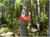 2
2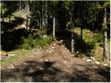 3
3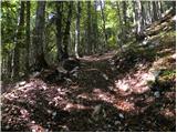 4
4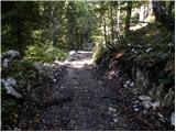 5
5 6
6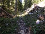 7
7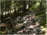 8
8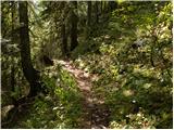 9
9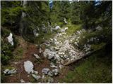 10
10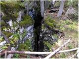 11
11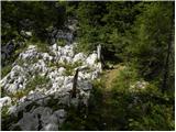 12
12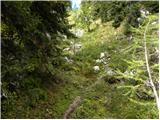 13
13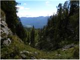 14
14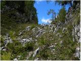 15
15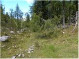 16
16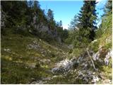 17
17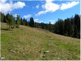 18
18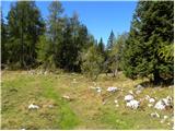 19
19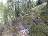 20
20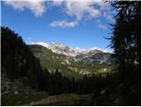 21
21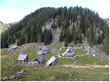 22
22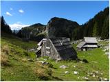 23
23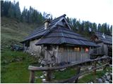 24
24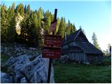 25
25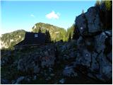 26
26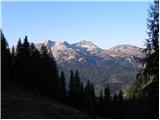 27
27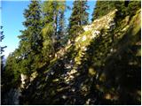 28
28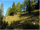 29
29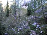 30
30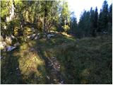 31
31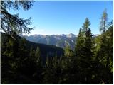 32
32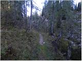 33
33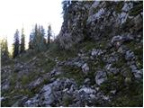 34
34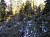 35
35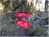 36
36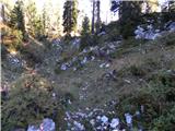 37
37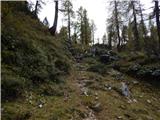 38
38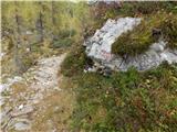 39
39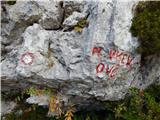 40
40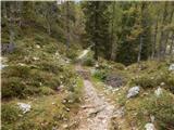 41
41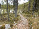 42
42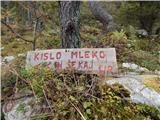 43
43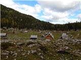 44
44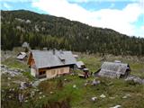 45
45
Discussion about the trail End of road on Vogar - Planina Dedno Polje (via Griva)