Kočna - Planina Obranica (od spomenika)
Starting point: Kočna (660 m)
Name of path: od spomenika
Time of walking: 1 h
Difficulty: easy marked way
Altitude difference: 375 m
Altitude difference po putu: 375 m
Map: TNP 1:50.000
Recommended equipment (summer):
Recommended equipment (winter): ice axe, crampons
Views: 5.828
 | 2 people like this post |
Access to the starting point:
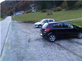
From the Ljubljana - Jesenice motorway, take the Lipce exit and turn left towards "Blejska Dobrava and Spodnje Gorje". Soon after entering the railway underpass, we are at the next crossroads, where we turn right - Bled, Kočna. The road, serpentine at first, climbs straight westwards and soon reaches the summit or settlement of Kočna in a left turn. Towards the end of the settlement, as the road descends slightly, we see a guest house on the left and a larger parking lot on the right - our starting point.
Path description:
On the side of the road where you parked, take the dirt track leading towards the forest. After a few metres we are at a slightly larger stone, on which there is a memorial and the first marker with the inscription Obranca, which directs us straight (west) into the forest. The path, which begins to climb, turns first slightly to the left in the forest and shortly afterwards back in the same direction, straight ahead, steeply upwards. At the first crossroads, turn right, where the steepness increases. At the second, more apparent, crossroads, the markings again direct us to the right up the slope, where the path soon turns left and soon straight ahead again, or uphill, to a tree with a marking, where it finally becomes a little lost. The path is supposed to turn right here, but due to the overgrowth and fallen trees, we take a steep straight ahead, where we soon find our path again - to the left. The steepness eases a little, and the signs lead us to a large number of fallen trees. As we cannot continue following the markings, we turn right up the slope a few metres before the fallen trees, following the already slightly overgrown by-pass. When we come across the markings again, they direct us to the left, across the valley or the wide ravine we are crossing. From here on, we climb up the steep slope again, and the path heads increasingly to the right towards the top of the steep, less tree-covered valley, in the middle of which we climb up to the fence at the edge of the mountain pasture Obranec. Continue either uphill to the left, where there is a viewpoint, or west, past the monument across the pastures, to the shepherd's hut.

Pictures:
 1
1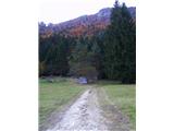 2
2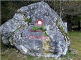 3
3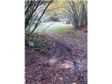 4
4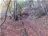 5
5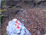 6
6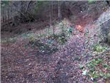 7
7 8
8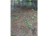 9
9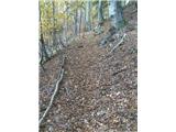 10
10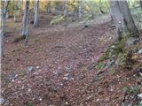 11
11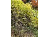 12
12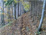 13
13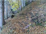 14
14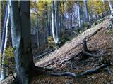 15
15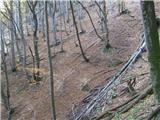 16
16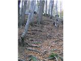 17
17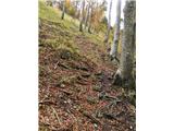 18
18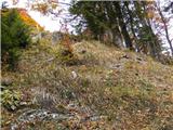 19
19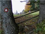 20
20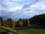 21
21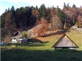 22
22
Discussion about the trail Kočna - Planina Obranica (od spomenika)
|
| Jon3. 10. 2011 |
Pot ni lahka kot piše v opisu poti. Zelo strma je (velika večina poti), in na trenutke tudi nevarno strma, posebej pri povratku nazaj.
|
|
|
|
| heinz3. 10. 2011 |
Jon, z ozirom na splošne kriterije o težavnostih evropskih planinskih poti, ki veljajo tudi pri nas, je pot, katera na nobenem svojem delu za napredovanje ne zahteva uporabe rok, (oprijemanje zajl, klinov, skalovja, oprimkov itd) velja zgoraj opisana za -lahko. Tako pač je. Drži pa, da je ponekod kar strma..
Lp,
|
|
|
|
| Jusk12. 02. 2020 |
Res je pošteno strma pot,se dobro razmigaš  danes sem šel po tej poti do Obrance in naprej na Planski vrh,pri naravnem mostu pa obrnem nazaj in po drugi poti mimo snežne jame nazaj na Obranco in dol na Kočno. Pot večinoma suha,brez posebnosti,šele naprej proti Planskem vrhu občasno malo ledena
|
|
|