Ravne - Matajurski vrh (via Črna prst)
Starting point: Ravne (735 m)
| Lat/Lon: | 46,2586°N 13,9592°E |
| |
Name of path: via Črna prst
Time of walking: 4 h 45 min
Difficulty: partly demanding marked way, easy pathless terrain
Altitude difference: 1201 m
Altitude difference po putu: 1440 m
Map: TNP 1:50.000
Recommended equipment (summer):
Recommended equipment (winter): ice axe, crampons
Views: 713
 | 2 people like this post |
Access to the starting point:
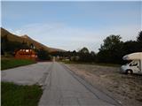
a) From the motorway Ljubljana - Jesenica take the exit Lesce and follow the road towards Bled and on to Bohinjska Bistrica. From Bohinjska Bistrica turn left towards Tolmin and Soriška mountain pasture. Soon we will see mountain signs for Črna prst along the road pointing to the right, but we continue straight ahead. Just a little later we come to a crossroads where a signpost points slightly right towards the village of Ravne. Continue past a large parking lot by the former ski slope Kobla, and we follow the asphalt road, which begins to climb steeply, to Ravne, where the road is laid. Here we continue until the asphalt ends. Where the asphalt ends is a larger parking lot next to the Janez Inn, where you park on the right side of the parking lot (the parking lot on the left side of the road is for the guests of the Janez Inn).
b) From Železniki or Petrovo Brda drive to Bohinjska Bistrica, where before the centre of the town turn left in the direction of Ravne. Follow the road, which begins to climb steeply, to Ravne, where the road is laid. Here, continue until the asphalt ends. Where the asphalt ends is a larger parking lot next to the Janez Inn, where you park on the right side of the parking lot (the parking lot on the left side of the road is for the guests of the Janez Inn).
Path description:
From the parking lot at the Janez Inn, continue in the direction of Črna prst and Orožnove huts, where you initially walk along a macadam road, which opens up a beautiful view of Triglav. After an initial climb, the road turns into the forest and turns slightly to the left, where you quickly arrive at a marked crossroads.
From the crossroads continue left in the direction of Črna prst, mountain pasture for Črna gora and Orožnove huts (straight ahead Bohinjska Bistrica and the old path towards Orožnove hut). The path continues along the right-hand side, passing a private house (formerly the Dr. Janez Mencinger's Mountain Home), and then a little further on joins cart track, which is the route to continue the ascent. A little higher, at a crossroads, continue right, and then the path continues through the forest. A little further on, the path leads past a log cabin and a cross, and then you arrive at a marked crossroads, where you continue to the right in the direction of Orožnove hut (left mountain pasture after Črna gora).
The path continues crossing the slopes slightly to the right, and in between it also descends more visibly. When the descent ends, the old path joins us from the right, slightly shorter but no longer officially marked. Walk along the forest path, crossing a few tracks, and at a marked crossroads continue on the right path. A few minutes higher, you reach a forest road, which you just cross (Orožnova koča on the right, after a dirt track).
There is a relatively steep climb through the forest, and a slightly longer path joins us from the right.
Continue left and in a few minutes you will reach the Orožnova hut at mountain pasture behind Lisec.
From the hut, continue left into the forest moderately uphill. The path continues slowly out of the forest onto the slopes below the Black soil. The steepness of the path starts to increase, as does the steepness of the slope on which we are walking. Already quite steep, the path leads us to the foot of the Črna prst walls. Continue up along the wall, then turn left and cross the ravine. Continue on a moderate ascent, crossing the slopes to the east. Just a few metres before the saddle, the mountain pasture route for Montenegro joins. At the saddle, turn right and within ten minutes' scenic walk you will reach the house on Črni prsti. There are a few steps to climb to the top. From Črna prst continue west towards Rodica, which is about a three-hour walk. The way forward initially leads us along a wide grassy ridge, which quickly narrows, and the path begins to descend more steeply. After a few minutes of descent, the path from mountain pasture Osredki joins us from the right, and we continue along the left (coastal) side of the ridge in the direction of Vogel.
After the crossroads, the path becomes more difficult as it crosses quite steep grassy slopes with the help of steel cables, but mostly without them, which are dangerous to slip on, especially in wet conditions. The path then bends slightly and leads to the saddle of Vrata (1721 m). After this, the ridge retreats to the left again and climbs crosswise over the next steep slope. A commemorative plaque warns that the route is not entirely easy. The steepness of the slopes then gradually eases and the path again approaches the main ridge (here you can climb to Četrt in 15 minutes - easy off-trail).
Continue westwards along the scenic, mostly grassy ridge, which climbs gently towards Konjski vrh, which the trail passes on the left. After this, the trail descends slightly and leads to an inconspicuous saddle between Konjski and Poljanski vrh. The latter, which again begins to climb gently, is also bypassed on the left and leads us to the foot of Matajurski vrh, which we will observe on the left-hand side. At the point where the path approaches Matajurski vrh, we will see a less well-trodden path on the left, which climbs gently southwards at first. The path, which is getting worse, turns slightly to the right and after a short steep climb leads to a side ridge. Once on the ridge, continue slightly left along a faintly visible path, along which you can see some old faded markings. Follow this increasingly scenic "path" to the summit, which is reached after a further 10 steps.
As most of the path is on a ridge, the possibility of lightning means that you should only set off on the path in good weather.
Ravne - Orožnova koča 1:45, Orožnova koča - Čez Suho 1:05, Čez Suho - Črna prst 15 minutes, Črna prst - Matajurski vrh 1:40.

Pictures:
 1
1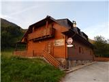 2
2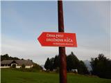 3
3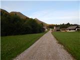 4
4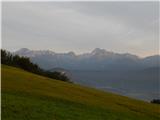 5
5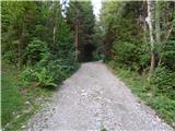 6
6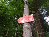 7
7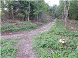 8
8 9
9 10
10 11
11 12
12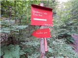 13
13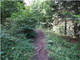 14
14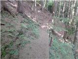 15
15 16
16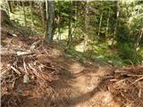 17
17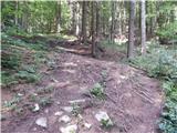 18
18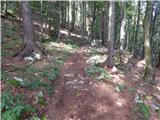 19
19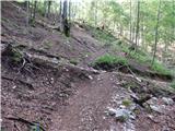 20
20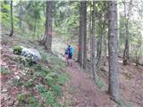 21
21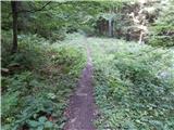 22
22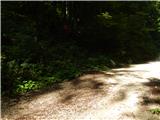 23
23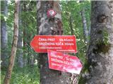 24
24 25
25 26
26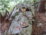 27
27 28
28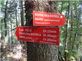 29
29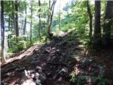 30
30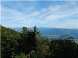 31
31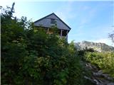 32
32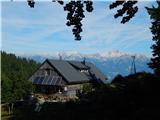 33
33 34
34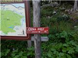 35
35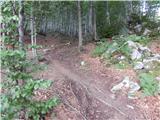 36
36 37
37 38
38 39
39 40
40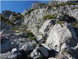 41
41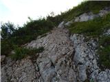 42
42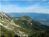 43
43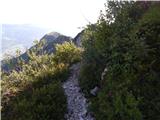 44
44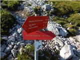 45
45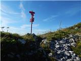 46
46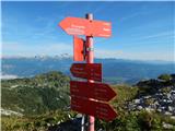 47
47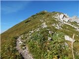 48
48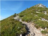 49
49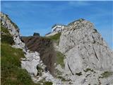 50
50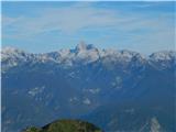 51
51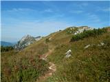 52
52 53
53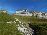 54
54 55
55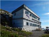 56
56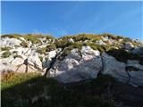 57
57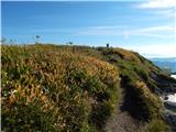 58
58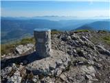 59
59 60
60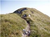 61
61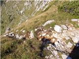 62
62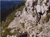 63
63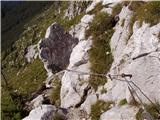 64
64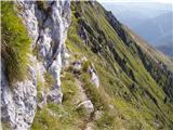 65
65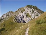 66
66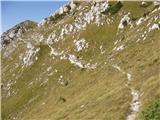 67
67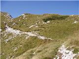 68
68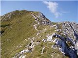 69
69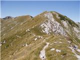 70
70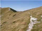 71
71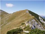 72
72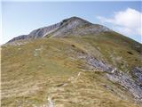 73
73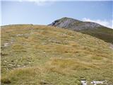 74
74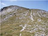 75
75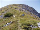 76
76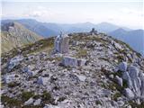 77
77
Discussion about the trail Ravne - Matajurski vrh (via Črna prst)