Koča pri Savici - Mali Šmohor
Starting point: Koča pri Savici (653 m)
| Lat/Lon: | 46,2896°N 13,8022°E |
| |
Time of walking: 6 h 40 min
Difficulty: easy marked way
Altitude difference: 1286 m
Altitude difference po putu: 1700 m
Map: TNP 1:50.000
Recommended equipment (summer): helmet
Recommended equipment (winter): helmet, ice axe, crampons
Views: 1.868
 | 3 people like this post |
Access to the starting point:
From the motorway Ljubljana - Jesenica, take the Lesce exit and follow the road towards Bled and on to Bohinjska Bistrica. Continue driving towards Bohinjsko jezero (Ribčev laz), at which you will come to a crossroads, where you will continue straight along the left (south) side of the lake in the direction of Ukanec and the Savica waterfall. Follow this increasingly narrow road to the large parking lot at the Savica cottage. There is a charge for parking.
Path description:
From the parking lot, follow the wide footpath towards the Savica waterfall and the Doma na Komni. After a short ascent, the path leads to a marked crossroads where the tourist path to the right branches off towards the Savica waterfall, and we continue slightly left or straight along the wide footpath towards Komna. The path continues to climb for a short time along Savica, and then leads us to the first of the 48 marked serpentines. After an hour and a half of moderate ascent through the forest, the path leads us to the 48 serpentine, from which we have a beautiful view of Lake Bohinj. Here the path turns slightly to the right and passes into the valley called Pekel, where it climbs gently for a while, then turns to the right and climbs slightly steeper again. After only a few 10 paces, the path turns left again and continues to climb parallel to the valley. The path, which is steep to moderately steep, gradually turns into a more sparse forest, from which you can soon see the Dom na Komni. The way forward leads us past a small man-made cave, and higher up, past a natural abyss, which is fenced off to prevent any of the hikers from falling into it. Next, the path climbs a little more and after a few steps of further walking leads us to a crossroads where the path to the right branches off to the Black Lake.
Continue straight ahead on the wide path (mulatjeri), which takes you just a little higher to the next crossroads. Continue left again (right Koča pri Triglavskih jezerih) along the path, which climbs a little steeper and after a few minutes of further walking leads us to Doma na Komni.
From the house, continue right (left Vogel, Tolminski Kuk and mountain pasture Govnjač) along the marked path in the direction of the hut below Bogatin. Next, a pleasant and perfectly laid path leads us in 15 minutes of further walking to Mountain pasture on the Kraju, in the middle of which stands the Hut pod Bogatinom.
On the other side of Mountain pasture, a path branches off to the right towards Mountain pasture Za Skalo, and we continue straight ahead along a wide mulatier in the direction of Bogatinsko sedlo and Krn. The path then ascends crosswise over the relatively steep slopes of Srednji vrh, skirting the valley of Gracija on the right. The path then climbs considerably further to the left, where it approaches the steep slopes of Bogatino. There is only a turn to the right and the path leads to Bogatinsko sedlo, from which a fine view of Krn opens up. At the saddle, continue straight ahead in the direction of Krn and Krnsko jezero (Bogatin and Mahavšček on the left, Lanževica on the right) on a path that gradually begins to descend. After a few minutes of descending, the path, which follows an old military causeway, leads to slopes partly covered with dwarf pines. A little further down, two paths branch off to the left, leading to Krn (Krn past Vrh nad Peski and over Batognica), and in both cases we continue straight ahead on the still descending path. Further on, the path is laid out and leads to a crossroads where a marked path branches off to the left to Mali Šmohor (straight ahead to Krnsko jezero and Dom pri Krnskih jezerih).
Continue in the direction of Mali Šmohor, initially walking through a small meadow, after which the path leads to dwarf pines. After a short climb through dwarf pines, the path leads to an old partly overgrown military mulatier, which is then followed up over less and less overgrown slopes. A pleasant and little-visited path, along which we can observe many remains of the Soča Front, leads us in a moderate ascent under the steep walls of Mali Šmohorje. Here, it is advisable to wear a helmet due to the risk of falling rocks. Continue cross-climbing over a scree slope, at the end of which the path turns left onto grassy slopes. The path then again reveals many remnants of the war (caverns, shovels and other iron, which is neatly stacked along the path). The path then climbs to the top of a ridge, where it turns right and, after a short climb, leads us to a viewpoint on the summit.

We can extend the trip to the following destinations: Veliki Šmohor
Pictures:
 1
1 2
2 3
3 4
4 5
5 6
6 7
7 8
8 9
9 10
10 11
11 12
12 13
13 14
14 15
15 16
16 17
17 18
18 19
19 20
20 21
21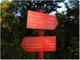 22
22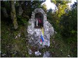 23
23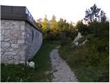 24
24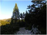 25
25 26
26 27
27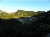 28
28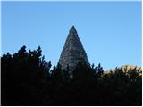 29
29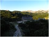 30
30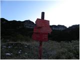 31
31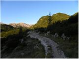 32
32 33
33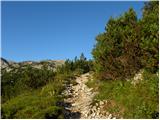 34
34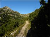 35
35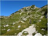 36
36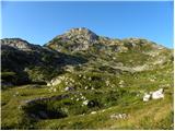 37
37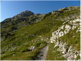 38
38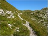 39
39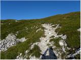 40
40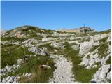 41
41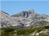 42
42 43
43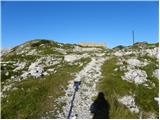 44
44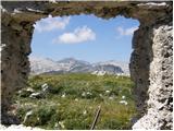 45
45 46
46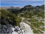 47
47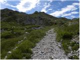 48
48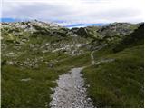 49
49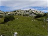 50
50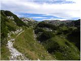 51
51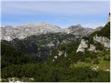 52
52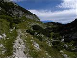 53
53 54
54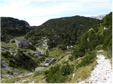 55
55 56
56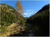 57
57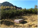 58
58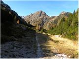 59
59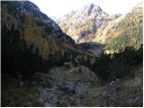 60
60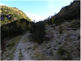 61
61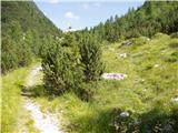 62
62 63
63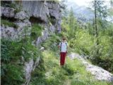 64
64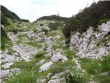 65
65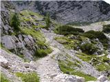 66
66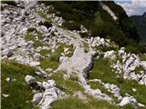 67
67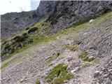 68
68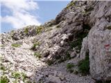 69
69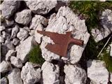 70
70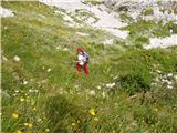 71
71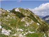 72
72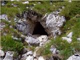 73
73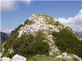 74
74 75
75
Discussion about the trail Koča pri Savici - Mali Šmohor