Reklanska dolina - Sart / Žrd
Starting point: Reklanska dolina (700 m)
| Lat/Lon: | 46,3937°N 13,4405°E |
| |
Time of walking: 5 h 15 min
Difficulty: difficult marked way
Altitude difference: 1624 m
Altitude difference po putu: 1750 m
Map: Julijske Alpe - zahodni del 1:50.000
Recommended equipment (summer): helmet
Recommended equipment (winter): helmet, ice axe, crampons
Views: 8.029
 | 1 person likes this post |
Access to the starting point:
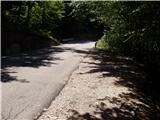
From Kranjska Gora, drive through the Rateče border crossing to Trbiž / Tarvisio. In Trbiz, turn left towards Bovec and follow the road to the crossroads near Lake Rabelj. Here, turn right towards the Nevea Pass / Sella Nevea. From the pass, follow the road through numerous tunnels and galleries to the Reclano side. About 1km after the last tunnel or gallery, park in one of the roadside car parks.
From Bovec, drive to the Predel border crossing, from which you descend to the Italian side. Just after Lake Rabelj, you will reach a crossroads where you turn left towards the Neveje Pass / Sella Nevea. Continue as described above.
Path description:
From the roadside parking lot, descend a few dozen metres to where you will see the mountain signs for mountain pasture Gorjuda (Casera Goriuda) on the left-hand side of the road. The path immediately leads into the forest, where it climbs steeply at first and then steeply. After a good 20 minutes of walking, the path leads to the first more difficult part, where a wide and protected artificial ledge is crossed with the help of a rope. A similar crossing is then repeated twice more, all accompanied by gushing water chutes, so that we are quite wet. The path then climbs steeper up the steep and slip-prone slope. All the key places, especially the ravine crossings, are well protected. The only problem arises if the route is taken after a heavi rain or thaw, when the ravines are full of water and crossing is impossible. The steepness then eases a little and the rather overgrown path then takes us through the forest to the rocky cliffs, where the path turns sharp left. With the help of a rope we cross another short slightly exposed spot, and then the problems disappear. Next, the path leads us quickly out of the forest and we see in front of us an old shepherd's hut (converted into a bivouac) at mountain pasture Gorjuda, where the crossroads of the path is. Continue along the right-hand side of the hut in the direction of the Marrusich bivouac along a rather overgrown path which, after a short climb, leads us back into the forest. The rather overgrown path crosses a torrential stream with the help of a small bridge and leads us into a rare, mostly larch forest. Here the path comes quite close to the mighty scraped slabs, then retreats slightly to the right and continues to climb parallel to them. When the path briefly lays down, the entrance to the ice cave can be seen on the right-hand side. Here you can cool down a little, but the ice can make the climb into the cave potentially dangerous. Next, an increasingly scenic route through a series of valleys leads us to the high mountain world of the Kanin mountain range. After a few more minutes of walking on the plateau, we reach a less well-marked crossroads, where we continue to the left (Tamaroz on the right). The way ahead climbs through a karst world full of scrapes and potholes, so we carefully follow the path which, after a good 20 minutes of climbing from the crossroads, leads us to the path Rifugio Giberti - Sart. Here, continue to the right and follow the relatively winding path to the Marrusich bivouac, which is reached after a few minutes. A few steps from the bivouac, you reach the Peravo Pass, where the next crossroads are located.
Continue straight ahead towards M. Sart on the path that starts to climb westwards. Soon the path bends to the right, north side of Grubij Peak. The rather sloping path then leads us to a beautiful alpine meadow (Škrbina v Senožeče), where we leave the mulatier. Continue climbing to the right and follow the poorly visible path up to the ridge, where you will continue climbing. The way forward is steeply climbing along a slightly exposed ridge. After half an hour of climbing, when we think we are at the top, we reach the Sarti (in the fog many people think it is the top), which offers a beautiful view of our destination. There is a slight descent along a barely visible path, which continues along a partially exposed ridge. The ridge then slowly widens from the left and after a few more minutes of ascent the path leads us to a scenic peak.
Starting point - mountain pasture Gorjuda 2:00, mountain pasture Gorjuda - bivouac Marrusich 2:00, bivouac Marrusich - Sart 1:15.

Pictures:
 1
1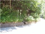 2
2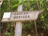 3
3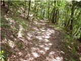 4
4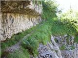 5
5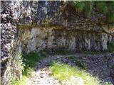 6
6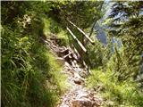 7
7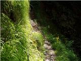 8
8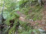 9
9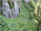 10
10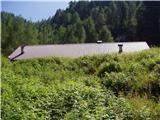 11
11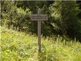 12
12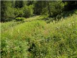 13
13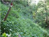 14
14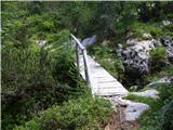 15
15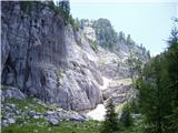 16
16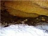 17
17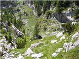 18
18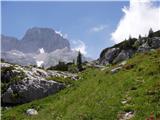 19
19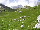 20
20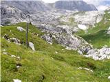 21
21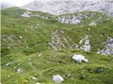 22
22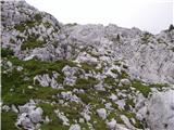 23
23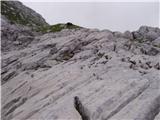 24
24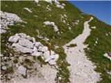 25
25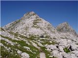 26
26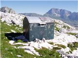 27
27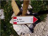 28
28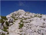 29
29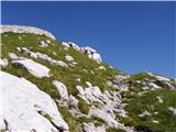 30
30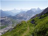 31
31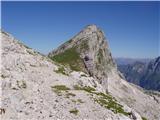 32
32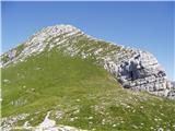 33
33 34
34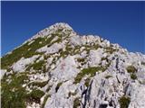 35
35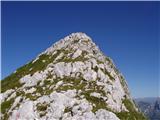 36
36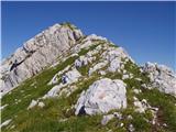 37
37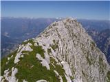 38
38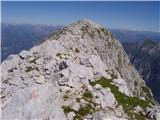 39
39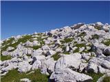 40
40 41
41
Discussion about the trail Reklanska dolina - Sart / Žrd
|
| mirank9. 11. 2017 |
Turo na Žrd sva pred par leti zaključevala s spustom po tej poti do planine Zg gorjuda in potem v območju planine zavila desno in po stezi prečila na sedlo, kjer sva imela avto pri žičnici. Ta pot mi je ostala v spominu po zoprnih drsnih skalah preden prideš na omenjeno planino (podobno Kotu nad Lengarjevim routom) in sicer zanimivi stezici na N sedlo, ki pa se vleeečeee...
|
|
|
|
| darinka423. 08. 2023 22:45:50 |
Nedolgo nazaj sva z Marijanom obrnila pri bivaku Marušič ker se je ob 12najsti uri pooblačilo čeprav je bila napoved šele pozno popoldne. Takrat sva šla po spodnji poti s Selle Neveje .Sestopila v dežju mimo koče Gilberti na izhodišče. Danes pa smo se vsi trije odločili, da gremo na Žrd iz Solbice. Po avtocesti do Tolmzza in potem po tisti ozki cesti na izhodišče. Lepa je ta pot . Do bivaka Igor Crasso. Ki je zgledno urejen. Potem pa po označeni poti do vrha. Tiste nevihte s pop tv , ki so jih včeraj napovedali so nekam poniknile. Krasno vreme smo imeli. Res pa je da je ta pot dolga in kondicijsko zahtevna. Še bolj andrenalinska je bila vožnja po ozki cesti za nazaj do Učje. Te pa res ne priporočam. Nekako smo jo preživeli.
|
|
|