Turkov rovt (Vrata) - Triglav (via Za Cmirom)
Starting point: Turkov rovt (Vrata) (941 m)
| Lat/Lon: | 46,4179°N 13,858°E |
| |
Name of path: via Za Cmirom
Time of walking: 6 h 20 min
Difficulty: easy pathless terrain, very difficult marked way
Altitude difference: 1923 m
Altitude difference po putu: 2000 m
Map: Triglav 1:25.000
Recommended equipment (summer): helmet, self belay set
Recommended equipment (winter): helmet, self belay set, ice axe, crampons
Views: 58.879
 | 2 people like this post |
Access to the starting point:
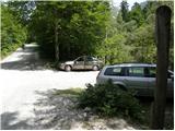
Leave the Gorenjska motorway at the Hrušica exit and follow the road towards Kranjska Gora. Just before the village of Dovje, the road branches off to the left and leads to Mojstrana (Vrata, Kot and Krma). Follow the road in the direction of the Vrata valley and follow it to the road marker for approximately 10. 5 km. Here you will see a small parking lot on the left side of the road and a road crossing the river. Park so as not to block the river crossing (Triglavska Bistrica).
Path description:
From the parking lot, first cross the Bistrica River, then take the footpath on the other side (do not continue on the worse road and do not continue on the Bistrica Trail Triglav), which climbs moderately through the forest. Slightly higher up, the unmarked path leading from Aljaž's house joins from the right. Continue to the left and follow the well-traced trail until it leads out of the forest onto extensive gravel. Here, the path from the lower starting point almost imperceptibly joins us from the left, and we continue slightly to the right, where we continue our ascent along a clearly visible track. The path turns right a little further on and climbs on scree to the foot of the cliffs. At the foot of the cliffs the path turns left and then climbs across the rubble. Higher up, you reach lane of dwarf pines, where a slightly less visible path turns towards the left side of the valley (loking in the direction of ascent). Next, we climb over a steeper scree slope, and then the path flattens out and leads us to the upper part of the valley behind Cmirom. Here the track starts to disappear again, and we return to the right side of the valley, where we quickly see a less well-trodden, but nicely traceable path, which continues to climb crosswise towards the saddle, which we see on the right or north side of Begunjski vrh. 15 minutes below the saddle, the track disappears completely, and we continue our ascent along a slightly steeper ravine, which we then climb to the aforementioned saddle.
At the saddle, we join the marked path Staničev dom - Cmir, and follow it to the left, where after a short traverse we reach Begunjska vratca. From the gate we continue in the direction of Staničev dom, which we reach after 10 minutes of further walking.
From Stanič's home, continue in the direction of Kredarica along the path which climbs gently under the Rž scree and then cross-climbs over the scree to an undistinguished notch in the side ridge of the Rž. The trail then descends slightly using the fixed safety gear and then ascends again. After less than an hour from Stanič's home, the path leads to the top of Kredarica. From the top, it takes a few minutes to descend to the Triglav Home on Kredarica.
From the Triglav Home, continue in the direction of Triglav along the path which begins to descend moderately towards the pass between Kredarica and Mali Triglav. Here, the path from the Vrata valley joins us from the right, and we continue straight along the increasingly steep path, which begins to climb over the broken rocks. After a few minutes of steep climbing along the Green Snow, we reach the start of the climbing section. At a large marking visible from a distance, you will see a sign warning you that you will continue your ascent on a very difficult protected mountain path. The path continues steeply up the broken rocks and then crosses to the left with the help of a rope to reach a technically very difficult place. The way forward climbs crosswise on an exposed ledge, which is protected only by wedges. Next, a very steep and well protected path leads us to the ridge of Mali Triglav, where we are joined on the left by a slightly easier path from Planika. Continue straight along the ridge path, which leads us in a few 10 steps of further walking to the top of the Mali Triglav. From Mali Triglav, from where we have a nice view of the summit and most of the trail ahead, the trail descends slightly, then leads us to an unmarked saddle between the two peaks. The path ahead starts to climb again, along a well-protected ridge path. This very scenic and, in some parts, very steep path is then followed all the way to the top of Triglav.

Pictures:
 1
1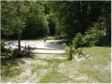 2
2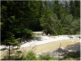 3
3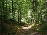 4
4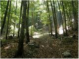 5
5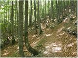 6
6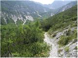 7
7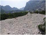 8
8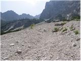 9
9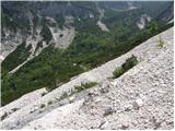 10
10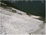 11
11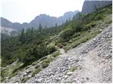 12
12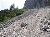 13
13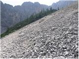 14
14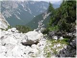 15
15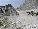 16
16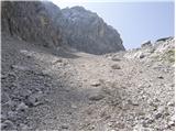 17
17 18
18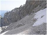 19
19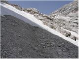 20
20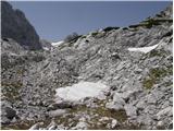 21
21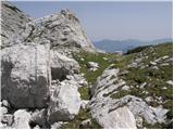 22
22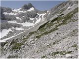 23
23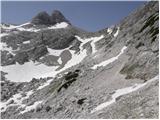 24
24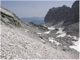 25
25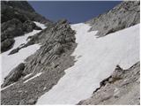 26
26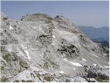 27
27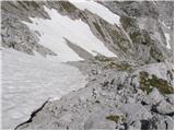 28
28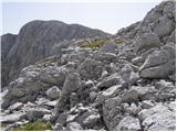 29
29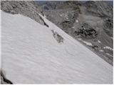 30
30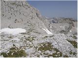 31
31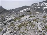 32
32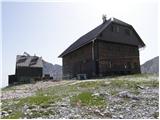 33
33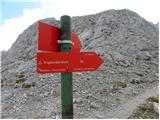 34
34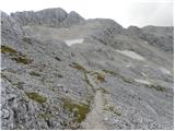 35
35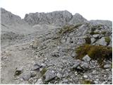 36
36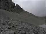 37
37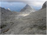 38
38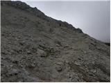 39
39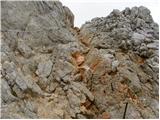 40
40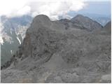 41
41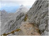 42
42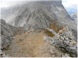 43
43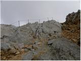 44
44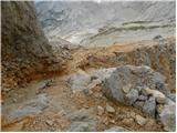 45
45 46
46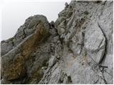 47
47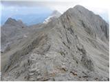 48
48 49
49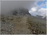 50
50 51
51 52
52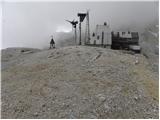 53
53 54
54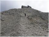 55
55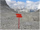 56
56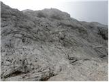 57
57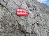 58
58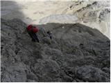 59
59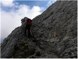 60
60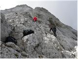 61
61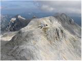 62
62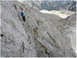 63
63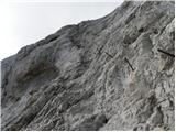 64
64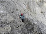 65
65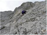 66
66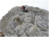 67
67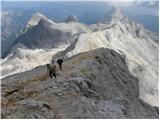 68
68 69
69 70
70 71
71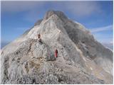 72
72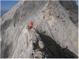 73
73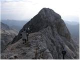 74
74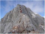 75
75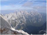 76
76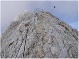 77
77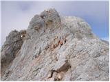 78
78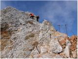 79
79 80
80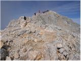 81
81 82
82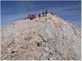 83
83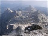 84
84 85
85
Discussion about the trail Turkov rovt (Vrata) - Triglav (via Za Cmirom)
|
| Virenque29. 06. 2010 |
Lahko brezpotje do vrha Triglava? No, to je pa nekaj novega.
|
|
|
|
| Gorazd G29. 06. 2010 |
Meni pa se to ne zdi nič novega. Za besedama "lahko brezpotje" je vejica in potem še nekaj piše ... 
|
|
|
|
| Suriljana4. 09. 2013 |
Omenjeno ''brezpotje'' je najlažja in tehnično najmanj zahtevna varianta za povratek iz Staniča do Vrat. V narekovajih govorim, ker je (vsaj letos) steza zelo dobro vidna, označena z možici - v glavnem ne moreš falit. Iz Staniča greš v smeri Cmira in takoj, ko pot zavije za Begunjskim vrhom, se od markirane poti odcepi steza direktno dol po melišču - nato se držiš levo v dolini pod Cmirom. Gre za večinoma pot po melišču, tako da si v Vratih zelo hitro, če se malo ''podričaš''. V Vrata prideš pa na cesto pri oznaki 10.5 km, tako da je potem še 1 km hoje do avta. Jo pa priporočam izključno za sestop, saj po melišču navzgor velja pravilo 3 korake gor, 2 dol.
|
|
|
|
| Janez Seliškar4. 09. 2013 |
Pri sestopu skozi gozd gremo mimo odcepa levo, lovska pot, ki nas pripelje do struge Triglavske Bistrice. Prečkamo jo, potem nas levo lepa gozdna pot pripelje na Anceljnov rovt. Z njega imamo še nekaj deset metrov do parkirišča pred Aljaževim domo. Tako se izognemo hoji po cesti od Turkovega rovta do parkirišča pred Aljaževim domom.
|
|
|
|
| lepenatka25. 10. 2013 |
Živjo, ima kdo kake informacije za pot po dolini Za Cmirom? Vsaka info dobrodošla.
|
|
|
|
| matic46. 08. 2018 |
Pot po dolini za Cmirom je dobro vidna, možicev je dosti. V začetnem/zgornjem delu (gledano navzdol) je treba čim bolj levo (desno so skoki).
|
|
|