Žlebe - Jeterbenk (via Turnice)
Starting point: Žlebe (410 m)
| Lat/Lon: | 46,1121°N 14,3954°E |
| |
Name of path: via Turnice
Time of walking: 1 h
Difficulty: easy marked way
Altitude difference: 364 m
Altitude difference po putu: 375 m
Map: Škofjeloško in Cerkljansko hribovje 1:50.000
Recommended equipment (summer):
Recommended equipment (winter): crampons
Views: 5.909
 | 1 person likes this post |
Access to the starting point:
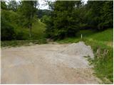
a) First, drive into Ljubljana, then continue along the Celovška road towards Medvode. When you arrive in Medvode, turn left at the first traffic light over the railway line towards Gole Brdo, Žleb and Preska. After the railway line, turn left (right towards Preska) in the direction of Medno, Golo Brdo and Žleb, and then a little further right (right towards Medno). Only about 500 m further on, you will reach the next crossroads, where at the beginning of Seničica, turn right (right towards Golo Brdo) in the direction of Žlebe. When the residential houses of Seničica are finished, we arrive in the forest, where we continue left at the crossroads towards Žlebe (also slightly to the right there are signs for Žlebe - it is a circular road). Continue along the slightly ascending road, which we follow until we reach a small pass. At the pass, turn left onto the dirt road, which quickly leads to the next crossroads, where you continue along the lower left road. From the crossroads, where there are also mountain direction signs, drive for about 100 m, or until you reach a left turn, at which there is a marked parking area.
b) From Škofja Loka, Kranj or Vodice, drive to Medvode and from there continue towards Ljubljana. At the last traffic light in Medvode, which is located about 100 m further from the Hofer store, turn right across the railway line in the direction of Golego Brdo, Žleb and Preska. After the railway line, turn left (right Preska) in the direction of Medno, Golo Brdo and Žleb, and then a little further right (straight Medno). Only about 500 m further on, you will reach the next crossroads, where at the beginning of Seničica, turn right (straight Golo Brdo) in the direction of Žlebe. When the residential houses of Seničica are finished, we arrive in the forest, where we continue left at the crossroads towards Žlebe (also slightly to the right there are signs for Žlebe - it is a circular road). Continue along the slightly ascending road, which we follow until we reach a small pass. At the pass, continue left on the dirt road, which quickly leads to the next crossroads, where you continue on the lower left road. From the crossroads, where there are also mountain direction signs, drive for about 100 m, or until you reach a left turn, at which there is a marked parking area.
Path description:
From the parking lot continue along cart track in the direction of Katarina, Jeterbenk and St. Marjeta (Petelinc on the left), which continues along the left side of the brook. After a few 10 steps leave the cart track and continue right into the woods, first descending to and crossing the stream. On the other side, continue climbing gently for a short distance, then the path turns right and climbs steeply. A little higher up, you reach a marked crossroads where you have two options for continuing.
You can either continue left in the direction Jeterbenk or right along a good minute longer path past the Church of St Margaret.
If you continue on the left path, you will soon reach the next crossroads, where another path branches off to the right towards the church. Here again, continue left, then slightly further on at an unmarked crossroads slightly right up (the lower left path leads to Jeterbenk "along the ridge" (of course, the path only goes to the ridge a little higher up)), where after a short climb you join the cart track leading from the church of St Marjeta.
Continue along the relatively wide cart track, which leads past the information board of the archaeological site at Gradišče. A few minutes further on, the path of the Knights of the Robber Knights branches off to the right, and we continue straight on the slightly steeper cart track. Just before the steepness subsides, we rejoin the path of the Knights of the Predatory Knights, and the waymarked path turns slightly more to the left and leads us over the ridge of Turnice to the western slopes of Jeterbenk. The way forward leads us across the meadow, from which we transiently open up some views, and then returns to the forest and leads us to the crossroads at the chapel.
From this crossroads, which is located at the edge of the forest, turn sharp left onto the macadam road, which will quickly take you to the cottage.
After the weekend, continue along the steep mountain path which climbs through the forest and which is joined, just a few steps below the summit, by the path from Slavkov's home at Golem Brdo and the path from Žleb 'po ridgen'.
From this crossroads, continue to the left and in a few steps you will reach the Jeterbenk peak, from which a beautiful view opens up.

Pictures:
 1
1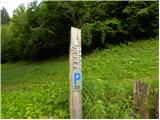 2
2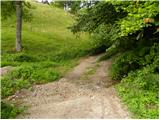 3
3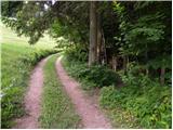 4
4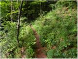 5
5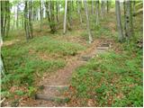 6
6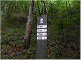 7
7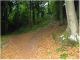 8
8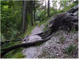 9
9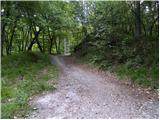 10
10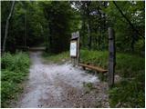 11
11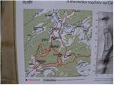 12
12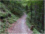 13
13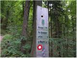 14
14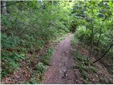 15
15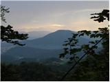 16
16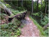 17
17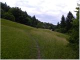 18
18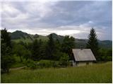 19
19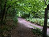 20
20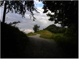 21
21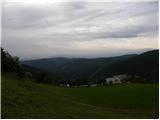 22
22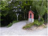 23
23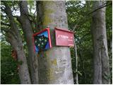 24
24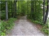 25
25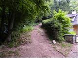 26
26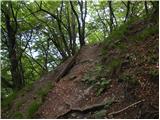 27
27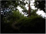 28
28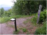 29
29 30
30
Discussion about the trail Žlebe - Jeterbenk (via Turnice)
|
| balon1. 09. 2013 |
Ali je v skrinjici na vrhu razen vpisne knjige tudi žig?
|
|
|
|
| balon22. 03. 2014 |
Zanima me ali je pot po zledu pfehodna ali ne. Lep pozdrav, Baloncki 
|
|
|
|
| grega_p15. 01. 2021 |
Hvala za lep opis, a v teh zimskih razmerah je v bistvu samo ena pot (tista, ki je zgažena) in tako ni bilo videti vseh omenjenih spodnjih razpotij.
Zgoraj pred glavnim kucljem vrha, je pot precej poledenela (nizke temperature in sonce). Tako da je bilo zadnjih 5 minut kar izziv.
Z Jeterbenka oz. prevala nižje se je danes videlo skoraj vse, kar nama ta lepa dežela ponuja...
|
|
|