Žiri - Sivka (via Vrsnik)
Starting point: Žiri (487 m)
| Lat/Lon: | 46,0416°N 14,1041°E |
| |
Name of path: via Vrsnik
Time of walking: 2 h 30 min
Difficulty: easy marked way
Altitude difference: 521 m
Altitude difference po putu: 635 m
Map: Škofjeloško in Cerkljansko hribovje 1:50.000
Recommended equipment (summer):
Recommended equipment (winter):
Views: 2.558
 | 2 people like this post |
Access to the starting point:
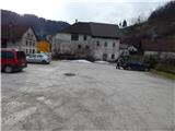
a) From Železniki, Kranj or Medvode, drive to Škofja Loka, and from there continue in the direction of Gorenje vasi in the Poljanska valley and Žire. From Žiri, continue towards Logatec, then before the end of the town you will reach the Lenger Inn and a few 10 m further on to a crossroads where the main road towards Logatec turns left and the road continues straight on towards Idrija. Park in a suitable place at the crossroads. There is a large parking lot next to the Lenger Restaurant, but it is a courtesy to ask the staff if you are allowed to park in this parking lot beforehand.
b) From Horjul or Polhov Gradec, drive to Šentjošt nad Horjul, and from there continue to Smreč. When you reach the main road Podlipa - Žiri, follow it to the right, and we drive along it to Žiri. When in Žire, reach the main road Škofja Loka - Logatec, follow it to the left, and we follow it past the parish church and the Lenger Inn and Pizzeria, to the junction where the main road to Logatec turns left, and in a straight direction the road continues towards Idrija. Park in a suitable place at the junction. There is a large parking lot next to the Lenger Inn, but it is a courtesy to ask employees in advance if we are allowed to park in this parking lot.
c) From the motorway Ljubljana - Koper take the exit Vrhnika, then when you reach the old road Ljubljana - Logatec, continue in the direction of Logatec, but only for a short time, as at the next junction you will turn right in the direction of Horjul. The road continues for a short distance through Vrhnika, then through the outskirts of Stara Vrhnika, and then soon we leave the road towards Horjul and continue slightly left in the direction of Smrečje. After Smrečje the road starts to descend towards Račeva and Žire. Once in Žire, we reach the main road Škofja Loka - Logatec, follow it to the left, and we follow it past the parish church and the Lenger Inn and Pizzeria, to the crossroads where the main road to Logatec turns left, and the road to Idrija continues in a straight direction. Park in a suitable place at the junction. There is a large parking lot next to the Lenger Inn, but it is a courtesy to ask employees in advance if we are allowed to park in this parking lot.
d) From the motorway Koper - Ljubljana take the exit Logatec, and when you reach the old road Logatec - Vrhnika follow it to the right (first exit from the roundabout), and follow it for only a short distance, as the signs for Rovte and Žiri then direct you to the left. After Rovte, the road starts to descend towards Žire, and when you reach the above-mentioned place, the road to Idrija branches off to the left. Park in a suitable place at the junction. There is a large parking lot next to the Lenger Restaurant (the restaurant is located some 10 m further on from the crossroads towards the centre of Žiri), but it is polite to ask the staff if you are allowed to park in this parking lot beforehand.
e) From the road Idrija - Spodnja Idrija, just after the end of Idrija, turn right (if coming from Spodnja Idrija, turn left before Idrija) over the bridge over the Idrijca river towards the Eurospin shop. On the other side of the bridge you will reach the village of Mokraška vas, and we stick to the main road leading to Ledinsko Razpotje and Žire. Higher up, the road leads us through some serpentines, and then we arrive at the Ledine crossroads, where the road gradually becomes a dirt track. After the neighbouring settlement Govejk, the road starts to descend towards Žire, and after a few kilometres of descent we arrive in Žiri and a little further on to a crossroads where we reach the main road Žiri - Logatec. Park at a suitable place at the crossroads. There is a large parking lot next to the Lenger Restaurant (the restaurant is located some 10 m further from the crossroads in the direction of the centre of Žiri), but it is a courtesy to ask the employees beforehand if you are allowed to park in this parking lot.
Path description:
If you have parked at the Lenger Inn, first walk to the crossroads where the road to Idrija branches off the main road. From this junction, turn left towards Logatec and continue along the main road, where the path leads you first past a sign (a cross) and then across the Osojnica stream. Walk along the main road for a few minutes, then at the house with the address Logaška cesta 46 you will see signs for Vrsnik pri Vidicu, which direct you to the right onto a slightly narrower asphalt road, which begins to climb, initially between a few houses. Behind an old bunker nearby, the agglomeration ends and the road gradually turns left, crossing the slopes further to the left. The tarmac ends quickly and the road then leads under an old quarry, and a few minutes higher up the road you reach the Plesk farm.
After the farm, continue on the grassy cart track, which is marked, and walk along it for only about 30 m, then at a slight right turn, continue left on the initially even worse cart track, which quickly turns into a footpath. Continue along a fairly steep path, which soon crosses another cart track, and in summer, even a rather overgrown path, with a view of the surrounding hills, leads us to the next crossing cart track, after which we reach a dirt road through a lane of woods. The road ascends gently and turns slightly to the left at a small level. From here, walk along the road for only a short distance, as signs then lead you to the right, on a path which quickly widens into the old wooded cart track. Beyond the well-preserved boundary stone of the old Rapallo border from 1920, we also leave cart track and continue a little further to the right, on a well-marked footpath that continues along an undistinguished ridge. Higher up, we reach a peak with an old wall and a newly built building inside (the name Vidic's home appears on maps). As we pass the wall and the house on the left, we emerge onto a road and see a signing box on the trunk of a nearby tree. Once on the road, continue in the route Ledine. After passing through the lane of a forest, you will see an old Italian building from the time of the Rapallo border on your right, and the surrounding hills ahead, and soon the Church of St. Thomas, which is located on the lookout between Lower and Upper Vrsnik. When the road turns right at a slightly lower level, you can go straight ahead and reach the Church of St Thomas in a few minutes along a trackless path or hayfield, but this approach is not desirable, especially at grass-growing times, as it would cause some damage to the farmers (a well-maintained path to the church leads from the village of Gornji Vrsnik). The road continues past a watering place for animals, and then gradually you reach the first or last houses in the village. At the first crossroads, turn right (St. Tomaž on the left for 10 minutes) and follow the asphalt road through the village. At a few small crossroads follow the marked road, and at a slightly larger crossroads, on the other side of the village, continue slightly right in the direction of the marked path towards the village Ledine. A gradual easy descent follows and a fairly scenic road leads to a place where you join the main Idrija - Žiri road.
Follow the road to the right, and we walk along it for just 10 m, or until we reach a marked crossroads at Govejk, from where we continue left in the direction of Ledine, which is still less than an hour's walk away. The path continues past a few houses and a larger wall, and then, after a short climb, completely flattens out. At the next crossroads, where you see the signs for Ledine, continue to the right, some 10 m further on, and near the "last" house, turn right at cart track. Continue along cart track, which after a few minutes turns from meadows into woods. After a few minutes out of the woods, the path widens into the passable cart track, and a slightly wider road joins a little further on. Follow the macadam road to the asphalt road in a few minutes, and quickly reach the marked crossroads, where the marked path from Ledinski Razpotje joins from the left.
Continue in the direction of Sivka, along the gently sloping road, which gradually leads to the village of Ledine, where you will see Jureč's shupa (museum collection) on the right and a registration box with a stamp and a registration book attached to the bus stop house on the left. The way forward takes us through the village, and after the signpost at the end of the Ledine settlement, we continue to the right, where we are also directed by the markings. The path then quickly climbs above the village, from where there is a beautiful view over part of the plateau, and on the left, along the path, we see a small park. oz NOB memorial.
The asphalt road continues to climb moderately over the initially quite scenic slopes, from which a beautiful view opens up, reaching all the way to the Trnovski Forest. Higher up, the road turns into a forest, where it leads us past a small sign, which we can see slightly to the right of the path. Crossing the meadow follows, and then we climb through the forest for a few more minutes. The main road leads us higher out of the forest, where we arrive in a few steps at a marked crossroads by the chapel.
From this crossroads, continue left (right Bevkov vrh, Ermanovec and also Mrzli vrh, for the latter there are no signs at the crossroads) and continue along the gently sloping macadam road, which we follow only for a short time, as the signs for Sivka then direct us slightly right on the footpath, which after a few steps passes into the forest. Once in the forest, the path climbs moderately and after about 5 minutes of further walking leads to the top of Sivka, where there is a registration box.
Description and pictures refer to the situation in 2015 (January).

Pictures:
 1
1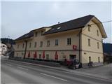 2
2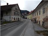 3
3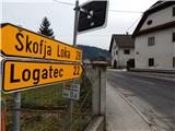 4
4 5
5 6
6 7
7 8
8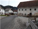 9
9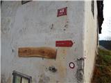 10
10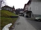 11
11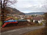 12
12 13
13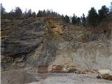 14
14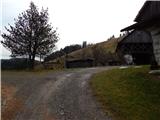 15
15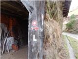 16
16 17
17 18
18 19
19 20
20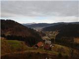 21
21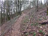 22
22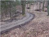 23
23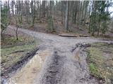 24
24 25
25 26
26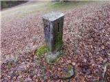 27
27 28
28 29
29 30
30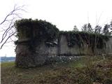 31
31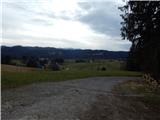 32
32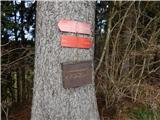 33
33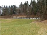 34
34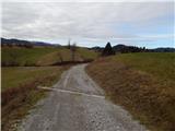 35
35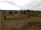 36
36 37
37 38
38 39
39 40
40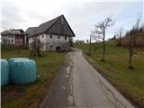 41
41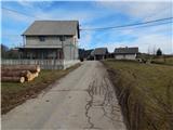 42
42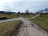 43
43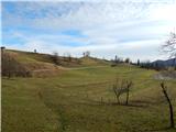 44
44 45
45 46
46 47
47 48
48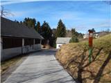 49
49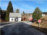 50
50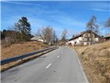 51
51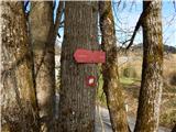 52
52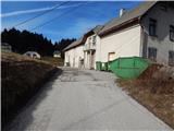 53
53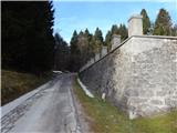 54
54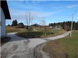 55
55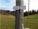 56
56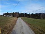 57
57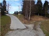 58
58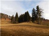 59
59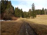 60
60 61
61 62
62 63
63 64
64 65
65 66
66 67
67 68
68 69
69 70
70 71
71 72
72 73
73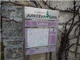 74
74 75
75 76
76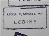 77
77 78
78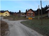 79
79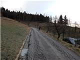 80
80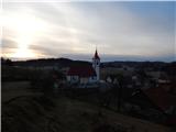 81
81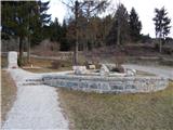 82
82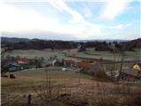 83
83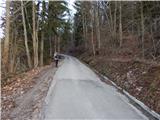 84
84 85
85 86
86 87
87 88
88 89
89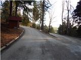 90
90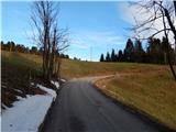 91
91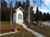 92
92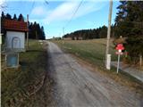 93
93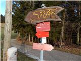 94
94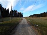 95
95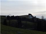 96
96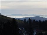 97
97 98
98 99
99 100
100 101
101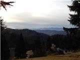 102
102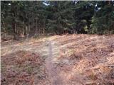 103
103 104
104
Discussion about the trail Žiri - Sivka (via Vrsnik)