Zidani Most (Sušin) - Veliko Kozje
Starting point: Zidani Most (Sušin) (201 m)
| Lat/Lon: | 46,0784°N 15,175°E |
| |
Time of walking: 2 h 30 min
Difficulty: easy unmarked way
Altitude difference: 792 m
Altitude difference po putu: 820 m
Map:
Recommended equipment (summer):
Recommended equipment (winter):
Views: 6.550
 | 1 person likes this post |
Access to the starting point:
From Zasavje or Celje, drive to Zidani Most and follow the road towards Radeče and Sevnica. Approximately 100m after the end of the municipality of Laško (signpost by the road), turn left under the railway (underpass). Continue along the road to one of the small car parks along the road.
From Trebnje or Krško, take the Sevnica and follow the road towards Zidane Most. At the end of Radeče, turn into the railway underpass (the underpass is located 100m before the confluence of the Sava and Savinja rivers). Continue as described above.
Path description:
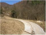
From the small parking lot, continue along the road along which you parked. At the beginning of the path we pass a chapel, a small well, houses and a man-made cave full of rubbish. The road, from which we occasionally get a view of the Sava River, climbs steeply. Higher up, the road leads us to grassy slopes where it turns right and after a few minutes leads us to a small hamlet. The road, which passes by houses, leads us just a little further to a crossroads where we continue left upwards in the direction of 'Žibert deer farming'. The way forward soon leads us to the grazing fence along which we climb up to the Žibert farm.
At the farm, where the road ends, we see a marking and it directs us to cart track, which climbs along the fence. After the farm you come to a crossroads of two cart track. Continue along the left-hand one, which continues to climb alongside a pasture fence. Cart track then turns slightly to the right and leads out of the wods onto grassy slopes which ascend to Mrzla mountain pasture.
At Mrzla planina, where we rejoin the road, we see a few houses, after which the road starts to descend. After a few minutes of descending, we come to two successive crossroads, where we continue to the left both times (here we join the marked path from Radeče). The road then climbs and soon leads us to a marked crossroads. Continue left across the meadow towards Veliki Kozje. The cart track soon leads us into the forest, where we join the marked trail from Zidanega Most. From here to the top we have a good 20-minute walk along a beautiful, moderately steep forest path.

We can extend the trip to the following destinations: Lisca
Pictures:
 1
1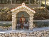 2
2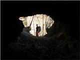 3
3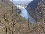 4
4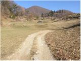 5
5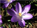 6
6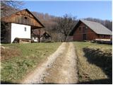 7
7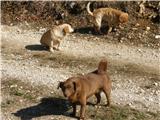 8
8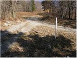 9
9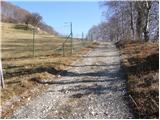 10
10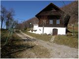 11
11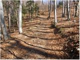 12
12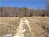 13
13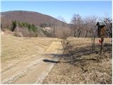 14
14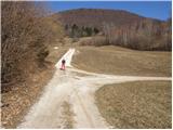 15
15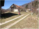 16
16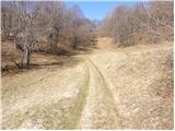 17
17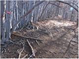 18
18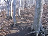 19
19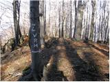 20
20 21
21
Discussion about the trail Zidani Most (Sušin) - Veliko Kozje
|
| karibu17. 08. 2018 |
Danes prehodil omenjeno pot. Smerokaza na sliki 9 ni več. Na kmetiji kjer "gojijo" jelene pa je nov lastnik iz tujine  Lep pozdrav in srečno pot!
|
|
|