Zgornja Kungota - Tojzlov vrh
Starting point: Zgornja Kungota (280 m)
| Lat/Lon: | 46,6388°N 15,6155°E |
| |
Time of walking: 2 h 30 min
Difficulty: easy unmarked way
Altitude difference: 423 m
Altitude difference po putu: 450 m
Map:
Recommended equipment (summer):
Recommended equipment (winter):
Views: 1.120
 | 4 people like this post |
Access to the starting point:
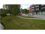
a) From Šentilj, when you arrive at Zgornja Kungota, continue along this road until you reach a junction that leads to Pesnica on the left and to Austria on the right. Before the junction you will see a parking lot on the right side of the road and park there. On the left side of the road there is a pharmacy, an ice-cream parlour, etc. . .
b) From Pesnica, when you arrive in Zgornja Kungota, turn right at the junction before the bridge in the direction of Šentil. There is a parking lot on the left and you park there. On the right side of the road there is a pharmacy, an ice-cream parlour, etc. . .
Path description:
From the parking lot, go to the junction with the main road. Turn right at the junction and cross the bridge to the next junction. At the crossroads turn left towards Jurij. Follow this path to the next crossroads. Turn left towards Gaj and follow this road over the bridge and past the houses to the next crossroads, where you go straight along the road. After a few metres the road changes from asphalt to gravel. Walk along the dirt road for about 900 metres until you reach an older house on the right hand side of the road. From this house continue on the dirt road for about 30 metres. Before the left-hand bend you will see on the left-hand side a minor road cart track going into the woods.
Turn left onto cart track and follow it to a crossroads. Here cart track starts to climb and passes through the forest, where you have to watch out for uprooted trees. At the next crossroads go straight ahead and follow cart track until you reach a forest road. When you reach the forest road, follow it in the right direction. Do not leave the road until the next major crossroads. At this crossroads, follow the better road straight ahead. This road climbs gently and turns left. You come to the next crossroads where you go straight ahead on the road. The road is getting better and better, but it is still gravel. At the next crossroads, follow the road to the left, which brings you to an asphalt road, which you follow to the right. After a few metres of walking you reach a crossroads where you go straight ahead or in the direction of Gaj nad Maribor. Walk along this road until you reach the next major crossroads. Turn left and stay on the asphalt road. Pass the tennis court on the left side of the road. From the tennis court onwards, the road is gravel. Follow the road until you reach a farm on the left with small horses. From the tennis court to the farm is about 1. 4 kilometres. From the farm, continue along the road for about 20 metres until you see a forest road on your right, which runs through the forest.
Turn right onto this road and follow it into the forest. Do not leave the road until the next crossroads. Halfway along the trail you will see the first markings and follow them. At the crossroads turn right on the worse cart track and the markings also lead in this direction. Follow the signs all the way to the end of the forest. In the woods, you will come to a fork, which you follow in the left direction (follow the markings), and then at the next fork in the right direction (again follow the markings). When you come out of the woods, follow cart track, which goes straight across the meadow. Above you see a farm and an asphalt road. Cart track leads to an asphalt road which you follow to the left. Here you can see Sveti Urban, Maribor and the surrounding area. Follow the road to a crossroads, where you turn right in the direction of Tojzl vrh. After about ten minutes, you will reach the Mountain Home on Tojzl Summit. If you look to the right from the mountain lodge, you will see a path leading into the forest and to Tojzlov vrh (follow the signs). After five minutes, you will reach Tojzlov vrh along this path.

Pictures:
 1
1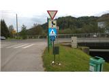 2
2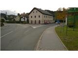 3
3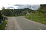 4
4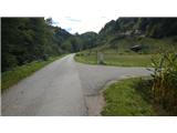 5
5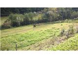 6
6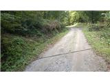 7
7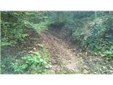 8
8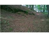 9
9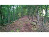 10
10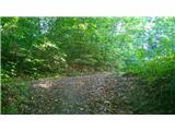 11
11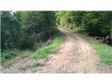 12
12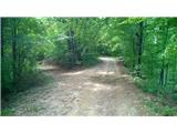 13
13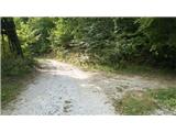 14
14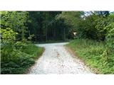 15
15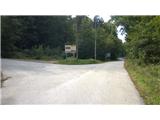 16
16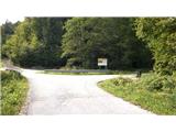 17
17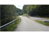 18
18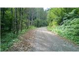 19
19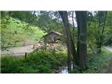 20
20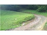 21
21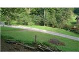 22
22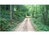 23
23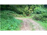 24
24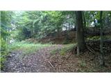 25
25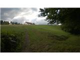 26
26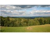 27
27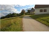 28
28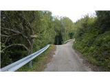 29
29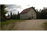 30
30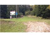 31
31 32
32
Discussion about the trail Zgornja Kungota - Tojzlov vrh