Zgornja Besnica (Podrovnik) - Sveti Jošt above Kranj (via Gaber)
Starting point: Zgornja Besnica (Podrovnik) (446 m)
| Lat/Lon: | 46,255°N 14,2674°E |
| |
Name of path: via Gaber
Time of walking: 2 h 30 min
Difficulty: easy marked way
Altitude difference: 399 m
Altitude difference po putu: 575 m
Map: Škofjeloško in Cerkljansko hribovje 1:50.000
Recommended equipment (summer):
Recommended equipment (winter):
Views: 13.950
 | 1 person likes this post |
Access to the starting point:
a) From Ljubljana, take the old road to Kranj, then follow the main road to the bridge over the Sava River. Just before the bridge, we leave the main road and continue straight ahead towards Besnice. Continue through Rakovica and Spodnja Besnica, and follow the road to Zgornja Besnica, where the signs for Podrovnik point to the left. Continue through the village and turn left at a small crossroads, slightly downhill. The road continues along the Besnica stream, and we continue along it for about 100 m from the sign "Use forest road at your own risk" and then park in a suitable space at a small junction.
b) From Jesenice or Bled, take the motorway towards Ljubljana, and we follow it to the Kranj - West exit. Continue along the old regional road towards Ljubljana, and we follow it to Kranj, where we turn right towards Besnice, just after the bridge over the Sava River. Continue through Rakovica and Spodnja Besnica, and follow the road to Zgornja Besnica, where signs for the village of Podrovnik direct you to the left. Continue through the village and turn left at a small crossroads, slightly downhill. The road continues along the Besnica stream, and we continue along it for about 100 m from the sign "Use forest road at your own risk" and then park in a suitable space at a small junction.
Path description:
From the starting point, continue along the left-hand road, which quickly leads to a small crossroads. Continue straight ahead (left across the Pillar Spruce stream - the Pillar Spruce is similar to the Cypress, and there are 4 such spruces in Slovenia) along the road, which after a few minutes leads us over a small bridge, after which we leave the road and continue our ascent to the left along the marked path. The path climbs moderately, then quickly lays down and leads us onwards along the gently sloping cart track. The marked path returns to the road just at its end, and here we see a rather old direction sign with the inscription "Mohor", which directs us to the wide ascending cart track. Cart track continues to climb along the stream for some time, then leaves it and leads us partly through the forest and partly over short viewing slopes to the main ridge of the mountains rising to the south of Zgornja Besnica. Here we come to a crossroads of mountain paths, and we continue to the left in the direction of the village Čepulje (to the right Sveti Mohor). The way forward continues for a short time along the gently sloping cart track, and then the markings direct us to the right onto a footpath which at first rises only slightly, and then begins to descend visibly towards the homestead of Gaber. Here you get on a worse road, which you follow for a few minutes, and then the signs lead you right up the bank. We follow a well-trodden path, which returns to the road, just at a marked crossroads. Cross the road (right Čepulje), then continue along the marked path towards Svetje Jošto. The way forward crosses the slopes of Špičasti hrib for some time, and then leads us to a crossroads where the path to Špičasti vrh branches off to the right. Continue straight on (left down Spodnja Besnica) and cross the slopes of the summit for a short time, then gradually move to a wide wooded ridge. Continue along cart track, passing Gladki Hill on the left. After this hill, the path descends steeply and then, in a few short ascents and descents, leads to the next marked crossroads.
Continue straight on in the direction of Svět Jošto (right down Čepulje and Planica) along the path, which descends moderately through the forest for the most part. A little further on, you enter an asphalt road, which you walk along for only a few steps, and then signs direct you left onto a marked footpath, which first crosses occasionally steeper slopes, and then gradually begins to climb more steeply. Higher up, another path from Spodnja Besnica joins us from the left, and we continue straight ahead, crossing the asphalt road leading to the top of Sveti Jošto a little further on. From the road, the path climbs over an increasingly scenic grassy slope, and we follow it all the way to the top, which we reach after less than 5 minutes of further walking.

Pictures:
 1
1 2
2 3
3 4
4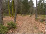 5
5 6
6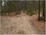 7
7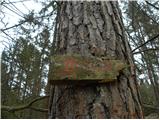 8
8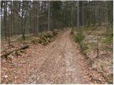 9
9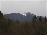 10
10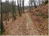 11
11 12
12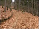 13
13 14
14 15
15 16
16 17
17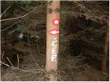 18
18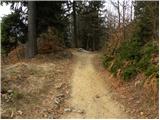 19
19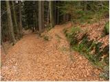 20
20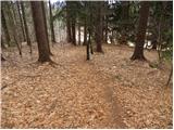 21
21 22
22 23
23 24
24 25
25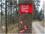 26
26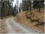 27
27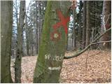 28
28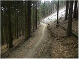 29
29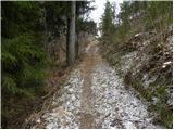 30
30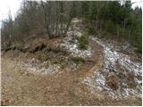 31
31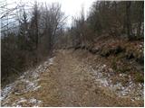 32
32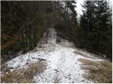 33
33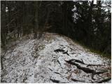 34
34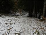 35
35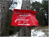 36
36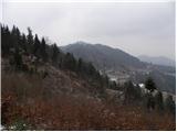 37
37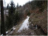 38
38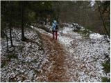 39
39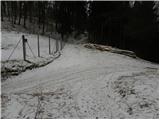 40
40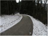 41
41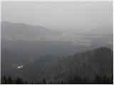 42
42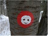 43
43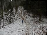 44
44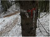 45
45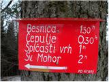 46
46 47
47 48
48 49
49 50
50 51
51 52
52
Discussion about the trail Zgornja Besnica (Podrovnik) - Sveti Jošt above Kranj (via Gaber)
|
| nordijc25. 09. 2021 00:36:32 |
veliko fotk, lepa reportaća, a kaj so zelo šparali z markacijami in primerno le za fane skupine Pop design in verza 2 poti, katero izbrati ker označene ni ?. Naj si gredo markacisti pogledat kako se to dela v Goriških brdih, vsako razpotje označeno katera pot je prava
|
|
|
|
| lina1214. 10. 2022 09:10:39 |
Za prvi del poti sem uporabljala gps, saj ni variante, da se pot najde po markacijah (jih ni). Sicer pa malo obljudena, prijetna in lepa pot po gozdu, priporočam!
|
|
|