Starting point: Zavrate (552 m)
| Lat/Lon: | 46,1611°N 15,1522°E |
| |
Time of walking: 1 h 20 min
Difficulty: partly demanding marked way
Altitude difference: 303 m
Altitude difference po putu: 350 m
Map: Posavsko hribovje - zahodni del 1:50.000
Recommended equipment (summer):
Recommended equipment (winter): ice axe, crampons
Views: 11.618
 | 3 people like this post |
Access to the starting point:
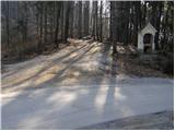
First we drive to Laško, then we continue driving towards the villages of Spodnja and Zgornja Rečica and Hude jame. In the village Zgornja Rečica you will come to an unmarked crossroads, where you will continue along the road on the left, and then follow it to the Zavrate pass, which you will recognise from the numerous hiking signs and the log cabin next to which is the entrance to the Barbara rov mine (it is one of the entrances to the mine).
The starting point can also be reached from Zasavje by driving from Hrastnik towards Rimske Toplice and Laško. When the road leading from Hrastnik to Laško starts to descend, you will see signs for the village Sedraž, which will direct you to the left. After about 100m of further driving, we reach a crossroads where we continue straight on towards the village Brezno (left Brdce, right Sedraž). The ascending road soon leads us to Brezno, where we come to an unmarked crossroads. Continue left and follow the road to the Zavrate pass, where you park.
Path description:
From the Zavrate pass, follow the footpath towards Baba and the Ostrež summit. The path initially leads us past the log cabin "pri knapu pod Baba", and then continues along the initially folded cart track. After a few minutes of easy walking, we see a direction sign pointing to the left on a well-trodden footpath, which starts to climb steeply. Higher up, the path becomes so steep that the fixed safety gear, which are not strictly necessary in dry conditions (in wet conditions, there is a high risk of slipping), are helpful. Follow this very steep and well-surfaced path to the top of Baba.
From the top, continue along the marked ridge trail, which first starts to descend and then begins to climb along the edge of very steep and, in wet conditions, slip-prone slopes. The trail, which occasionally climbs quite steeply, leads us to Ostri vrh after about 40 minutes' walk from Baba.
Pictures:
 1
1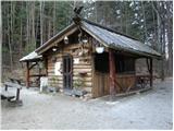 2
2 3
3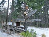 4
4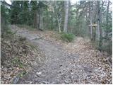 5
5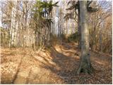 6
6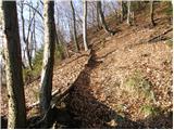 7
7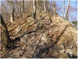 8
8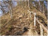 9
9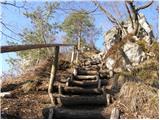 10
10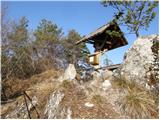 11
11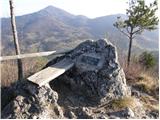 12
12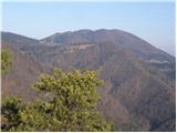 13
13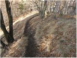 14
14 15
15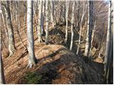 16
16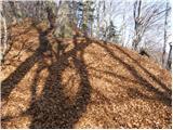 17
17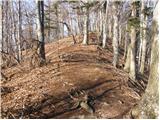 18
18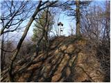 19
19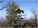 20
20
Discussion about the trail Zavrate - Ostri vrh
|
| VanSims17. 04. 2010 |
Pot od Babe do Ostrega vrha je lahka, na korak je treba malo paziti na tisti grebenski poti neposredno po Babi in pa ko se spuščamo na sedlo med gorama, ker je na poti nekaj korenin. Drugače pa ena lepših poti ki sem jih prehodil.
|
|
|
|
| brinta30. 01. 2012 |
Pot prehodila včeraj, in je bila kljub slabšemu vremenu čudovita. Pohvale PD Laško, pot je odlično označena.
|
|
|
|
| Enka20. 05. 2012 |
Očitno se ne znajdem najbolje  , saj mi danes ni uspelo najti prevala Zavrate po poti iz Laškega. Mimo Plečnikove cerkve sem prišla do kmetije, kjer se asfalt konča, nad kmetijo in pod kmetijo se namreč spremeni v precej švoh gozdno cesto, kar se mi ni skladalo s temle opisom niti s sliko (asfaltne) ceste na Zavratah (slika 1). Pa tudi vedela nisem ali naj grem po desni ali levi gozni cesti... Ker vse do "doline" nisem našla žive duše in se mi ni vozilo nazaj po strmi cesti, sem odšla naprej po svojih opravkih. Zdaj po brskanju po netu in ogledu zemljevida sklepam, da je bila ena od obeh gozdnih cest vendarle prava. Zgornja (desna)? Mi lahko tole kdo malo razloži? In še eno vprašanje - ali ni v bistvu bolj priporočljiv dostop iz Hrastnika (boljša cesta)?
|
|
|
|
| VanSims14. 06. 2013 |
Pot iz Hrastnika je od odcepa od glavne ceste predvsem krajša. Par zavojev(malo sicer strmih) in že smo na Zavratah.
|
|
|
|
| Enka14. 06. 2013 |
Hvala VanSims, ravno zadnjič sem razmišljala, da bo spet treba v te konce pokukat :-).
|
|
|
|
| docepe214. 03. 2015 |
Nekje približno na sredini poti iz Babe na Ostri vrh se iz leve priključi kar dobro uhojena pot, ki ni markirana. Točno tam so oznake na drevesu za smer Babe in Ostri vrh.
Mi lahko kdo pove od kod pride ta pot, ker očitno hodijo po njej?
|
|
|
|
| Mark024. 03. 2024 14:12:23 |
Včeraj prehodil to pot, lepa in ravno prav za noge pretegnit. Je pa žal na obeh vrhovih (Na Babi in na Ostrem vrhu) podrt steber z nadstreškom in tablo. Upam, da bodo to kmalu uredili, glede na to da je brunarica in njena okolica nedavno urejena in obnovljena.
|
|
|