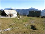
Zavetišče na planini Šija - Toplar (Kačja pot)
Starting point: Zavetišče na planini Šija (1528 m)
| Lat/Lon: | 46,4248°N 14,3354°E |
| |
Name of path: Kačja pot
Time of walking: 1 h 45 min
Difficulty: easy pathless terrain
Altitude difference: 472 m
Altitude difference po putu: 550 m
Map: Karavanke - osrednji del 1:50.000
Recommended equipment (summer):
Recommended equipment (winter): ice axe, crampons
Views: 9.983
 | 5 people like this post |
Access to the starting point:
From the Ljubljana - Jesenice motorway, take the Ljubelj exit. Continue into the centre of Tržič and follow the road through Dolžanovo gorge to the village Jelendol, where the signs for mountain pasture Kofce, Šija and Pungrat direct you to the left. The road then loses its asphalt surface and starts to climb steeply. Follow this road in the route mountain pasture Pungrat and Šija at the junctions. Park in the parking lot near the shelter at mountain pasture Šija.
Path description:
Slightly north of the shelter, you can see a wooden mountain sign with the inscription "snake trail to the front ridge" (the mountain trail is found slightly to the right of the route indicated by the sign). The trail continues on, crossing a grazing fence and leading out of the forest to a small scree slope. After this scree slope, the path crosses a short lane of spruce forest and then leads us to the avalanche slopes, where the path turns slightly to the left. Next, in a gentle ascent, cross a grassy slope, a lane of dwarf pines and a larger scree slope, after which you come to a lane of scrub (rushes and individual trees). Here the path starts to climb steeply and quickly leads under rocky cliffs. Cross a narrow passage (watch your head) and the steep path then leads to a place where you join the marked path coming from the house at Kofce.
Continue right up the path, which climbs steeply and quickly leads to an exposed passage. Without fixed safety gear, cross a short, but crumbly and slightly exposed ledge, after which you enter lane of dwarf pines. The way ahead climbs over a short lane of dwarf pines and then continues along the side ridge of Košuta. The increasingly scenic and rather steep path joins the ridge path higher up.
Continue left in the route Veliki vrh (right Kladivo, straight up Kofce gora 10 steps) on a path that starts to descend gently along the edge of the ridge. The path crosses the slopes of Košuta to the west and after about 15 minutes of walking joins the normal path to Veliki vrh (descent possible), where you enter a small, unmarked valley. The trail then leaves the valley and rejoins the southern slopes, where it passes the summit of "Toplar (2000m)" on the south side. It is at this point that you leave the marked trail leading to Veliki vrh and turn right onto a pathless world. After three minutes of steep but easy climbing on the trackless path, you reach Toplar.
Shija - Kofce gora 1:15, Kofce gora - Toplar 30 minutes.

Pictures:
 1
1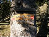 2
2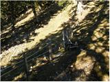 3
3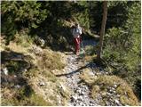 4
4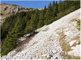 5
5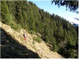 6
6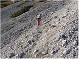 7
7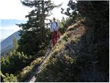 8
8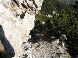 9
9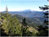 10
10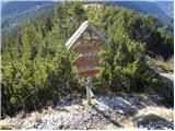 11
11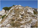 12
12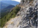 13
13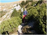 14
14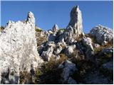 15
15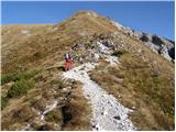 16
16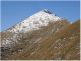 17
17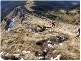 18
18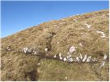 19
19 20
20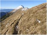 21
21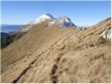 22
22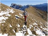 23
23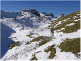 24
24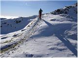 25
25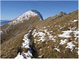 26
26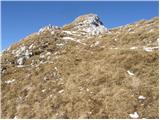 27
27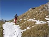 28
28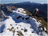 29
29
Discussion about the trail Zavetišče na planini Šija - Toplar (Kačja pot)
|
| ROBERT13. 10. 2006 |
raj za ovce 
|
|
|