Starting point: Zamlake (903 m)
| Lat/Lon: | 45,9126°N 14,4659°E |
| |
Time of walking: 20 min
Difficulty: easy unmarked way
Altitude difference: 58 m
Altitude difference po putu: 65 m
Map: Ljubljana - okolica 1:50.000
Recommended equipment (summer):
Recommended equipment (winter):
Views: 478
 | 1 person likes this post |
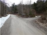
Access to the starting point:
a) First, take the Ig, and from there continue in the direction of Iška vas and Iškega Vintgar. Just after Iška vas you will reach the village of Iška, where the road to Gornji Ig and Rakitna turns sharp right. Take the ascending road mentioned above and follow it past Gornji Ig and higher up to the road for Krim. At the turnoff, turn right and after a few metres park in the parking lot next to the road.
b) From the motorway Ljubljana - Koper take the exit Brezovica, then continue in the direction of Podpeči (Podpeči can also be reached from Črna vas or Ig). In Podpeči continue in the direction of Borovnica, Krim and Rakitna and continue along the edge of the Ljubljana Moor for a short distance, then the signs for Rakitna direct you left onto a steeply ascending road. The road then leads through Preserje, where it also begins to descend. After a short descent, continue left in the direction of Krimo and Rakitna, and we then follow the mostly ascending road to a junction where the road to Krimo branches off to the left. From this junction, turn left and then continue along the dirt road leading to Gornji Ig and Krimo. After Brancljeva senožetje, where the NOB monument is located, the road starts to descend and leads to a crossroads where you turn left towards Krimo. Park just after the crossroads in the roadside parking lot.
c) First drive to Cerknica, then continue driving in the direction of Begunje, and when you arrive in Begunje follow the signs for Rakitno. From Rakitna, continue along the main road towards Preserje, and follow it to the crossroads where the road to Krimo branches off to the right. From this junction, turn right and continue along the dirt road leading to Gornji Ig and Krimo. After Brancljeva senožetje, where the NOB monument is located, the road starts to descend and leads to a crossroads where you turn left towards Krimo. Park just after the crossroads in the roadside parking lot.
Path description:
From the starting point, continue along the road leading to Ig, then descend slightly. After leaving the municipality of Brezovica, you will reach the municipality of Ig, where you will take the first cart track on the right. After cart track you reach a large clearing in a few minutes, where cart track ends. Continue across the clearing to the right, and when you reach the forest, the markers (white triangle with red border) appear. Follow the markers through the forest, and when a small clearing appears on the right, continue left up to the trackless path, which in a few 10 steps of walking on the trackless path will take you to the top of Mišnice, where in the winter time through the treetops you will get some views.
Description and pictures refer to the situation in 2016 (March).
Pictures:
 1
1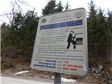 2
2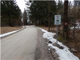 3
3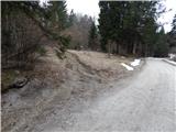 4
4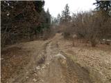 5
5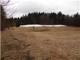 6
6 7
7 8
8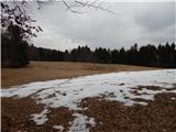 9
9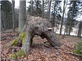 10
10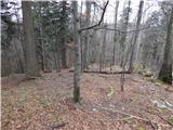 11
11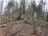 12
12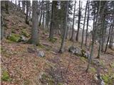 13
13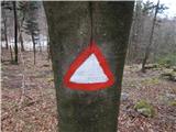 14
14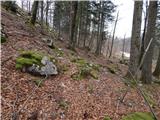 15
15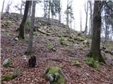 16
16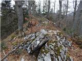 17
17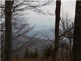 18
18
Discussion about the trail Zamlake - Mišnice