Starting point: Zamlake (903 m)
| Lat/Lon: | 45,9126°N 14,4659°E |
| |
Time of walking: 50 min
Difficulty: easy marked way
Altitude difference: 204 m
Altitude difference po putu: 204 m
Map: Ljubljana - okolica 1:50.000
Recommended equipment (summer):
Recommended equipment (winter):
Views: 40.775
 | 3 people like this post |
Access to the starting point:
a) First, take the Ig, and from there continue in the direction of Iška vas and Iškega Vintgar. Just after Iška vas you will reach the village of Iška, where the road to Gornji Ig and Rakitna turns sharp right. Take the ascending road mentioned above and follow it past Gornji Ig and higher up to the road for Krim. At the turnoff, turn right and after a few metres park in the parking lot next to the road.
b) From the motorway Ljubljana - Koper take the exit Brezovica, then continue in the direction of Podpeči (Podpeči can also be reached from Črna vas or Ig). In Podpeči continue in the direction of Borovnica, Krim and Rakitna and continue along the edge of the Ljubljana Moor for a short distance, then the signs for Rakitna direct you left onto a steeply ascending road. The road then leads through Preserje, where it also begins to descend. After a short descent, continue left in the direction of Krimo and Rakitna, and we then follow the mostly ascending road to a junction where the road to Krimo branches off to the left. From this junction, turn left and then continue along the dirt road leading to Gornji Ig and Krimo. After Brancljeva senožetje, where the NOB monument is located, the road starts to descend and leads to a crossroads where you turn left towards Krimo. Park just after the crossroads in the roadside parking lot.
c) First drive to Cerknica, then continue driving in the direction of Begunje, and when you arrive in Begunje follow the signs for Rakitno. From Rakitna, continue along the main road towards Preserje, and follow it to the crossroads where the road to Krimo branches off to the right. From this junction, turn right and continue along the dirt road leading to Gornji Ig and Krimo. After Brancljeva senožetje, where the NOB monument is located, the road starts to descend and leads to a crossroads where you turn left towards Krimo. Park just after the crossroads in the roadside parking lot.
Path description:
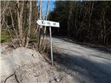
From the starting point, continue along the macadam road in the direction of Krimo. At the very beginning, the path leads us along the slopes of the 1005-metre-high Koreno, which we pass by on the right, and then quickly move to the slopes of Malinovac, a peak which is only 1 metre lower than the Krimo and which we pass by on the left. The road continues mainly northwards, passing by one lesser-known peak, the 983-metre-high Gnojevec, which you pass on the right. A little further on, we arrive at a marked crossroads, where the path from the Plehanov laz hunting lodge joins us on the left.
At this crossroads, leave the road and continue the ascent to the right on the relatively steep cart track in the direction of the footpath to the Krim. In a small valley, the cart track ends, and we continue slightly to the left, along a well-trodden path which leads us just a little higher to a fence restricting or forbidding access to a nearby military area. We walk along the fence for a short time, and then we are on the road leading to the Dom na Krimu. Follow the road to the left, and in less than a minute's walk you will reach the top of the Krimo, where you will have a beautiful view of the Ljubljana Marshes and the Alps in the background.

Pictures:
 1
1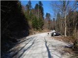 2
2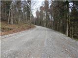 3
3 4
4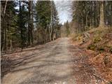 5
5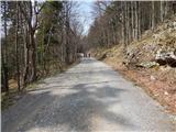 6
6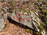 7
7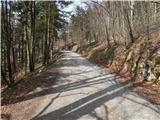 8
8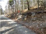 9
9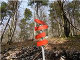 10
10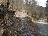 11
11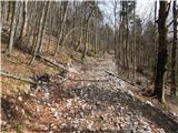 12
12 13
13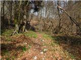 14
14 15
15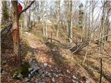 16
16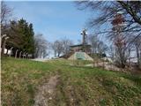 17
17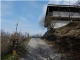 18
18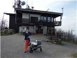 19
19
Discussion about the trail Zamlake - Krim
|
| Mikens23. 06. 2019 |
POMEMBNO!
Vse pohodnike naprošam, naj imajo pse na vrvici! (območje medveda.)
Lep lovski pozdrav.
Klement Mal, LD Tomišelj
|
|
|