Starting point: Zakojca (706 m)
| Lat/Lon: | 46,1653°N 13,9277°E |
| |
Time of walking: 1 h 45 min
Difficulty: easy marked way
Altitude difference: 597 m
Altitude difference po putu: 600 m
Map: Škofjeloško in Cerkljansko hribovje 1:50.000
Recommended equipment (summer):
Recommended equipment (winter): ice axe, crampons
Views: 22.630
 | 2 people like this post |
Access to the starting point:
The Tolmin - Podbrdo road branches off at Grahovo ob Bači, which after a few kilometres of climbing leads to the village of Bukovo. Here, turn left and follow the cross road to the village of Zakojca, which is the starting point of our tour.
From the Idrija - Tolmin road, the road branches off at Reka in the direction of Police and Bukovo. Follow this mostly ascending road towards the village Bukovo at the junctions. From the village Bukovo we continue on a cross road which, after a few kilometres of further driving, leads us to Zakojca, which is the starting point for our tour.
Path description:
In the centre of the village, just a few metres behind the National Liberation Monument, you will see the start of the trail to Kojca by the transformer. At first, the ascent follows the cart track, which runs straight up a grassy slope with a view. The path, which becomes steeper and steeper, leads us along a grazing fence to the vicinity of a hunting observation post, which can be seen for the whole of the initial part of the route. In the vicinity of the observatory, the path turns slightly to the left and continues to climb along the cart track, which has a few forks, so follow the markings carefully. Higher up, cart track turns into a dense forest, and we follow it only as far as where the signs direct us onto a steep footpath. The path through the forest then leads us in a few minutes to a small pass, where it turns left and starts to climb even steeper.
The relatively long slope is negotiated in a number of switchbacks, and then the path turns left and leads over a wire fence onto the avalanche slopes. Cross these slopes in a slight ascent, and then return to the forest, where we join the path from the Vrh Ravni prevala just a little further on.
Here we continue straight in the direction of Kojce along the path, which leads us just a little further to the main ridge of the summit. Here the path turns slightly to the right and begins again to climb steeply up the increasingly scenic top slope of the mountain. Higher steepness eases and the path leads us out of the forest to the grassy slopes, which are then climbed to the top of Kojce in a few minutes of scenic walking.

Pictures:
 1
1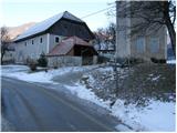 2
2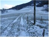 3
3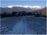 4
4 5
5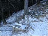 6
6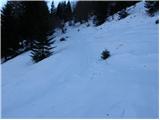 7
7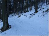 8
8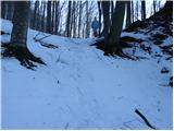 9
9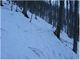 10
10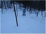 11
11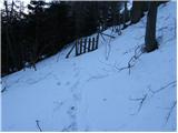 12
12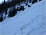 13
13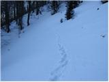 14
14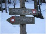 15
15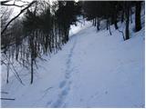 16
16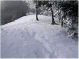 17
17 18
18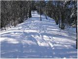 19
19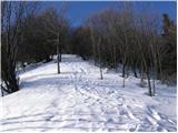 20
20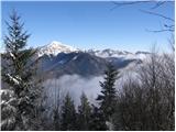 21
21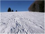 22
22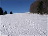 23
23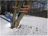 24
24 25
25
Discussion about the trail Zakojca - Kojca
|
| grahlck28. 04. 2009 |
Ali je na tej poti kaj snega. Hvala.
|
|
|
|
| Lj4. 04. 2011 |
Razgleden, prostran, travnat vrh. Naredile smo luštno krožno turco: iz Zakojce na Kojco, sestop na preval Vrh ravni in po cesti nazaj v Zakojco. Pa še žlikrofi na prijaznem kmečkem turizmu,kaj češ lepšega? 
|
|
|
|
| J.P.28. 12. 2022 19:37:18 |
Tale turca je luštna v snegu. Lp
|
|
|