Zagreb (Šestine) - Sljeme (path HPD (path 52))
Starting point: Zagreb (Šestine) (291 m)
| Lat/Lon: | 45,8543°N 15,9502°E |
| |
Name of path: path HPD (path 52)
Time of walking: 2 h 15 min
Difficulty: easy marked way
Altitude difference: 742 m
Altitude difference po putu: 742 m
Map:
Recommended equipment (summer):
Recommended equipment (winter):
Views: 7.201
 | 1 person likes this post |
Access to the starting point:
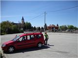
a) From the centre of Zagreb, take the Pantovčak street via the British Square, follow it to the end (roundabout), turn left onto Šestinski vijenac and you will soon reach the church and the cemetery behind it (Šestinski trg), where there is a large parking lot.
b) Cross the Croatian border in Rigonci, continue through Zaprešić, along Aleja Bologna and Ilica. Shortly at the beginning of Ilica turn left onto Vrapčanska, follow it for approx. 2 km, turn right onto Trdica, follow it to Krvarić Street, from which continue along Mikulići Street, continue on Lukšiće Street to Šestinska Street and the church/cemetery behind which there is a parking lot where you can leave your car. As the streets are quite narrow and uncluttered, we recommend using a map or navigation.
Path description:
Starting from the parking lot, follow the road to the left (from the signpost for the market square), past the ski service and the bar. Walk along the main street, but only as far as the brook (with a bakery on the corner) and Potočani Street, where you will see the first signs and the trail marker 52. The asphalt road climbs up the street past the houses and soon leads to a sign marking the entrance to the Medvednica Park. Soon the concrete road leaves in a sharp curve (left) and the road turns into cart track and later into a wide, well-marked mountain path. The path continues through the forest, followed by a slightly steeper part, which soon flattens out and leads to a water spring (dry at the time of the visit). The path then splits (follow the signs for the summit) and crosses quite steep slopes in places (dangerous for slipping). Soon you see a tower at the top, and the path turns into a wide cart track along a wide summit ridge. Continue straight ahead, in the direction of the tower. Cross the tarmac road, continue past the abandoned funicular terminus; there are a few steps of stairs to the top.
At the top there is a restaurant (Vidikovac). The stamp of the summit is a stamp embedded in the wall of the pub. Due to the forest, the view is limited only towards Gorjance.

Pictures:
 1
1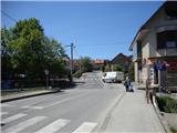 2
2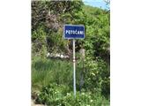 3
3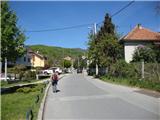 4
4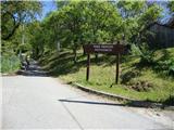 5
5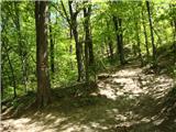 6
6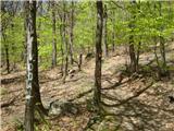 7
7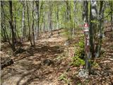 8
8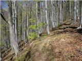 9
9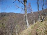 10
10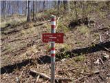 11
11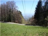 12
12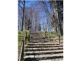 13
13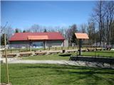 14
14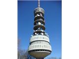 15
15 16
16
Discussion about the trail Zagreb (Šestine) - Sljeme (path HPD (path 52))