Starting point: Zabočevo (400 m)
| Lat/Lon: | 45,9095°N 14,4008°E |
| |
Time of walking: 1 h 40 min
Difficulty: easy pathless terrain
Altitude difference: 540 m
Altitude difference po putu: 550 m
Map: Ljubljana - okolica 1:50.000
Recommended equipment (summer):
Recommended equipment (winter):
Views: 6.034
 | 1 person likes this post |
Access to the starting point:
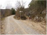
From the motorway Ljubljana - Koper take the exit Vrhnika and follow the road towards Verda, Bistra, Borovnica and Podpeči. In Borovnica you will reach a crossroads where you will turn right in the direction of Pekel. Follow the relatively narrow road in the direction of Brezovica at Borovnica, but only until the signs for the village of Zabočevo direct you to the left. The road soon leads us to the village, and we follow it a little further to the mountain signs for Rakitno. Park in one of the roadside car parks.
Path description:
From the starting point, where there is also a warning sign that you are entering the bear area, follow the footpath in the direction of Rakitna. The path initially leads us along the wide cart track, which after a good 10 minutes of moderate ascent leads us to a small clearing, where there is also a less well-marked crossroads.
Rare and occasionally rather faded markings direct us here to the right to the noticeably steeper cart track, which then continues to climb crosswise. The path leads us higher up to a forest road, which we only cross, as the markings for Rakitna and Krimšček direct us to cart track, which continues to climb through the forest.
The increasingly winding path, which continues to the south-east, leads us after a while to a crossroads at the NOB monument.
Continue straight ahead on the worse forest road (left down Rakitna) along which, in addition to the usual markings, you will also see triangular markings. Higher up, you reach an unmarked crossroads, where you continue along the left broad cart track, along which the triangular markings continue (here the path with the usual markings turns right). Cart track, which is getting worse, climbs steeper higher up, and leads you out of the wods onto the grassy slopes, where you also reach a small pass.
At the pass, which is located between Novaška gora on the left and Krimščko on the right, we also leave the marked path and continue our ascent to the right on the initially less visible path, which completely disappears higher up. When the path disappears, continue slightly to the left and after a few steps of pathless ascent, reach the top of Krimščko.

Pictures:
 1
1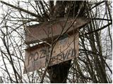 2
2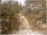 3
3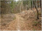 4
4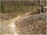 5
5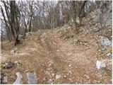 6
6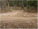 7
7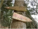 8
8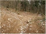 9
9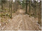 10
10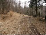 11
11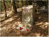 12
12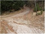 13
13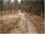 14
14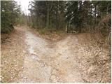 15
15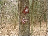 16
16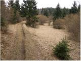 17
17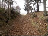 18
18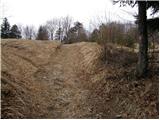 19
19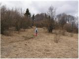 20
20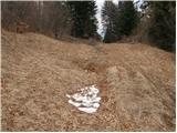 21
21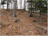 22
22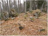 23
23
Discussion about the trail Zabočevo - Krimšček
|
| basist11. 04. 2010 |
A kdo ve kaj označujejo te trikotne markacije? Sam sem jih zasledil tudi na Srebotniku in Prevejku. To sta vrhova med Ljubljanskim barjem in Rakitno. Gre morda za kakšno posebno pot?
|
|
|
|
| anamarijana11. 04. 2010 |
RES NE VEM OD KJE VAM IME kRIMŠČEK.KOT DOMAČINKA VEM,DA JE TO KRIMČEK.
|
|
|
|
| basist11. 04. 2010 |
Ok. Ne se jezit  ) A o teh trikotnih markacijah kej veš?
|
|
|
|
| edob12. 04. 2010 |
Pozdravljen! Tisti trikotniki razmejujejo lovsko območje Rakitna in Borovnica.Sicer pa čez Krimček poteka markirana pot na Slivnico,vmes pa na Krimsko jamo.Trikotniki s tem nimajo veze.
|
|
|
|
| dj1212. 04. 2010 |
Hvala " edob " za razlago teh trikotnikov.Enkrat v bližnji prihodnosti bo treba tudi na Krimček skočit za nabiranje kondicije. LP D&A
|
|
|
|
| darh19. 05. 2013 |
Tu opisanega vzpona smo se lotili včeraj popoldne - izkazal se je kot nalašč za čas, ki smo ga imeli na voljo. Malo bolj zeleni posnetki in še nekaj vtisov pa tule.
|
|
|