Wiesser Alm - Mirnock (Path 184)
Starting point: Wiesser Alm (1607 m)
| Lat/Lon: | 46,75697°N 13,73224°E |
| |
Name of path: Path 184
Time of walking: 1 h 30 min
Difficulty: easy marked way
Altitude difference: 503 m
Altitude difference po putu: 503 m
Map:
Recommended equipment (summer):
Recommended equipment (winter):
Views: 1.100
 | 2 people like this post |
Access to the starting point:
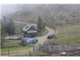
a) Drive through the Karavanke Tunnel into Austria, then continue along the Tur Autobahn, leaving at the Beljak bypass and continuing on to Treffen am Ossiacher See and Afritz am See. At the end of Afrizt am See, just before the lake Afritzer See, turn left, where you will see signs for Afritzer See and Weisser Alm. Follow the main road through the village of Liezberg until you reach a roadblock where you pay with coins to use the Liezberger Straβe mountain road. After about 9 km on a dirt road, we reach a small parking lot at mountain pasture Weisser Alm.
b) From Styria or Carinthia, first drive to Dravograd and then via Border crossing Vič to Austria, where you follow the signs for Klagenfurt and then on to Villach. Continue on the motorway to Tur, which you leave at the Beljak bypass and continue to Treffen am Ossiacher See and Afritz am See. At the end of Afrizt am See, just before the lake Afritzer See, turn left, where you will see signs for Afritzer See and Weisser Alm. Follow the main road through the village of Liezberg until you reach a roadblock where you pay with coins to use the Liezberger Straβe mountain road. After about 9 km on a dirt road, we reach a small parking lot at mountain pasture Weisser Alm.
Path description:
Just a little further on from the parking lot at mountain pasture at mountain pasture Weisser Alm we come to a crossroads where we continue straight on to where the signs for Mirnock lead us along route 184, with the path over Rindernock to the left. The path rises gently and soon you reach a sign for Mirnock and Hochalmhütte, which takes you left along a slightly steeper track. The path dips a few times and becomes steeper again. Shortly before the end of the forest border, we reach the crossroads again, because we follow the sign for Mirnock or track 184, which rises a little steeper from the forest border. Here you can enjoy blueberries in early autumn. Soon the slope becomes grassy and you can see the top of the cross in front of you. Follow the path up the grassy slope to join Route 185 just below the summit. Turn left and in 10 m you are at the top. You can leave the very scenic summit by following the circular path which passes Rindernock Peak. If you choose the circular route, you will descend to the trailhead on 183, which is quite similar to the 184 trail described above.

Pictures:
 1
1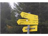 2
2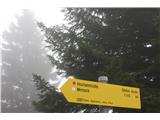 3
3 4
4 5
5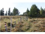 6
6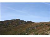 7
7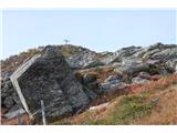 8
8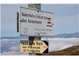 9
9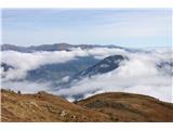 10
10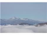 11
11 12
12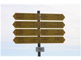 13
13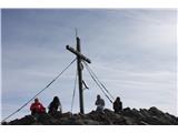 14
14
Discussion about the trail Wiesser Alm - Mirnock (Path 184)