Waldheim Hütte - Geierkogel (Seetal Alps) (direct way)
Starting point: Waldheim Hütte (1614 m)
| Lat/Lon: | 47,0562°N 14,6305°E |
| |
Name of path: direct way
Time of walking: 1 h 40 min
Difficulty: easy unmarked way
Altitude difference: 571 m
Altitude difference po putu: 571 m
Map: WK 212 (Seetaler & Seckauer Alpen 1:50.000)
Recommended equipment (summer):
Recommended equipment (winter): ice axe, crampons
Views: 2.681
 | 1 person likes this post |
Access to the starting point:
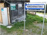
From the Gorenjska side, go through the Ljubelj border crossing to Klagenfurt or through Karawanks to Villach. Continue on the motorway towards the signs for Graz / Graz. Leave the motorway after about 2km through a tunnel in the direction of Bad St. Leonhard. Continue past the village of St. Peter and a little further on turn left towards the village of St. Anna. At the next crossroads follow the road towards Waldheim Hütte. Park in the pay parking lot next to the hut.
From Carinthia, drive first to Dravograd and then on to Austria. Follow the road towards St. Paul, St. Andra and Wolfsberg. In Wolfsberg, head towards Bad St. Leonhard and on to St. Peter. Continue following the description from Gorenjska.
From the Styrian side, take the Maribor and continue through the Šentilj border crossing into Austria. Follow the motorway in the direction of Klagenfurt / Klagenfurt. Leave the motorway in the direction of the Bad St. Leonhard exit. Follow the description from Gorenjska.
Path description:
From the parking lot, take the cart track, which begins a moderate climb up a grassy slope surrounded by forest. After a few minutes' walk, the meadow and cart track turn slightly to the right. At this point, the path climbs slightly more steeply for a short time, then the slope eases. A few minutes of almost flat walking follows, and then a gently sloping dirt track leads out of the forest onto a completely unpaved slope. As most of the path passes through grazing areas, we cross a grazing fence a few times. The path then leads to two successive crossroads, where you continue straight on towards Zirbitzkogel.
The trail continues to climb up the gentle grassy slopes and follows the cart track. When the track turns right, continue straight on the marked footpath. The path ahead is slightly steeper and after about 15 minutes' walk leads to an indistinct broad grassy ridge. Here you leave the marked path to Zirbitzkogel. Bear left along the ridge towards the summit. The almost flat path leads to the summit after just over five minutes.

Pictures:
 1
1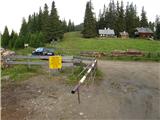 2
2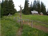 3
3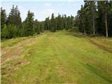 4
4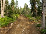 5
5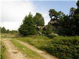 6
6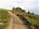 7
7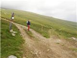 8
8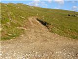 9
9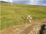 10
10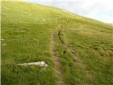 11
11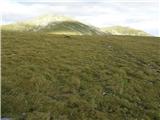 12
12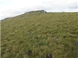 13
13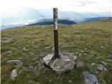 14
14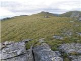 15
15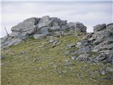 16
16
Discussion about the trail Waldheim Hütte - Geierkogel (Seetal Alps) (direct way)