Vrzdenec - Koreno (via Samotorica)
Starting point: Vrzdenec (380 m)
| Lat/Lon: | 46,0222°N 14,2665°E |
| |
Name of path: via Samotorica
Time of walking: 1 h 45 min
Difficulty: easy marked way
Altitude difference: 349 m
Altitude difference po putu: 400 m
Map: Škofjeloško in Cerkljansko hribovje 1:50.000
Recommended equipment (summer):
Recommended equipment (winter):
Views: 7.902
 | 2 people like this post |
Access to the starting point:
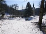
First, drive to Horjul (to get here by Dobrova or Vrhnika), then continue driving towards Vrzdenec and Gorenjska vas. At the first sharp left turn, after the village Vrzdenec, you will notice a narrow asphalt road that branches off the main road to the right. Take this road, which after a short steep climb leads to the church of St. Kancian above Vrzdenec. Park in one of the car parks near the church.
Path description:
Just a little further from the church, at the end of the road, we will notice mountain direction signs directing us to cart track in the direction of Kožljek (do not continue to the right in the direction of Koreno). Cart track, which begins to climb along the stream, leads us after just one minute's walk to an unmarked crossroads.
Continue right along the second cart track (the first one to the right is quite overgrown, the left one is lost), which turns right immediately after crossing the stream and then climbs up its right bank. After a short climb, cart track turns sharp left and gradually starts to move away from the stream. Further on, the markings become more frequent, and the path soon leads to a marked crossroads, where we continue to the right in the direction of Samotorica (left at Hlipč). We continue our ascent along cart track, which leads us higher out of the wods and onto the grassy hillsides which are open to the view. The ascent continues along the widening cart track, which leads us past the hunting observation post to the Church of St Michael at Samotorica.
At the church, step onto the road and follow it to the right, which quickly leads to a marked crossroads. Continue straight ahead in the direction Koreno (left Kožljek, right Horjul) along the road, which climbs gently along the edge of the forest. After a few minutes of further walking along the road, you will notice markings pointing to the right on the footpath. The marked path, which continues along cart track, turns slightly to the left just after the cross and starts to descend gently. The dirt track soon leaves the wods and turns into grassy slopes, over which, in a few short ascents and descents, you reach the village of Koreno, where you join the asphalted road. Follow the well-marked road to the Lenart agritourism farm, where signs direct you to the left onto a narrow road which leads up to the Church of St. From the church, continue along the less visible path, which leads past a large cross to a lookout point with a viewing platform and a registration box underneath.

Pictures:
 1
1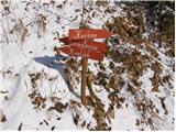 2
2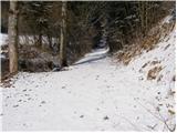 3
3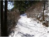 4
4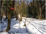 5
5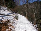 6
6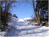 7
7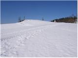 8
8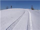 9
9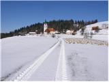 10
10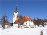 11
11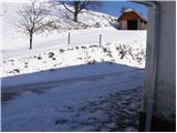 12
12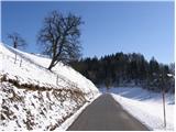 13
13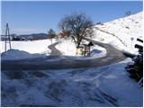 14
14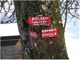 15
15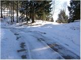 16
16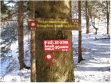 17
17 18
18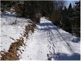 19
19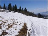 20
20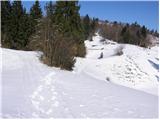 21
21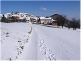 22
22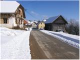 23
23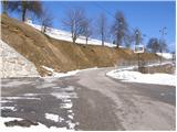 24
24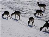 25
25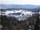 26
26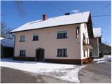 27
27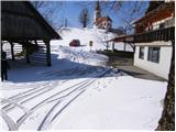 28
28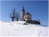 29
29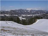 30
30 31
31
Discussion about the trail Vrzdenec - Koreno (via Samotorica)
|
| francimedved25. 02. 2009 |
Pred kratkom sem bil gor. Je odličen izlet da se pozimi izogneš Ljubljanski megli. Lp Franci 
|
|
|
|
| podplat7. 03. 2009 |
zanima me opis poti iz vrzdenca desno proti Korenu, ker ni nikjer opisana, smerna tabla pa obstaja, prav tako pa me zanima, kje se pot priključi na katero od navedenih poti. Hvala lp Borut
|
|
|
|
| mabe20. 06. 2011 |
Pot je v nekaterih odsekih zelo slabo oznacena. Najmanj 3x ali celo veckrat sem se moral vrniti nazaj in pot ponovno preveriti.
|
|
|
|
| tista17. 01. 2021 |
Pot je dobro oznacena (jan 2021) markacije so jasne in pogoste. Na vrhu je mozen dostop le do cerkve, saj je povsod ograja zaradi pasnika. Markirana pot po novem ne pelje mimo lovske opazovalnice ampak peljejo markacije desno direktno na cesto. Sicer pa je pot primerna tudi za otroke, zacetek je strm (ni prehudo) nato pa je pot razgibana in ni naporna.
|
|
|