V Koncu - Grintovec (via Gamsov skret)
Starting point: V Koncu (900 m)
Name of path: via Gamsov skret
Time of walking: 5 h 15 min
Difficulty: very difficult unmarked way
Altitude difference: 1658 m
Altitude difference po putu: 1750 m
Map: Kamniške in Savinjske Alpe 1:50.000
Recommended equipment (summer): helmet, self belay set
Recommended equipment (winter): helmet, self belay set, ice axe, crampons
Views: 25.818
 | 3 people like this post |
Access to the starting point:
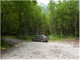
Drive into Kamnik and follow the road towards the Kamnik Bistrica valley. From your home in Kamniška Bistrica, continue driving along the forest road, which takes you higher up to a crossroads where you continue straight ahead (right Jermanca, starting point for Kamniško sedlo). The road then takes you past Žagana peči to the parking lot at the lower station of the cargo cableway to Kokrsko sedlo.
Path description:
From the parking lot at the lower cable car station, continue along the road to the "upper car park". Here you will see two cart track on the left-hand side of the road next to the car park. The left-hand cart track, which is marked with signs on a tree, leads towards Kokrsko sedlo. We take the right cart track (this cart track is also on the left side of the road).
Initially, follow the above-mentioned cart track for a while, from which a few side tracks branch off, and then the track becomes a lane. Continue for some time on a narrow track through the forest. The path here follows the left side of the valley throughout, thus avoiding the steep rock jump in the lower part of the valley.
Once out of the forest, the path crosses a slightly steeper slope to the right and leads to grassy slopes. The ascent then follows a grassy terrain, which leads us to the foot of the Kogel walls.
Here the better-beaten track turns left towards the wall, and we continue slightly right along a narrow track. The path is quite poorly visible at this point and follows the left side of the torrent up the valley. The waterfall of the above-mentioned torrent (usually without water) can serve as a good orientation. The path turns left a little before the waterfall and enters the cliff.
Here the trail becomes very difficult and first we have to climb a few metres up an almost vertical slope. Then you climb up a narrow shelf, which crosses the slope to the right and leads to steep grassy slopes. Although the ledge is protected, the climb is quite difficult. It should also be borne in mind that the fixed safety gear are usually in slightly worse condition than we are used to on marked routes. We continue to climb for some time on fairly steep grassy slopes, then the slope becomes gradually less steep and the path leads us to an unexpected bench from which there is also a very nice view on all sides.
In the following, we climb up the grassy slope all the way to the marked Kokrsko sedlo - Kamniško sedlo trail.
Here we turn left and follow the marked path, which soon leads us in slight downhills and uphills to a crossroads, where we continue right in the direction of Grintovca and Skute (left bivouac 1 minute) along a relatively gently sloping path, which soon leads us to the next crossroads. This time we continue on the left path (right Skuta), which leads us further across a karst world full of scrapes and potholes. Next, carefully follow the markings which, after a short climb, lead us to Mlinarski sedlo, where we join the path from Jezersko. Continue left in the direction of Grintovec (to the right Dolgi hrbet and Skuta) along the path, which becomes technically demanding. The path continues along and along the exposed ridge in places, and then passes to the axial side of the ridge, where it becomes a little more difficult, but the numerous fixed safety gear are helpful. The path, which is exposed to falling rocks in the upper part, leads us to the summit after about 1 hour's walk from Mlinarski sedlo.
I recommend descending over the Grintovec roof.
V Koncu - Bivouac 3:15, Bivouac - Vrh 2:00.

Pictures:
 1
1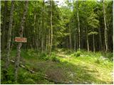 2
2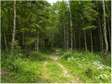 3
3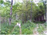 4
4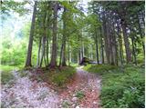 5
5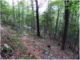 6
6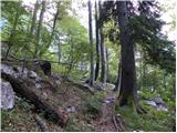 7
7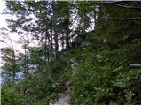 8
8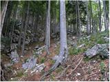 9
9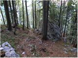 10
10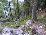 11
11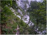 12
12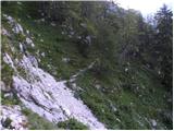 13
13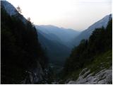 14
14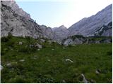 15
15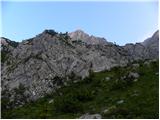 16
16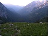 17
17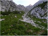 18
18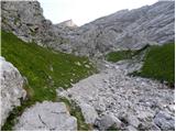 19
19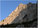 20
20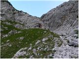 21
21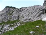 22
22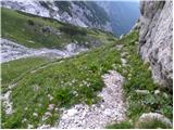 23
23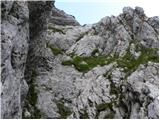 24
24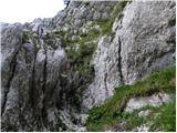 25
25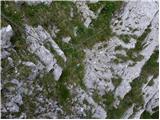 26
26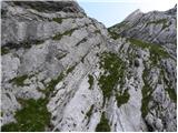 27
27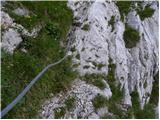 28
28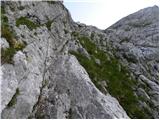 29
29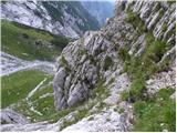 30
30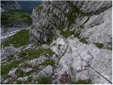 31
31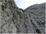 32
32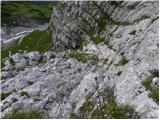 33
33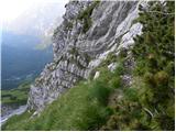 34
34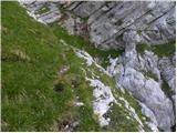 35
35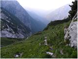 36
36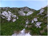 37
37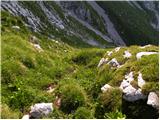 38
38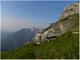 39
39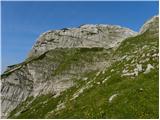 40
40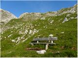 41
41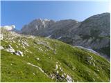 42
42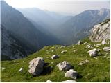 43
43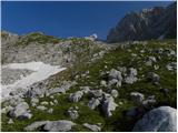 44
44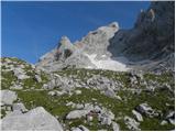 45
45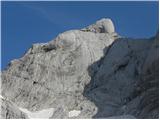 46
46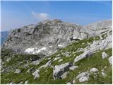 47
47 48
48 49
49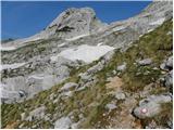 50
50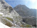 51
51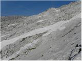 52
52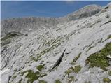 53
53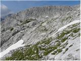 54
54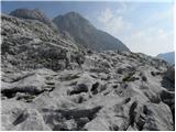 55
55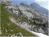 56
56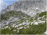 57
57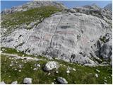 58
58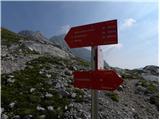 59
59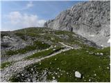 60
60 61
61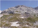 62
62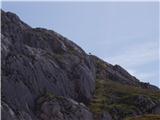 63
63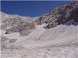 64
64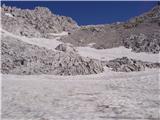 65
65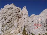 66
66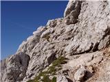 67
67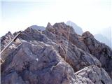 68
68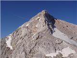 69
69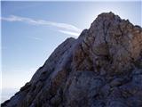 70
70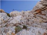 71
71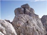 72
72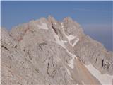 73
73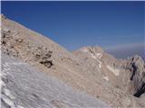 74
74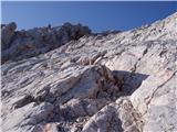 75
75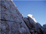 76
76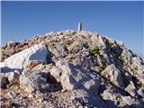 77
77 78
78
Discussion about the trail V Koncu - Grintovec (via Gamsov skret)
|
| Planinko15. 09. 2007 |
 LAGANINI by planinko (the master of the climbing)
|
|
|
|
| Virenque8. 07. 2008 |
Gamsov skret...ha, kaj takega!
|
|
|
|
| the dancer2. 11. 2008 |
Zanima me  , a se za pravilni vstop v Gamsov skret skrene že na prvem neoznačenem razpotju (od Jermance), ker danes sem malo zgrešil, šel naravnost čez poseko in na naslednje razpotju levo in po melišču navzgor, kjer sem pršu do jame, jo obšel po desni, imel cca 100vm plezarije in se kasneje višje praktično že v stenah priključil na pravo pot in z zailami premagal skok? Hvala 
|
|
|
|
| fpetel13. 11. 2008 |
Kak so pa zajle? Baje je ena poškodovana. Katera varjanta je varnejša: po starem prehodu ali po zavarovani inačici?
Lp.
|
|
|
|
| the dancer3. 11. 2008 |
Zajle so mal načete, samo ni panike se da potegnit za njih. Starega prehoda ne poznam So ble mal vlažne stence, sam ni panike, sem nižje doli lezel vsaj 100m vr  , ker sem pač kiksnil pravi vhod v Gamsov skret
|
|
|
|
| pohodnik385. 08. 2017 |
V soboto 29.7. prehodil omenjeno pot kjer že kar nekaj let nisem šel po njej.Sprva v gosti megli da sem kar malo iskal markirano pot na podih pod Skuto drugače pa je pot brez posebnosti in zahtevna,lepa kot vedno VIDEO Lp! Tone
|
|
|
|
| MinasTirith1. 09. 2019 |
Opis poti izjemno zahtevno se mi zdi pretiran.
Pot zahteva sicer dobro fizično pripravljenost, vendar vse v mejah normale. Tako da tisti ki bi se radi podali na pot, zadeva ni tako zahtevna.
|
|
|
|
| garmont1. 09. 2019 |
Ne vem kje si videl, da je pot izjemno tahtevna.  Nikakor pa je ni za podcenjevati, sploh pri sestopu...
|
|
|
|
| bumbam22. 10. 2019 |
Pot čez Gamsev skret sem imel dolgo v načrtu, predvsem zaradi neprevidene plezarije. Pa je bil strah čisto odveč. Dejansko je za splezat po parih klinih ne več kot 5m, potem je lepa polica preko katere se povlečeš z jeklenico. Nato sledi par minut po strmih travah in na koncu si nagrajen z lepo klopco in čudovitim razgledom (2.15h od avta). Pot po Mlinarskem sedlu je lepa in dobro zavarovana. Pot je predvsem lepa, ker je neobljudena in obdana z čudovitimi razgledi.
|
|
|
|
| bumbam22. 10. 2019 |
..popravek..do bivaka 2.15h, do vrha 3.15, hitrega koraka
|
|
|
|
| M E S A16. 10. 2022 20:20:52 |
15.10. opravil to pot. Na neoznacenem delu poti (tik pred prvim vstopom v steno - del cez gamsov skret) je treba biti pazljiv, da se ostane na pravi poti.
Varovala na celotni trasi (cez gamsov skret in kasneje z mlinarskega sedla do vrha) so na pravih mestih in v zelo dobrem stanju.
Meni je del cez gamsov skret manj zahteven kot del z mlinarskega sedla na grintovec.
|
|
|