Starting point: Trbovlje (310 m)
Time of walking: 1 h 15 min
Difficulty: easy marked way
Altitude difference: 387 m
Altitude difference po putu: 387 m
Map:
Recommended equipment (summer):
Recommended equipment (winter):
Views: 2.563
 | 1 person likes this post |
Access to the starting point:
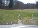
In Trbovlje, first go to the hospital, then at the roundabout by the hospital turn uphill towards Klek. After a few dozen metres, you will reach a kindergarten on the left-hand side of the road. A little further on, there is a crossing over the road to a short flight of steps, where the path starts across a meadow towards a forest.
Path description:
The path leads us across a meadow and through a forest, and soon leads back to the road, which we follow for a while. Before a major bend, there is a steep shortcut on the left. The shortcut brings us back to the road, and straight ahead is another shortcut that saves us a detour. Follow the road all the way to Klek. Shortly at the beginning of the village, there is a pub on the right side of the road, and we continue to the first small crossroads, where we turn right in the direction of Planinska vas. On the left side of the road you will soon see the start of the marked mountain trail leading to Sveta mountain pasture.
The way ahead is steep at the beginning, but then becomes more level. The path passes through a forest and is marked. Higher up, the path leads to a meadow, where it immediately splits into three directions. Go immediately to the left and then left again (following the path straight across the meadow, you would continue the ascent to Sveta mountain pasture and Maple). On the right-hand side you see an unfinished house and a caravan. Head up into the forest, where you will find trail markers in the trees along the trail. The path is marked with some plastic markers. The easy path soon leads us to the top, where we have a view of Trbovlje.
There is also a bench at the top where you can rest.
From the top, the path continues past the larger rocks and descends steeply down past a small lookout point. I did not follow this path, so I do not know where it leads.
You can return to the starting point by the same route you came.
Alternatively, you can take the circular route, which branches off to the right just after the start of the descent and leads you to a natural cavity in the rock face, which lies directly below the summit. The path then continues through the forest. Make sure you keep to the left forks of the path, as it is not marked. After a while you will come to a large rock with an interesting shape on which there is a marker. Bear left and then follow the path all the way to the left again. The trail leads to the road in Klek, which takes you back to Trbovlje.

Pictures:
 1
1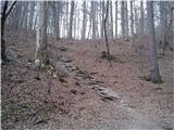 2
2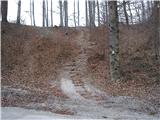 3
3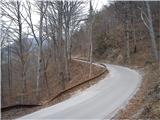 4
4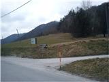 5
5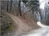 6
6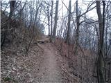 7
7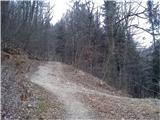 8
8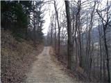 9
9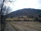 10
10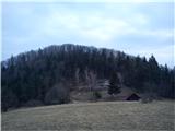 11
11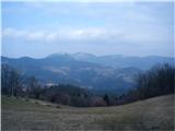 12
12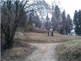 13
13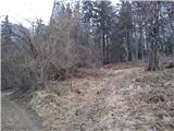 14
14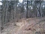 15
15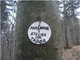 16
16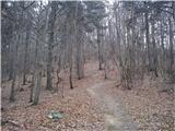 17
17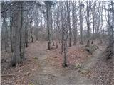 18
18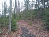 19
19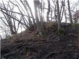 20
20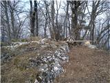 21
21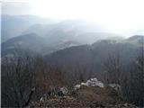 22
22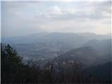 23
23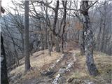 24
24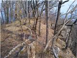 25
25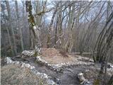 26
26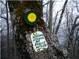 27
27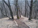 28
28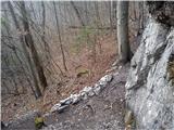 29
29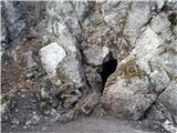 30
30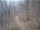 31
31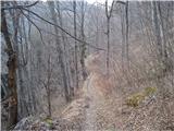 32
32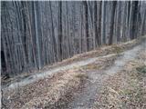 33
33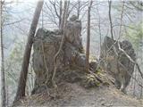 34
34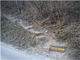 35
35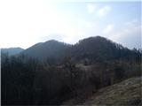 36
36
Discussion about the trail Trbovlje - Tabor