Tomšičeva cesta (Jesenice) - Kozjek (via Šporn)
Starting point: Tomšičeva cesta (Jesenice) (600 m)
Name of path: via Šporn
Time of walking: 25 min
Difficulty: easy unmarked way
Altitude difference: 166 m
Altitude difference po putu: 166 m
Map: Karavanke - osrednji del 1 : 50.000
Recommended equipment (summer):
Recommended equipment (winter): ice axe, crampons
Views: 1.521
 | 3 people like this post |
Access to the starting point:
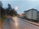
From the Ljubljana - Jesenice motorway, take the Lipce exit and turn right towards Jesenice. In Slovenski Javornik, turn left at the junction with the traffic lights towards the town centre. At the second traffic-controlled junction (by the gymnasium) turn sharp right, back along Tomšičeva cesta, passing the primary school on the left. After less than a kilometre of driving, as the road descends slightly, you will come to the vicinity of the former shop on Tomšičeva Street (now a buffet "Čavs bar"). About 20 m before this building, you will see a pedestrian crossing, which you will use on your way to Jelenkamn. Park in a suitable place nearby (or a few 100 m further on, below the incline, near the railway at a large turning point).
Path description:
Cross the road at the pedestrian crossing and continue straight uphill on the steep asphalted road, which leads you past a few houses. As the road levels out and crosses the stream, you will see a track climbing uphill to the north around a right-hand bend by the first house on the left. Leave the road and take this path, which climbs gently towards the woods. Soon you will come across the fenced water reservoir of Šporen with the year 1957. The path (initially logging trail) leads us along the stream bed into the forest, where we cross one of the stream branches. At logging trail, our path turns slightly right (the train turns left) and crosses the brook a second time, near which it continues uphill. Soon, close to the source of the said stream, the path curves further to the right and shortly leads to a level crossing with a crossroads.
Continue slightly right along the path along the edge of the plain called (right) Hlevček (stable), for about 100 metres, then leave the path (straight Babji zob (Babji zob) below Kozjek), and turn left onto the western slope of Kozjek, where after a short climb along the right-hand edge you will come across the path. This leads us in a few minutes' climb along the ridge of the hill to its summit with a beautiful viewpoint.

Pictures:
 1
1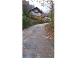 2
2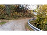 3
3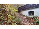 4
4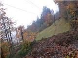 5
5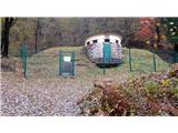 6
6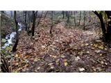 7
7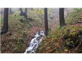 8
8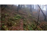 9
9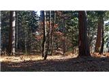 10
10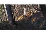 11
11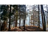 12
12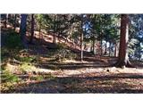 13
13 14
14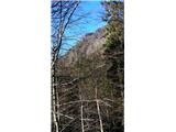 15
15 16
16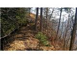 17
17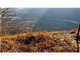 18
18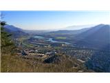 19
19
Discussion about the trail Tomšičeva cesta (Jesenice) - Kozjek (via Šporn)
|
| heinz22. 02. 2023 15:00:56 |
Priporočam ogled zemljevida, ki se nahaja na Španovem vrhu, kot dokaz da domačini vrh od nekdaj imenujejo KozjEk in ne napačno -KozjAk.
(fotografije žal ne morem prilepiti)
Lep dan, srečno in veselo na vseh poteh želim!
H.Blagne
|
|
|