Tolminske Ravne - Vrh nad Škrbino (on mule track and direct way)
Starting point: Tolminske Ravne (924 m)
| Lat/Lon: | 46,2294°N 13,7715°E |
| |
Name of path: on mule track and direct way
Time of walking: 4 h
Difficulty: partly demanding marked way
Altitude difference: 1130 m
Altitude difference po putu: 1150 m
Map: TNP 1:50.000
Recommended equipment (summer):
Recommended equipment (winter): ice axe, crampons
Views: 3.520
 | 2 people like this post |
Access to the starting point:
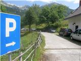
Take the Tolmin, then continue in the direction of Žabč and Zadlaz (the turn-off from the main road is on the left bank of the Tolminka River). When you arrive in Žabče, at a small crossroads, turn slightly right in the direction of Zadlaz. At Zadlaz-Žabče the road descends a little, where it crosses the Zadlaščica River via a bridge, and then starts climbing steeply again on a narrow, but constantly asphalted road. After about 12 km from the main road, you reach a marked parking area in Tolminske Ravne, where you park.
Path description:
From the parking lot, follow the path in the direction of Koča na planini Razor and mountain pasture at Kal. Initially, follow cart track, which continues from the nearby house and leads you across a meadow with a view. On the other side of the meadow, cross a pasture fence and the path leads to a marked crossroads, where you continue along the bottom right-hand cart track (slightly left-hand mountain pasture on Kal).
Continue along cart track, which descends gently to the right, then lays down and continues for a few minutes without any major changes in elevation. After the concrete trough, the path splits again and we take the lower lay-by (slightly steep left), which continues along the wide cart track. A little further on, after crossing a pasture fence, cart track turns into a mulatier, and soon we go slightly left from it, onto a marked footpath which intersects a longer bend in the mulatier. After a few minutes of climbing, we return to the mulatier, which is reached just at a small crossroads. Take the upper right-hand path, which ascends crosswise to the right, but soon turns sharply to the left. The mulatier continues to climb gently to moderately, leading crosswise to the left, gradually changing to quite steep slopes, where the passage is not difficult, as the path is quite wide throughout. As the higher slope flattens out, the mulatier turns slightly to the right and leads us out of the forest to the south-western part of the mountain pasture Razor. From here there is a short moderate climb and the path leads us to the cheese cottage and about a minute further on to the hut at mountain pasture Razor.
From the hut, continue in the direction of Globoko, Vogel, Vrh nad Škrbino. . . along the path which crosses the lane of a forest and then splits on a grassy slope.
This time continue straight on in the direction of Vrh nad Škrbino and Dom na Komni (Vogel, Globoko and Črna prst to the right), following a path which turns slightly to the left and continues climbing up a slope covered with dwarf pines. After a few minutes, the path is laid out, and then, north of the inexpressive Kopecko peak, after a short moderate climb, it leads to the next crossroads, where it continues to the right in the direction of Vrh nad Škrbino (following the left path, you will arrive at Škrbina, from where you can continue towards Tolminski Kuk, Bohinj or Vrh nad Škrbino on a very difficult path). The way ahead climbs gently to moderately at first through dwarf pines and turns slightly to the left. After leaving dwarf pines, continue climbing moderately for a short distance, and the path leads across the grassy slope, just below the ridge. After crossing a few small scree slopes, the path turns right and starts to climb quite steeply up the grassy slope. Climb steep grassy slopes until you reach the ridge, where you join a very difficult path from Škrbine.
Go right here and, with beautiful views, quickly reach the summit.
Tolminske Ravne - mountain pasture Razor 1:45 mountain pasture Razor - Vrh nad Škrbino 2:15.

Pictures:
 1
1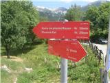 2
2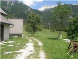 3
3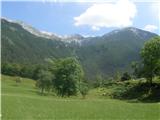 4
4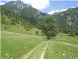 5
5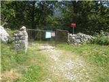 6
6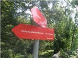 7
7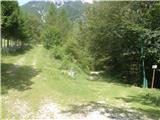 8
8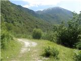 9
9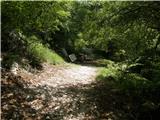 10
10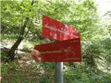 11
11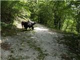 12
12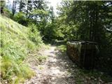 13
13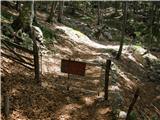 14
14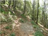 15
15 16
16 17
17 18
18 19
19 20
20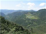 21
21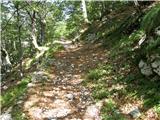 22
22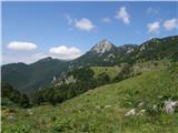 23
23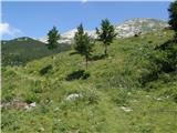 24
24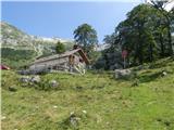 25
25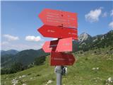 26
26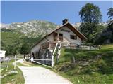 27
27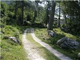 28
28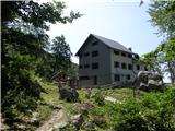 29
29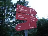 30
30 31
31 32
32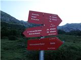 33
33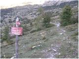 34
34 35
35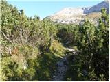 36
36 37
37 38
38 39
39 40
40 41
41 42
42 43
43 44
44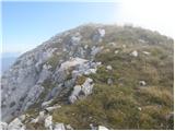 45
45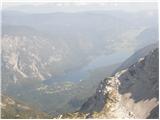 46
46 47
47
Discussion about the trail Tolminske Ravne - Vrh nad Škrbino (on mule track and direct way)
|
| darinka420. 10. 2021 10:49:03 |
Včeraj šli s Tolminskih Raven. Po krajši strmi poti do odcepa za Škrbinsko sedlo. Mi smo se spustili desno in do drugega križišča, kjer se pot odcepi proti škrbinski plošči. Zanimivo je bilo tukaj hodit do vrha. Z Marijanom sva obujala spomine na letošnji marec , ko sva tam hodila v snegu in prišla na Vrh nad Škrbino ter stala na vrhu na opasti.Zdej je bilo vse drugače. Kar strma pot pelje do vrha. Nadaljevali smo po grebenu na vrh Meja, Rušnat vrh, Krnica in zadnji vrh Vogel . Potem je bilo treba sestopiti v dolino po drugi poti v Tolminske Ravne. Po grebenu smo se dvakrat spustili nekoliko okrog , ker se po vrhu ni dalo iti. Cesto v Tolminske Ravne poporavljajo in je zaprta od sedmih do sedemnajste ure. Niti nismo vedeli. Nas niti ni motilo, ker je naša tura trajala 11 ur in 16 km in 1740 višincev. Kar dostikrat se je bilo treba spustiti in se ponovno vzpenjati.
|
|
|