The Kot Valley - Mali Triglav
Starting point: The Kot Valley (950 m)
| Lat/Lon: | 46,4157°N 13,8977°E |
| |
Time of walking: 5 h 35 min
Difficulty: very difficult marked way
Altitude difference: 1775 m
Altitude difference po putu: 1900 m
Map: Triglav 1:25.000
Recommended equipment (summer): helmet
Recommended equipment (winter): helmet, ice axe, crampons
Views: 8.099
 | 2 people like this post |
Access to the starting point:
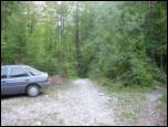
Leave the Gorenjska motorway at the Hrušica exit and follow the road towards Kranjska Gora. Just before the village of Dovje, the road branches off to the left and leads to Mojstrana (Vrata, Kot and Krma). Follow the road in the direction of the village of Radovna and the valleys of Krma and Kot. The relatively steep road then leads us past the TNP signboard, after which the road soon lays down and leads us to a crossroads where a dirt road branches off to the right into the Kot valley (straight ahead to Radovna and Krma). This sometimes slightly worse road is then followed to a parking area, where you will also see mountain signs.
Path description:
From the starting point, continue along the worse road, which after a few minutes leads to a turning point (parking here is not recommended). The path ahead turns slightly left and crosses a torrent. On the other side of the torrent, we climb steeply through the forest for some time. After half an hour's walk, the path starts to climb. There are a few dozen steps of walking on a steep path, where we are helped by wedges, which are not strictly necessary in dry conditions. The steepness then eases and the path leads us to a small spring (dries up in the dry season) at 1340m. Here an unmarked path branches off to the left to Macesnovec, and we continue on the marked path that crosses the torrent. There is a short steep section where we are helped by a rope ladder (not difficult). The path then crosses the lane of dwarf pines and climbs higher up on rockier slopes, where we see the Thick Stone (a large boulder visible at the top of the slope). We climb up to the Thick Stone on a rough path surrounded by the dwarf pines path (not difficult). Next, the path climbs up along a small scree slope and turns slightly higher to the right, where it leads to a crossroads. Continue left in the direction of Stanič's home and Rjavina (to the right of Vrbanove Špice, a very difficult path). The steepness then eases and there are a few minutes of easy walking to the next crossroads. Continue on the right path towards Stanič's home, passing the Pekel sinkhole, which can be seen on the right below us (the path to the left leads to Rjavina on the climbing route). Continue climbing steadily up to Stanič's home, which offers a fine view of Triglav.
Continue in the direction of Kredarica along the path which climbs steeply under the Rži scree and then climbs across the scree to an undistinguished notch in the side ridge of the Rži. The trail then descends slightly using the fixed safety gear and then ascends again. After less than an hour from Stanič's home, the path leads to the top of Kredarica. From the top, it takes a few minutes to descend to the Triglav Home on Kredarica.
At the home, the Triglav signs direct us slightly down to the edge of the glacier (Zeleni sneg), and then up to the start of the climbing part of the route. The route climbs steeply immediately, and the fixed safety gear rungs are particularly helpful. After a half-hour climb, a slightly easier route from Planika joins us from the left. Only a few steps further we reach the inexpressive summit of the Mali Triglav.

Pictures:
 1
1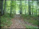 2
2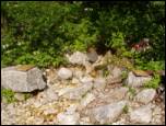 3
3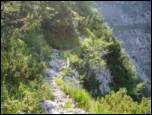 4
4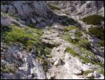 5
5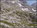 6
6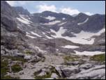 7
7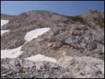 8
8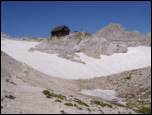 9
9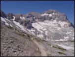 10
10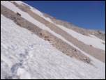 11
11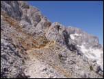 12
12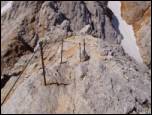 13
13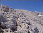 14
14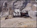 15
15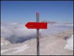 16
16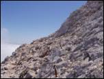 17
17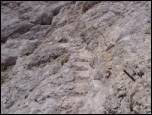 18
18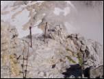 19
19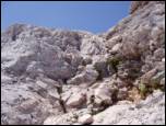 20
20 21
21
Discussion about the trail The Kot Valley - Mali Triglav