Sveti Trije kralji - Veliki vrh (on Pohorje)
Starting point: Sveti Trije kralji (1181 m)
| Lat/Lon: | 46,43788°N 15,46004°E |
| |
Time of walking: 30 min
Difficulty: easy marked way
Altitude difference: 163 m
Altitude difference po putu: 163 m
Map: Pohorje 1:50.000
Recommended equipment (summer):
Recommended equipment (winter): ice axe, crampons
Views: 796
 | 1 person likes this post |
Access to the starting point:
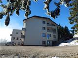
Drive into the centre of Slovenska Bistrica, where you turn off at the traffic lights in the direction of the health centre and continue along Partizanska cesta. Then drive through the town, continuing straight on, on the outskirts of the town, and at the industrial zone turn onto the road towards Tinje, Sveti Trem kralji and Black Lake. The asphalt road is slightly narrower and starts to climb, initially leading past the Hunting Hut of the pizzeria Gams, then higher up through the village of Visole, and a few kilometres higher up we arrive at Zgornje Tinje, from where we follow the signs for the ski resort of Jakec - Trije kralji (Three Kingdoms). Park in the parking lot at the foot of the ski slope, or near the Church of St. Three Kings.
Path description:
From where we parked, we walk to the Church of St. Three Kings, and from the church we continue in the direction of the Black Lake and the Urška Trail, where we quickly arrive at the edge of the nearby ski slope of the ski resort RTC Jakec - Trije kralji. The way forward initially takes you along the edge of the forest, just a few metres away from the ski slope, and higher up you cross the ski slope to the right (during ski slope opening hours, you cross the ski slope above the ski lift). On the other side of the ski slope, the path goes slightly to the right and leads under the reservoir.
A little beyond the lake, we reach the connecting ski slope, which we continue to climb (during ski slope opening hours, we walk along the leftmost edge of the ski slope), and when we reach the second ski slope a few minutes higher up, where the marked path to the Black Lake crosses the ski slope, we continue along the left edge, where there are also signs for the Urška Trail. A few minutes of steeper climbing follows and, with increasingly beautiful views, we arrive at a bench on the Big Top, from where we have a beautiful view of Pohorje and the valley.
From here you can continue another 10 m into the forest, where the highest point of the peak is located.
Description and pictures refer to January 2022.

Pictures:
 1
1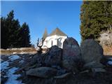 2
2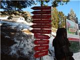 3
3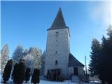 4
4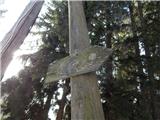 5
5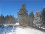 6
6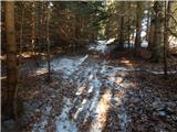 7
7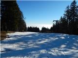 8
8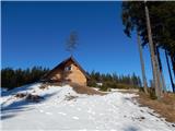 9
9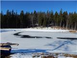 10
10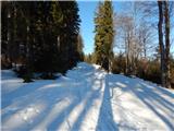 11
11 12
12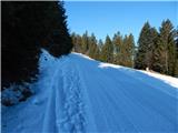 13
13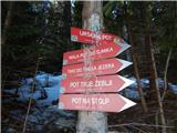 14
14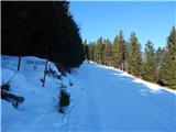 15
15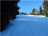 16
16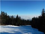 17
17 18
18 19
19 20
20 21
21
Discussion about the trail Sveti Trije kralji - Veliki vrh (on Pohorje)