Sveti Trije kralji - Črno jezero on Pohorje
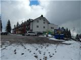
Starting point: Sveti Trije kralji (1181 m)
| Lat/Lon: | 46,43788°N 15,46004°E |
| |
Time of walking: 50 min
Difficulty: easy marked way
Altitude difference: 15 m
Altitude difference po putu: 115 m
Map: Pohorje 1:50.000
Recommended equipment (summer):
Recommended equipment (winter): ice axe, crampons
Views: 4.360
 | 2 people like this post |
Access to the starting point:
Drive to the centre of Slovenska Bistrica, where you turn off at the traffic lights in the direction of the health centre and continue along Partizanska cesta. Then drive through the town, continuing straight on, on the outskirts of the town, and at the industrial zone turn onto the road towards Tinje, Sveti Trem kralji and Black Lake. The asphalt road is slightly narrower and starts to climb, initially leading past the Hunting Hut of the pizzeria Gams, then higher up through the village of Visole, and a few kilometres higher up we arrive at Zgornje Tinje, from where we follow the signs for the ski resort of Jakec - Trije kralji (Three Kingdoms). Park in the parking lot at the foot of the ski slope, or near the Church of St. Three Kings.
Path description:
From the starting point, walk to the Church of St. Three Kings and continue in the direction of the Black Lake and Urška's path and quickly arrive at the nearby ski slope, which you continue along for a short time and then cross (during the ski slope's operation, the ski slope and the ski lift are crossed higher up - above the ski lift and the ski slope). The way forward takes us past the ARSO weather station, and we continue to follow the markings, and after a few minutes on the connecting ski slope we arrive at another ski slope, which we also cross (up Veliki vrh, next to the ski slope). Then we cross the ski lift and another ski slope, and then the trail comes into the forest, where after a few minutes of further walking we arrive at a cross, next to which stands the Urška Trail teaching board. The way forward descends slowly and leads us to a marked crossroads, where we choose the left path (straight Šumik and Ruška koča), where we continue in the direction of Osankarice and Črnega jezera. Continue to descend gently to moderately and follow the markings. When the descent ends, you will reach a crossroads near Černý jezero.
Continue straight on (left Oplotnica - the path past Kos) and in a few steps you will reach the lake.
Description and pictures refer to the situation in April 2022.

Pictures:
 1
1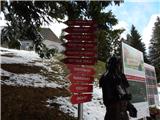 2
2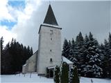 3
3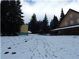 4
4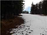 5
5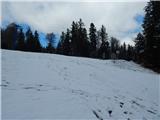 6
6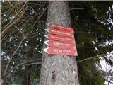 7
7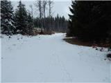 8
8 9
9 10
10 11
11 12
12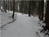 13
13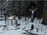 14
14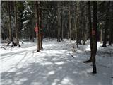 15
15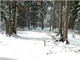 16
16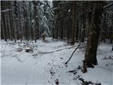 17
17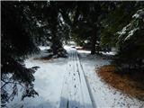 18
18 19
19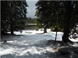 20
20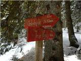 21
21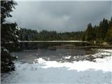 22
22
Discussion about the trail Sveti Trije kralji - Črno jezero on Pohorje